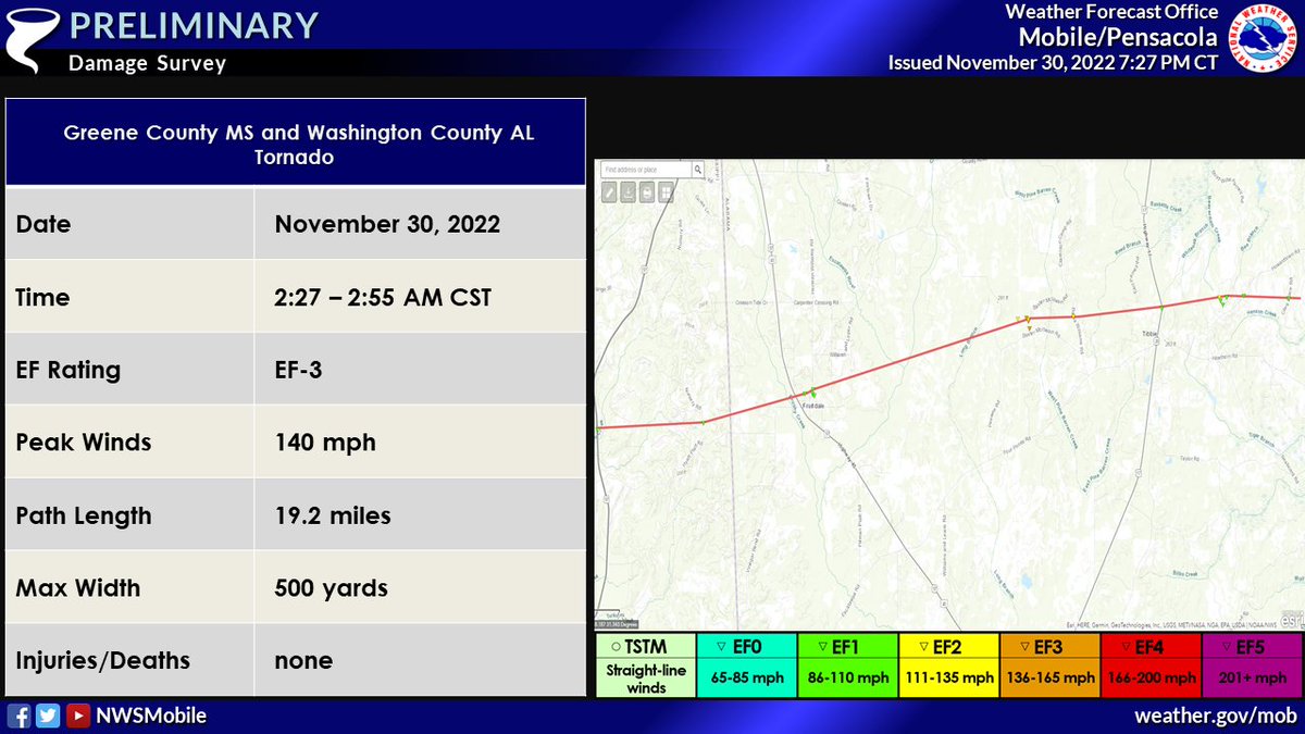
🌪 A NWS Mobile survey team found EF-3 tornado damage from the storm that moved across northeastern Greene County MS & into parts of Washington County AL early this morning. Peak winds were estimated to be 140 mph with a path length of 19.2 miles & a max width of 500 yards. (1/2)
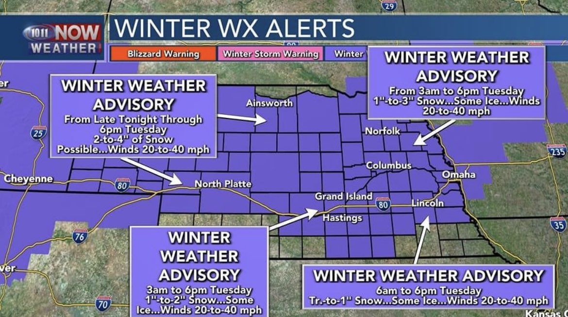
A winter weather advisory is in effect for most of Nebraska, including Madison County. Snow accumulations up to 4 inches and a light glaze of ice is possible.
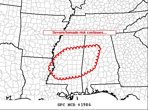
A 15% significant chance for tornadoes has been announced. A potential tornado outbreak is on the horizon. With some supercells a long track or significant tornado can be possible
Chasers out:
@kilocharlie1738@Misfitstorm12 @VuhxWx @Weathergeek051 @zaneo_11
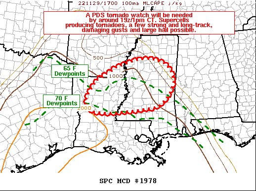
We have decided to keep the Enhanced for our Day 3 Tuesday Outlook. Rich dewpoints of 60-70 degrees is likely across the ENH highlighted area. With 1.3k-2k j/kg also being likely. Low level wind shear is around 45-50kts. Which will allow for a very unstable environment
#wxtwitter