This evening, an Emergency Alert has been sent to people across England and Wales as the wildfire risk remains very high. The request came directly from Fire and Rescue Services.
I was in Stourbridge today and saw first-hand the devastating impact these fires have had on people’s homes and lives.
Our priority now is to keep everyone safe and prevent more fires from starting.
During this period of extreme heat, I’m asking everyone to take extra care. Please do not light any fires in gardens, the countryside or other open spaces, including parks, moorland and wooded areas.
Our firefighters and emergency responders are working around the clock in incredibly difficult conditions.
We can all help them. Please take the Emergency Alert seriously and follow the guidance in place.
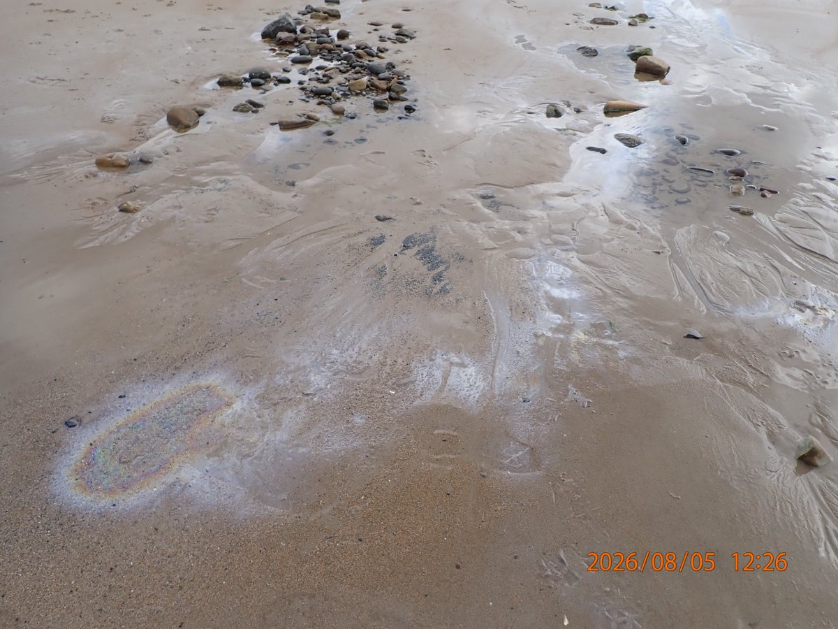
⚠️ We are currently investigating reports of fuel/oil-like pollution at Blyth South Beach. As a precaution, members of the public are advised to keep dogs and other pets away from the area until further notice.
⚠️⚠️ Amber weather warning issued ⚠️⚠️
Extreme heat across southern parts of England and Wales
Monday 22 and Tuesday 23 June
Latest info 👉 https://t.co/QwDLMfRBfs
Stay #WeatherAware ⚠️
The freezing level will fluctuate over the next few days, but will often be sufficiently low to allow snow over higher ground in northern areas and perhaps to lower levels at times ❄️
Whilst colder air may occasionally encroach further south, rain is more likely to fall here 🌧️
⚠️ SEVERE FLOOD WARNING: River Otter at Ottery St Mary
Danger to life. Do NOT drive or walk through floodwater – just 30cm can sweep a car away.
🚗 Do NOT drive through floodwater – 30cm can sweep a car away
📍 Check your route before travelling
📞 If stranded, call 999
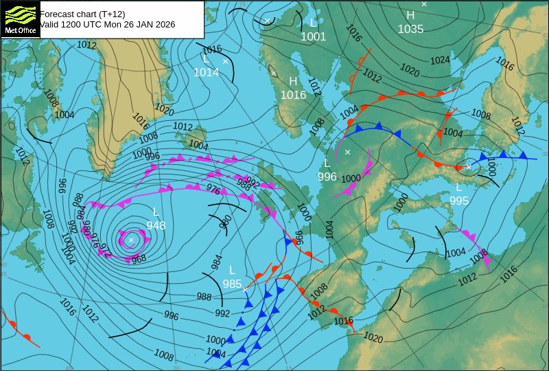
Low pressure 985mb southwest of the UK today will deepen as it moves towards Ireland tomorrow. The depression named #StormChandra by @metoffice.
In Wales, the strongest winds and gales will be in the southwest with a yellow warning.
Heavy rain a concern with a yellow warning.
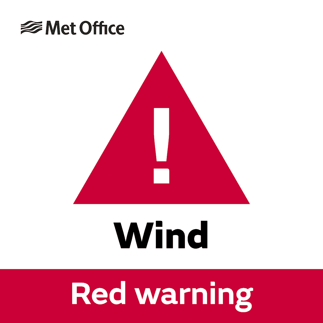
⚠️⚠️🔴 Red weather warning issued 🔴⚠️⚠️
Very strong winds across the Isles of Scilly and parts of Cornwall
Thursday 16:00 – 23:00
Latest info 👉 https://t.co/QwDLMfRBfs
Stay #WeatherAware ⚠️
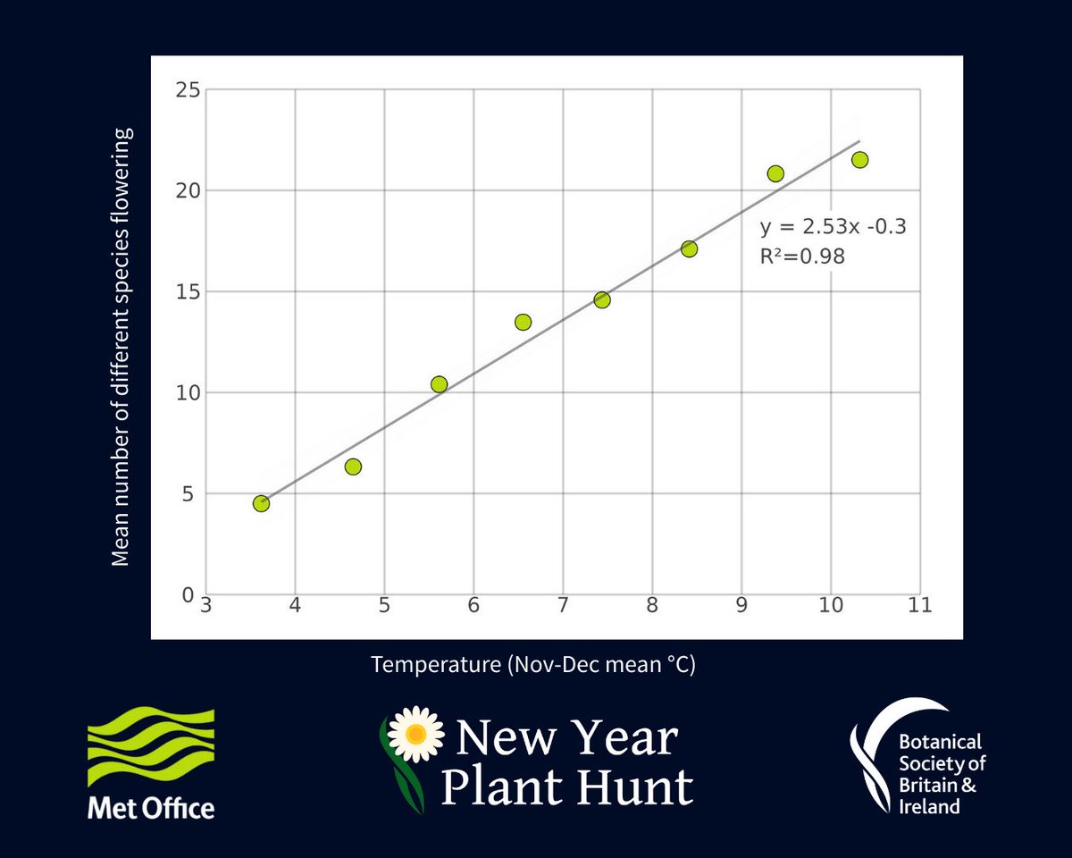
Rapidly rising winter temperatures in the UK over the last decade are resulting in a big increase in the number of plant species in flower.
https://t.co/pLZrQPKHcJ
*HIGH RISK* has been issued for the southern Alpine flank on Thursday, August 28th. Severe thunderstorms will blast parts of northern Italy and southern Switzerland with large hail, intense rainfall, flash floods, severe winds, and possibly tornadoes.
https://t.co/F5o7ALJ2bZ
Have you noticed something on the radar today even when there's no rain? 🤔
Some of the showers have been evaporating before reaching the surface
But there's also been some buggy interference from flying ants, who emerge every summer on warm and humid days 🐜
It's likely to be the coldest night of winter so far 🥶
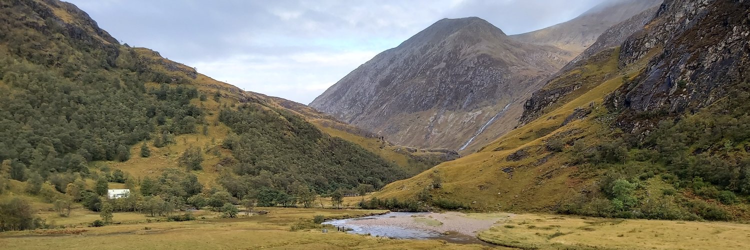
There will be a very severe frost for some with the lowest temperatures across the snow-covered glens in Scotland 📉
But in far west temperatures will start to creep up 📈
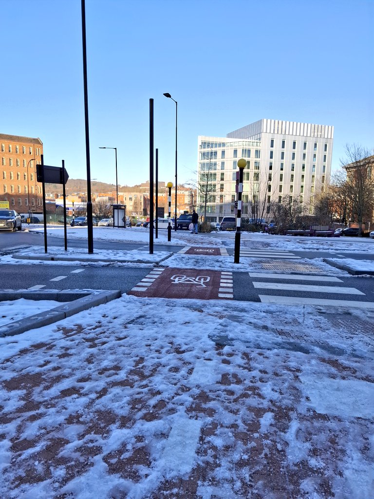
@SheffCouncil @sccactivetravel @sccstreetsahead Why spend millions on active travel infrastructure and then zero on keeping these assets ice/snow free? How can the city make cycling or walking more attractive if no effort is made on making them usable in winter? 😪
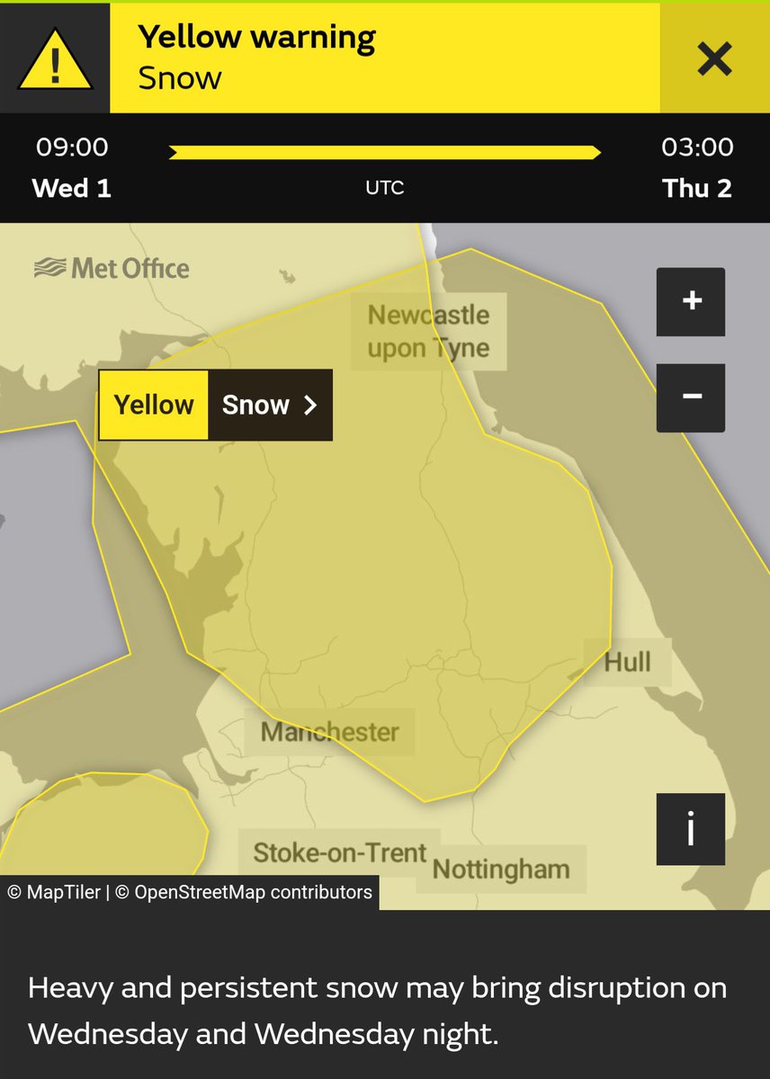
A series of @metoffice weather warnings have been issued for the Lake District from tomorrow until New Years Day - for gales and heavy snow. Keep an eye out on the forecast and #BeWeatherAware
Red, Amber and Yellow weather warnings are in force across the the UK for strong winds, heavy rain and snow as a result of #StormDarragh
Here's an overview of the warnings on Saturday 👇
More details: https://t.co/QwDLMfRBfs
We're keeping a close eye on developments in the Atlantic Ocean this weekend 👀
An area of low pressure is expected to 'explosively' deepen as it crosses the jet stream and this will bring a period of stormy weather to parts of the British Isles on Sunday 🌬️