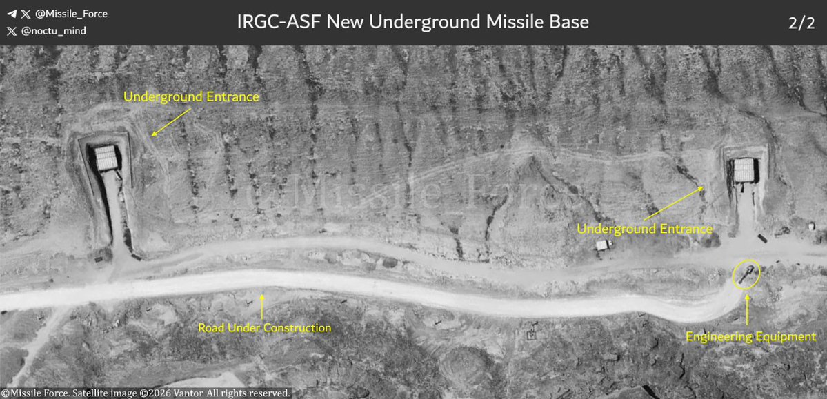
Satellite imagery shows four entrances at an underground missile base still under development. Each entrance has been equipped with an unidentified protective structure, likely intended to reduce the risk of entrance blockage during airstrikes.
Collaboration: @noctu_mind
Satellite imagery from December 2025 reveals new underground constructions at a missile base. With these two new entrances, the total number of documented entrances at this base now reaches four.
On March 21, the Zionist regime released footage of an airstrike, claiming it showed “part of a large missile site in western Iran.” But geolocation of the footage revealed that all targets struck were actually located along the main street of “Sarab-e Key Hatam” village.
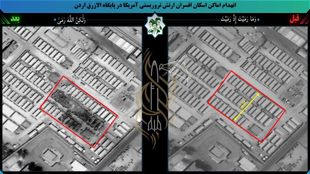
Mapped coordinates of IRGC Aerospace Force missile impacts at Al Azraq Air Base, Jordan:
31.82396, 36.78275
31.83134, 36.79123
31.83237, 36.79640
31.83225, 36.79622
31.83261, 36.79610
• High-quality satellite image showing the destruction and demolition of the Batelco Center's data processing and artificial intelligence control center, belonging to the U.S. military, located in Bahrain, by IRGC.
High-resolution satellite imagery showing the destruction of a U.S. Air Force fighter aircraft readiness shelter at Al Azraq Air Base, Jordan, during the IRGC Aerospace Force missile strikes.
Target coordinates: 31.8243, 36.7857
🛰 King Faisal Air Base, Jordan, Satellite imagery released by Iranian media reveals damage at 3 locations, including a newly built facility at the base.
🚨🔥Satellite imagery from July 16 shows three buildings completely destroyed at the Zayed Military City in Abu Dhabi, United Arab Emirates.
Explore and Compare: https://t.co/MiN5l8USjH
#UAE#Iran#Military
• New high res sat-images of Iran's attacks on US bases in Jordan & Oman
1: Destruction of the US army support force accommodation center in Duqm,Oman
2&3: Destruction of the US army helicopter hangar & anti-drone surveillance, monitoring system at Prince Hassan Base in Jordan
Coordinates of a damaged structure at Al Udeid Air Base, Qatar:
25.12093, 51.33041
The second image shows the structure and its surrounding area as of February 2026.
Iran's IRGC-affiliated Fars News Agency has released high-resolution satellite imagery showing the damage caused by recent Iranian missile strikes.
The first image appears to show damage to a warehouse or hangar at Al Udeid Air Base in Qatar, contradicting the Qatari Ministry of Defense's claim that all incoming missiles were successfully intercepted.
Coordinates of the impact points at Jordan's Prince Hassan Air Base from yesterday's strikes, including a hangar and a runway:
32.16476, 37.14887
32.15515, 37.14977