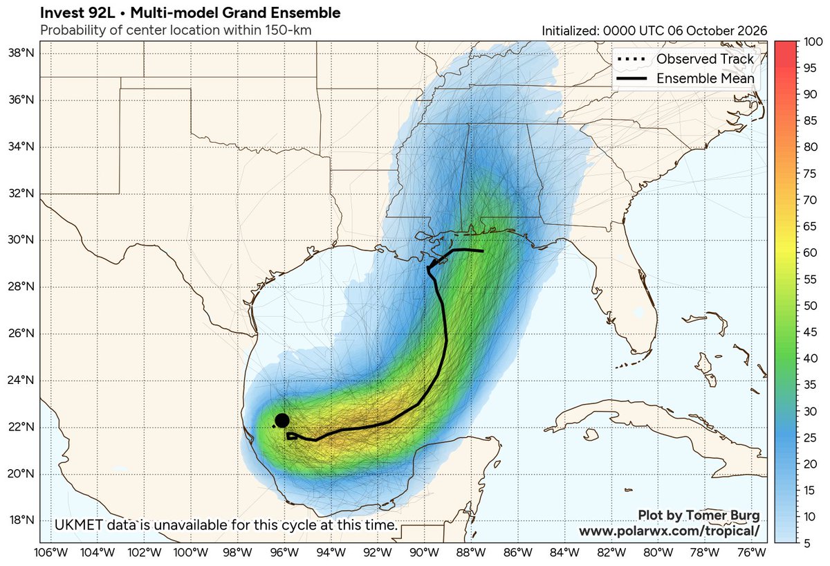
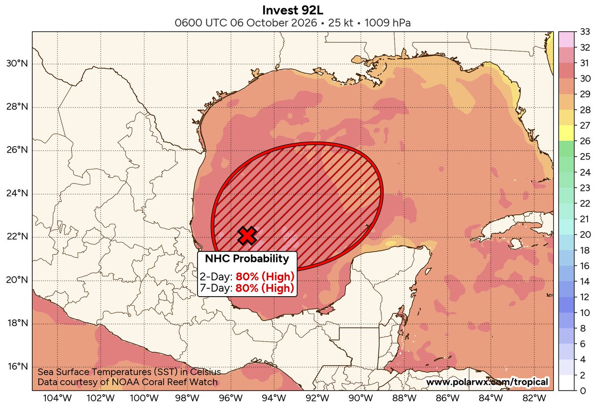
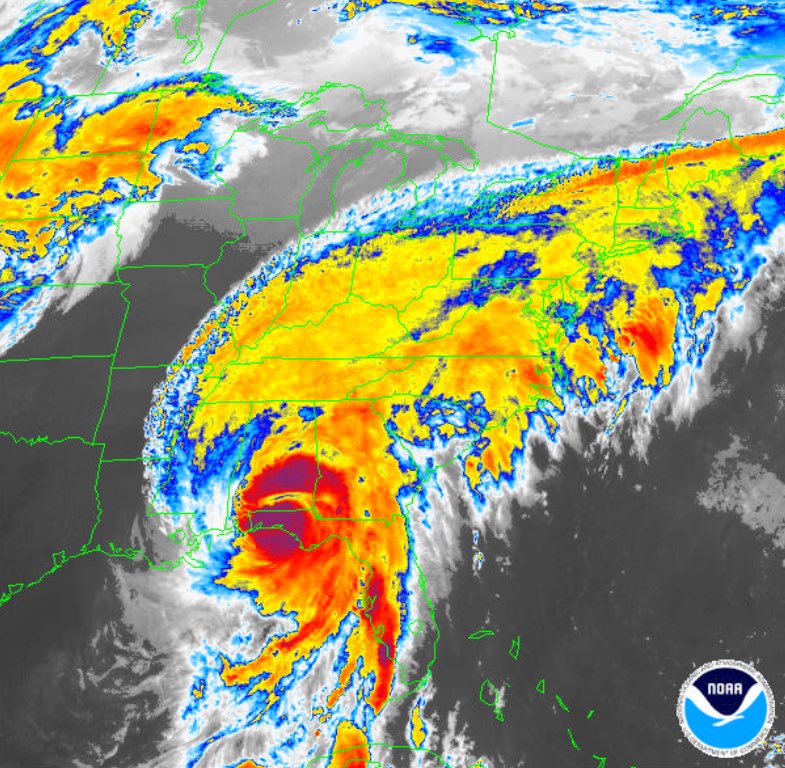
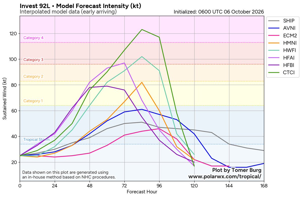
TROPICS/THE WEEKEND: A trough of low pressure (Invest 92L) over the southwestern Gulf is producing disorganized showers and thunderstorms. Although environmental conditions appear only marginally conducive for development, a tropical depression is likely to form within the next couple of days. The system is expected to drift east-northeastward through the middle portion of the week before turning northward.
Most reliable models and their ensemble members bring the system to the Central Gulf Coast around Mobile Bay Saturday. Concerning intensity, this could be a strong tropical storm or even a hurricane at the time of landfall. The name will be Isaias.
Isaias has potential to be a high impact event for the Gulf Coast and the state of Alabama, but it is important to note that it is still too early for a specific impact forecast for any place. There are many big events going on, including the National Shrimp Festival in Gulf Shores, the Alabama/Georgia football game in Tuscaloosa, and the Zach Bryan concert in Auburn.
Saturday isn't looking good this morning based on the latest model output; it will be a day with lots of rain, and potentially lots of wind. Maybe even some risk of a few isolated brief tornadoes. But understand this could change based on the ultimate track and intensity of the tropical system.
We will be much more specific tomorrow evening; this is when the system will have developed a core, and we get dropsonde data from hurricane hunter aircraft, which will be baked into the models. For event planners I would not make a decision until tomorrow night.
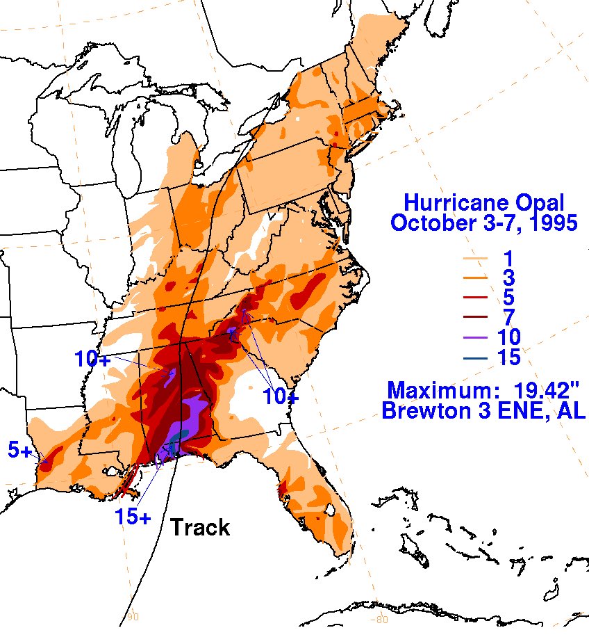
ON THIS DATE IN 1995: Hurricane Opal slammed into the Gulf Coast at Pensacola at category three strength.
For forecasters and residents along the northern Gulf Coast, Opal became a frightening lesson in just how quickly a hurricane could change. On the evening of October 3, 1995, Opal was a Category 2 hurricane over the Gulf of Mexico with winds near 100 mph. By the following morning, it was undergoing rapid intensification, a dramatic increase in a hurricane’s wind speed over a short period, while accelerating toward the Florida Panhandle. Thousands who had expected a Category 2 hurricane suddenly faced the possibility of something far more dangerous, and late evacuations produced gridlock on highways leading away from the coast.
The numbers coming back from Air Force reconnaissance were extraordinary. Opal’s central pressure plunged to 916 millibars, and maximum sustained winds reached an estimated 150 mph, making it a powerful Category 4 hurricane just shy of Category 5 intensity. At the time, the 916-millibar pressure made Opal the most intense Atlantic hurricane ever observed during October. The extraordinary strengthening occurred while the hurricane was still hundreds of miles south-southwest of Pensacola.
Part of the explanation was beneath the storm. Opal crossed an unusually deep pool of very warm Gulf water, providing an abundant supply of ocean heat at a time when atmospheric conditions were also favorable for strengthening. Because the warm water extended well below the surface, Opal could churn the Gulf without quickly bringing colder water upward. Changes within the hurricane’s compact inner core also contributed to the explosive strengthening.
Just as remarkably, Opal then weakened almost as rapidly as it had strengthened. Its small inner eyewall collapsed as a larger outer eyewall became dominant, while the hurricane encountered less favorable conditions approaching the coast. By landfall near Pensacola Beach around 5 p.m., Opal had weakened to a Category 3 hurricane with maximum sustained winds near 115 mph and a central pressure of 942 millibars. Hurlburt Field near Mary Esther measured sustained winds near 84 mph and a peak gust of 144 mph, although that extreme gust has been considered questionable.
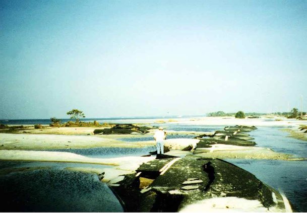
The weakening winds did not spare the coastline. Opal had already generated an enormous ocean response while it was a Category 4 hurricane offshore. Storm surge reached 15 feet from the Navarre Beach area eastward toward Destin, while tremendous breaking waves pushed water and debris even farther inland. Nearly 300 homes were destroyed, another 1,000 suffered major damage, and portions of Highway 399 and U.S. Highway 98 were washed away. The devastation demonstrated that the ocean does not immediately respond when a hurricane’s wind speed begins to fall.
Opal raced northward through Alabama, bringing destructive winds, falling trees, power outages, heavy rain, and tornadoes. Nine short-lived tornadoes were documented across six Alabama counties, mostly near and east of the storm’s track. About 2.6 million people in Alabama lost electricity, some for more than a week, and two people were killed in Gadsden when a massive oak tree fell onto their mobile home. Nine direct deaths occurred in the mainland United States, and total damage approached $3 billion. Opal became a lasting lesson in how quickly hurricane intensity can change.
Giving Tuesday is here. In 2024, we were able to cover over $250k of therapy, helping over 280 people get the help they need. Combine that with the over 28M people reached with hope + help online, the mental health curriculum provided to 300 schools, and the 86k+ individuals who found support in our mental health toolkit—we’re so proud of the ways this community allowed us to show up for people who need it most.
Help us keep this work going in 2025: https://t.co/HF6jKhIwJW
#GivingTuesday #GivingTuesday2024