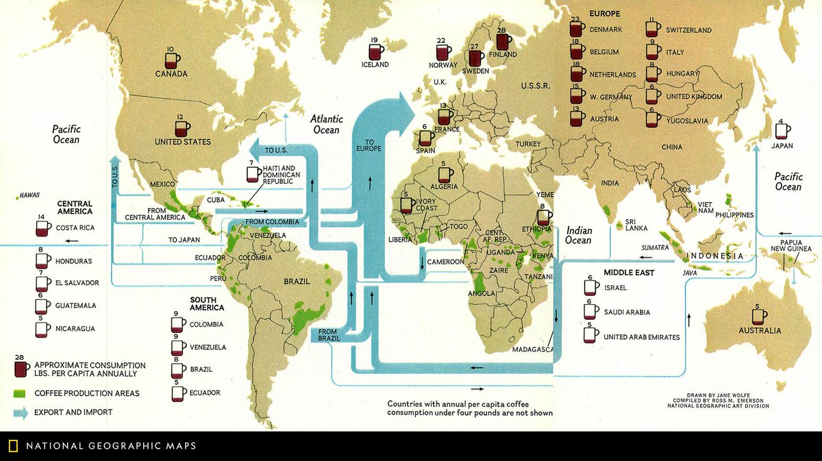
Map of the Day: Happy #NationalCoffeeDay! Published in March 1981, this map shows the consumption, production, export, and import of coffee around the world. #MapOTD
Millions of people live along US East Coast, yet we know very little about deep waters just offshore. #Okeanos expedition in May/June helped reveal some mysteries of our deepwater backyard: https://t.co/ilcoE2N9EQ
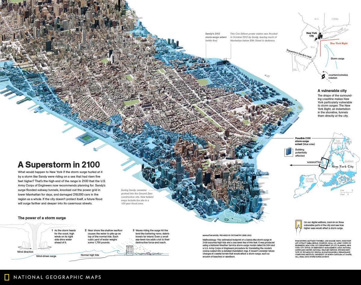
Map of the Day: What would happen to New York if the storm surge hurled at it by a storm like Sandy were riding on a sea that had risen five feet higher? This September 2013 map theorizes what a superstorm in 2100 might look like. https://t.co/WYkzjfcKTG #MapOTD
Mapping the country's #Indigenous linguistic landscape that's evolved over thousands of years: @StatCan_eng census shows where 60 languages in 12 overarching families—Inuit, 10 First Nations and Michif (Métis)—are being spoken today @CanGeo@RCGS_SGRC https://t.co/xytYbRLATO
"If you step back and look at the planet in total, you see how richly interconnected and intertwined all the actual systems are." #onestrangerock https://t.co/pCsOfyqGMy
Educator Melissa in Redwood City,CA is looking for a #GeoMentor to help with a middle school Geography Club and GeoInquiries for a Social Studies class! Her contact info can be found in the online database or by emailing [email protected] for details. https://t.co/XOaBwiR4vH