My book is launching like a satellite, y'all!🛰️📖 A little whimsy and adventure can help us spiral up into hope when life doesn't go as planned.
Pre-order Nellie and the Sea of Trials by Cassie Vest as an ebook today on Amazon! Paperback available Tuesday!
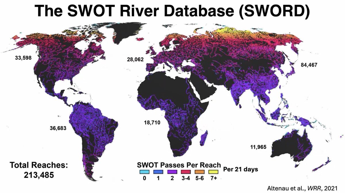
Would you like to learn more about #hydrology datasets from the Surface Water and Ocean Topography (SWOT) mission? In a new video, Dr. Tamlin Pavelsky, NASA's Hydrology Lead for the SWOT mission, introduces the hydrology data products.
➡️View video: https://t.co/iqJ6IxDzpY
In the recent Hacking Limnology AEMON-J July 2024 Virtual Summit follow along with Dr. Cassie Nickles, from NASA's #PODAAC, as she shows you how to access and use SWOT data via Jupyter Notebooks and data transformation tools. #hydrology
View recording: https://t.co/pjkthxWlcz
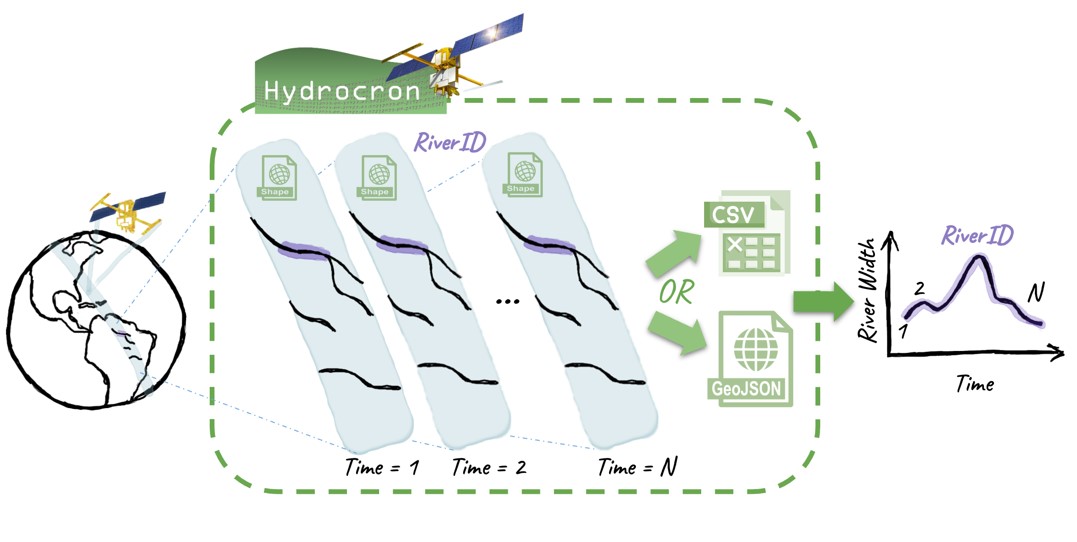
Hydrocron, a new API from NASA's #PODAAC repackages #hydrology data from the Surface Water and Ocean Topography (SWOT) satellite to facilitate time-series analysis. Illustration Credit: NASA JPL
Learn how you can use Hydrocron in your data workflow: https://t.co/CG0sEK29jG
A recent workshop demonstrated how to work with data from the Surface Water and Ocean Topography (SWOT) mission. Jupyter Notebooks and other workshop resources are openly available to help you dive into working with SWOT data: https://t.co/WZnO2qWPsk
In a new #Jupyter Notebook developed at NASA's #PODAAC, learn the basics of #xarray and how to use the open-source #Python library, Dask, for parallel computing (data access and data analysis) in the cloud. #CloudComputing
➡️Check it out at: https://t.co/QrKc8DHNil
Successfully cohosted a SWOT data access workshop this past week at the AGU Chapman Remote Sensing of the Water Cycle conference!! #SWOT#SWOTsatellite#DataAccess#NASAEarthdata
Check out our content here: https://t.co/8spxEPVrMY
Did you know that WaterSciCon will be offering almost three dozen hands-on, interactive workshops.? Dont miss your opportunity to participate in these immersive learning sessions! Submit an abstract by 24 January! @the_AGU
https://t.co/iUEcGrA7eb
Excited for WaterSciCon in June!! PO.DAAC & the USGS are co-convening a session on Making Data More Accessible: Intersections of Terrestrial Hydrology Datasets, consider submitting an abstract for your cool water tools & data stories by January 24th! https://t.co/IM343gy4Ld
Interested in SWOT data? PO.DAAC is hosting a workshop! Join us at the AGU Chapman Remote Sending of the Water Cycle meeting in February: https://t.co/xJ5HO0De32
A whole new view 🤩 🌊
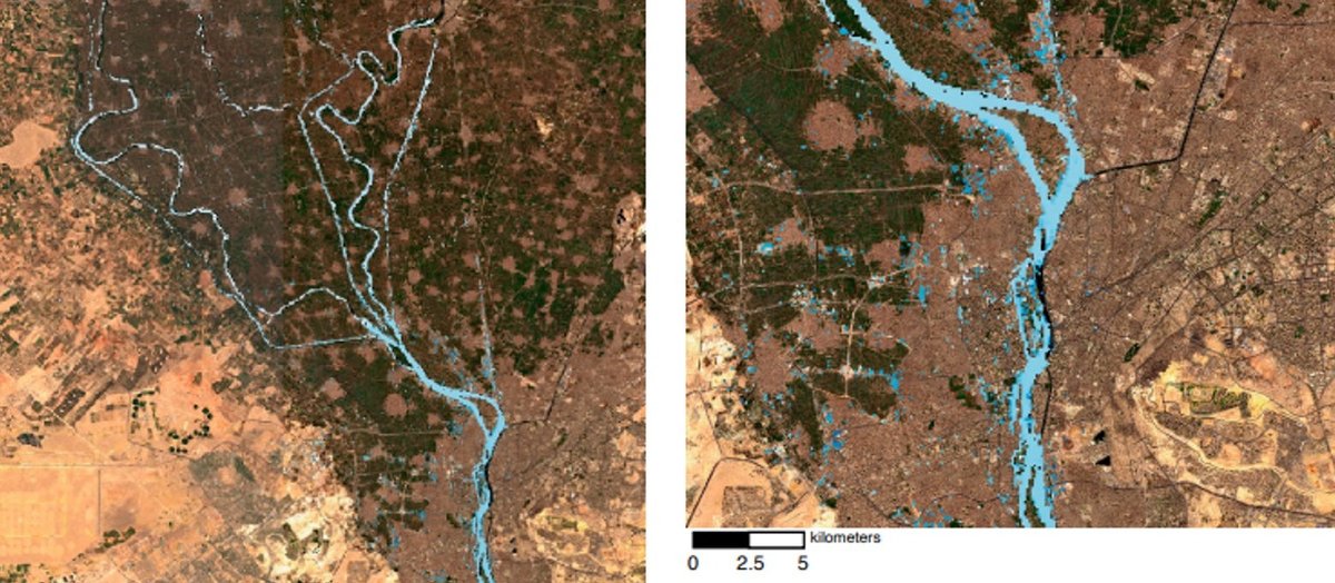
First taste from the SWOT mission shows Earth’s water in higher definition than ever before. The spatial resolution of SWOT ocean measurements is 10 times greater than sea surface height data gathered over the same area by seven other satellites combined.
In a new 'Data-in-Action' story from NASA's Physical Oceanography DAAC (#PODAAC) view how SMAP data was used to visualize ocean salinity as powerful storms wreaked havoc in California.
Learn more: https://t.co/pWjZpmhcXR
Our launch date is set! 🌎
@NASA's Surface Water Ocean Topography mission, or SWOT, will provide the first global survey of Earth's surface water. It's scheduled for launch on December 5, 2022. https://t.co/7r0x0AluCt
#TrackingWorldWater
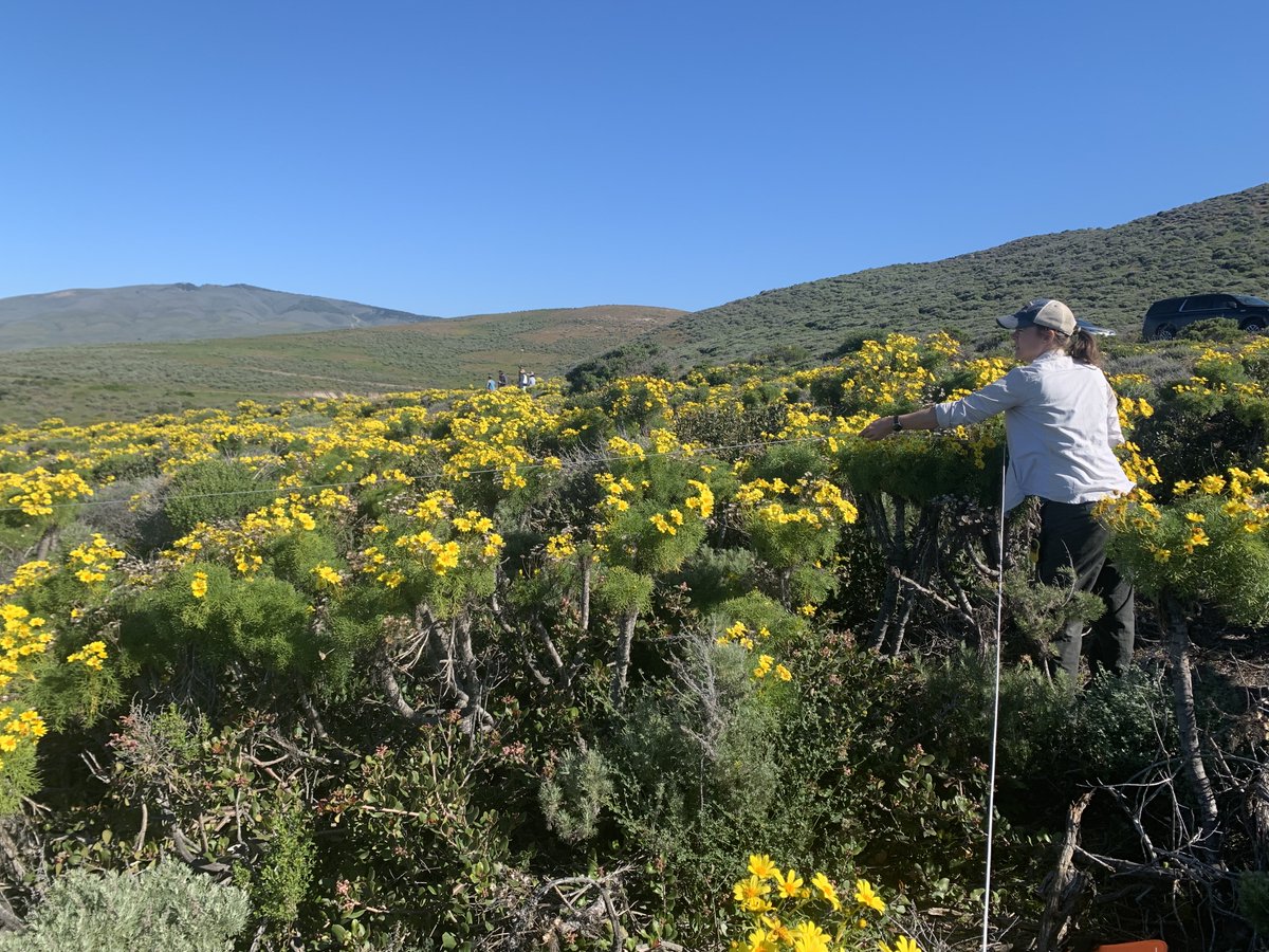
With boots on the ground and eyes in the sky, scientists of the SHIFT campaign are in Santa Barbara County, California, studying some of the most diverse ecosystems in the world and how they are changing in the face of climate change. #SHIFTForScience! 🥾✈️
By land, air, and sea 🥾 ✈️ 🌊
In Santa Barbara County, scientists of the SHIFT campaign are studying some of the most dynamic ecosystems in the world and collecting clues about the resilience of plant and aquatic communities in a warming climate. #SHIFTforScience