Planning a survey trip (aka Pub Meetup) to The Penny Black (formally the Black Bull) tomorrow Wednesday 19th March from around 19:30 - https://t.co/5oQGE4MhmD
Hope to see some of you there.
Very late notice, but some of us are meeting in Diggers aka. Athletic Arms. this evening. We might resolve loc_name vs. alt_name Should be around from 7:30
We have an #OpenStreetMap Edinburgh gathering tomorrow evening, in Cloisters https://t.co/xAQeQ56NT8 Join us for a #geobeer and some Map/geo chat from 19:30
@johnrobson87@CyclingEdin@SpokesLothian It looks like the way has been changed to a path, but I'm wondering if it needs to be disconnected from your description? https://t.co/uINar5tvRR
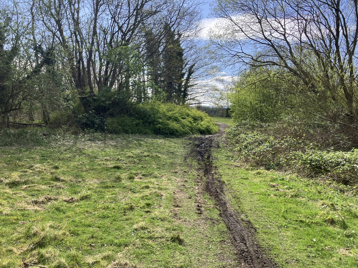
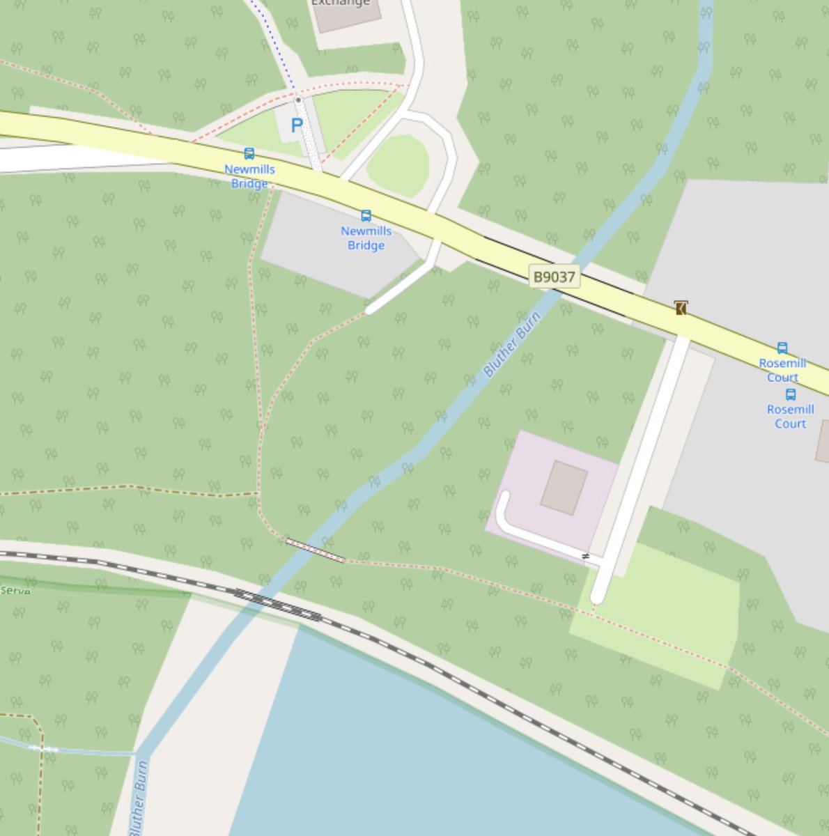
Twitter #HiveMind does anyone know the story of this path in Valleyfield Fife. Crosses the Bluther Burn then just stops even though indicated as a connection on @OSMScotland?
Seems like a good missing link avoiding the main through road.
@CyclingEdin@SpokesLothian
Twitter #HiveMind does anyone know the story of this path in Valleyfield Fife. Crosses the Bluther Burn then just stops even though indicated as a connection on @OSMScotland?
Seems like a good missing link avoiding the main through road.
@CyclingEdin@SpokesLothian
Andres Freund, the principal software engineer at Microsoft who discovered the xz backdoor really does deserve a big pat on the back. 👏
The outcome could have been much, much worse.
@highlandcyclist Hi, is this the location of the cycle path - continuing from the other one, along the west side? As we can add it to our map.
https://t.co/IN7dTMfBR3
If there's any other cycling infrastructure missing from the map feel free to tweet us or add a note to the map. ^M
We are still, working out our social plan for April. However the inaugural #geomobEDI is taking place on the 26th March, and we (at least @chrisfl) will be there. https://t.co/9Vjqem9rE3
@CyclingEdin@DAstonSNP@LewisMichie0@STVNews@FinlayMcF@jomowat @cocteautriplets @owenboswarva OpenStreetMap was updated by a volunteer mapper to remove the road connection 4 months ago, Google at least a month ago.
Maybe should be something councils check after a roads project is complete?
Would also be interesting to know exactly what satnavs these drivers were using. ^M
A lovely note left by a blind OpenStreetMap user asking to add missing tactile paving and crossing information.
In the end their daughter had added the info using @StreetComplete
Great motivation to keep on adding these details.
https://t.co/X5BQGHRVFx
@oliphantly@scottechclub Not quite a startup event, but we are having a OpenStreetMap event on Tuesday, any one using OSM or maps or GIS is welcome to come along. https://t.co/NMJkVtFskA