If you were impacted by last night’s storm, please take photos of damage to your home, business, or community infrastructure and submit your damage using Otter Tail County’s Severe Weather and Disaster Damage Self-Report form at https://t.co/v4ge0jccaw
@OTCemergency
Risk for severe storms Tues PM into early Wed AM. With this potential largely occurring during the overnight hours, make sure to have a way to be alerted if a warning is issued for your area, as well as have multiple ways to receive warnings. #NDwx#MNwx
Get free monthly preparedness tips from Otter Tail County Emergency Management! Subscribe to Emergency Management News in our Notification Center → visit https://t.co/mAtb5YkqIH & click Notify Me. Takes just a minute! #BeReady#OtterTailCounty@OTCemergency
There is an emergency. Your child is nonverbal. Deputies already know because you used Smart911 Safety Profile.
Load your child's photo, communication needs & calming strategies so first responders arrive prepared. Free & private. Signup https://t.co/y3LySfBJea
@OTCemergency
A push of drier air behind a front will bring low humidity values, gusty southwest and when combined with dry grasses will create critical weather conditions this afternoon. Avoid burning as any fire that would start is prone to spread quickly. #NDwx#MNwx
🚩Another Red Flag Warning has been issued today, April 23 as low humidity and high winds will combine to create extreme fire risk. Don't burn. Campfires are discouraged. Be careful with outdoor activities that cause heat or sparks. Check fire danger at https://t.co/gXYJ4UkN1H
Thursday, April 16 at 1:45 p.m. and 6:45 p.m. CDT
Today is Statewide Tornado Drill Day. Outdoor warning sirens countywide will sound twice today -
1:45 PM – to help schools, care facilities, and businesses practice
6:45 PM – so that second shift workers and families can, too.
Do you know your safe place? 🌪️ The National Weather Service wants you to find it, snap a selfie, and post it with #SafePlaceSelfie. One simple action could save a life — start with yours. 📸
@NWS@OTCemergency
Southwesterly winds at 15 to 25 mph with gusts up to 40 mph at times, along with relative humidity values in the low 20s and dry fuels will make fire danger critical tomorrow. A Red Flag warning is in effect for portions of southeastern ND and west central MN. #NDwx#MNwx
Get monthly preparedness tips from Otter Tail County Emergency Management! Subscribe to Emergency Management News in our Notification Center at https://t.co/mAtb5YkqIH → click Notify Me. Free & easy! #BeReady@OTCemergency
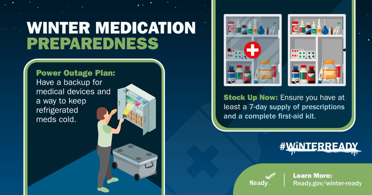
Medical needs don't go away when the power goes out. If you or your loved ones take refrigerated medicines or use power-dependent medical devices, make sure you have backup plans so you can continue taking care of yourself if winter weather interrupts daily life. #WinterReady
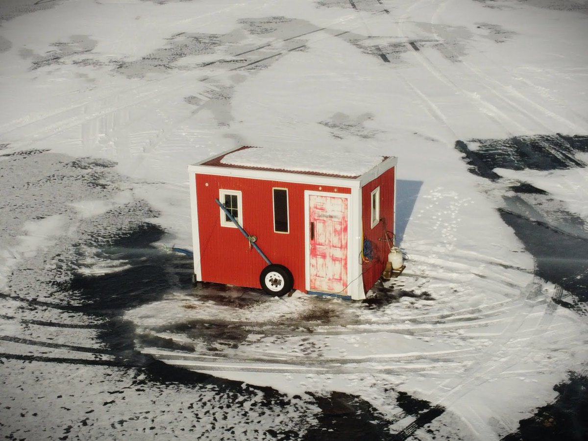
Tom's fish house. Heater running. Fish biting. Then—BEEP BEEP BEEP.
His CO detector just saved his life.
Test your carbon monoxide detectors today. You can't see or smell CO.
More winter safety tips @OTCEmergency#IceFishingSafety#OtterTailCounty
Your dad calls: "I'm having chest pains." You tell him to call 911. He calls 911 but cannot speak. But your dad had set up his Smart911 profile, the dispatcher saw:
Exact cabin location
His medical conditions
Front door code
Visit https://t.co/y3LySfBJea
@OTCemergency
Headed to New York Mills Public Library this morning, to join Elevate for a 10:30 AM Coffee Talk on Smart911.
https://t.co/1seMNWtmI2
https://t.co/upCZjgVOx4
It's the 1st Wednesday of the Month
While frequently known as "tornado sirens," outdoor warning sirens could be used to alert the community & visitors to any number of hazards - and that's why we test them every month of the year.
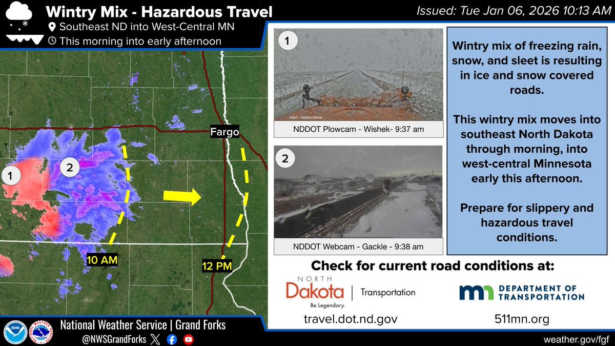
Wintry mix of freezing rain, snow, and sleet is resulting in ice and snow covered roads. This wintry mix moves into southeast North Dakota through morning, into west-central Minnesota early this afternoon. Prepare for slippery and hazardous travel conditions. #ndwx#mnwx
Final graphic this morning is showing the probability of 2 inches of new snow or more. Highest chances of more than 2 the farther north you go, and this is where blizzard potential is highest. #ndwx#mnwx
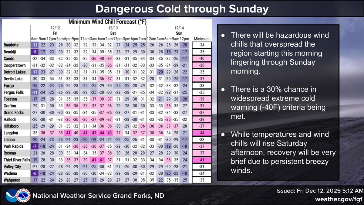
The coldest air yet seen this season will overspread the region today, lasting through Sunday. Temperatures will fall well below zero overnight, with wind chills colder then -30F. If you venture outdoors, dress warmly. #ndwx#mnwx
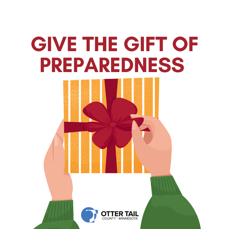
✅ Emergency weather radio with hand crank and USB charging
✅ Flashlights, batteries, and portable phone chargers
✅ First aid kits for home, car, or backpacks
✅ Fire extinguishers and smoke detectors
✅ Emergency blankets and hand warmers for vehicle kits
@OTCemergency