Tornado Warning for...
Eastern Lee County in north central Illinois...
* Until 1130 PM CDT.
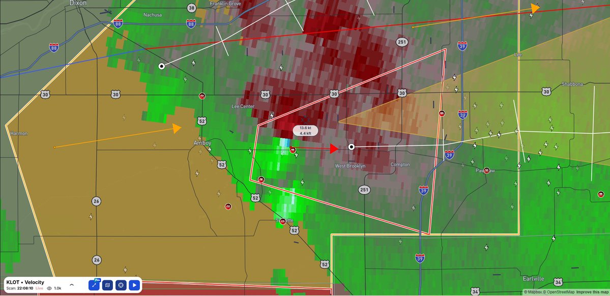
* At 1022 PM CDT, a severe thunderstorm capable of producing
multiple tornadoes was located near West Brooklyn, or 8 miles east
of Amboy, moving east at 10 mph.
#ILwx#ilwx
...A TORNADO WARNING REMAINS IN EFFECT UNTIL 1030 PM CDT FOR
SOUTHEASTERN LEE COUNTY...
At 1008 PM CDT, a confirmed tornado was located near Sublette, or
near Amboy, moving east at 15 mph.
#ILwx
...A TORNADO WARNING REMAINS IN EFFECT UNTIL 1030 PM CDT FOR
SOUTHEASTERN LEE COUNTY...
At 1003 PM CDT, a severe thunderstorm capable of producing a tornado
was located near Sublette, or near Amboy, moving east at 20 mph.
#ILwx
* Tornado Warning for...
Southeastern Lee County in north central Illinois...
* Until 1030 PM CDT.
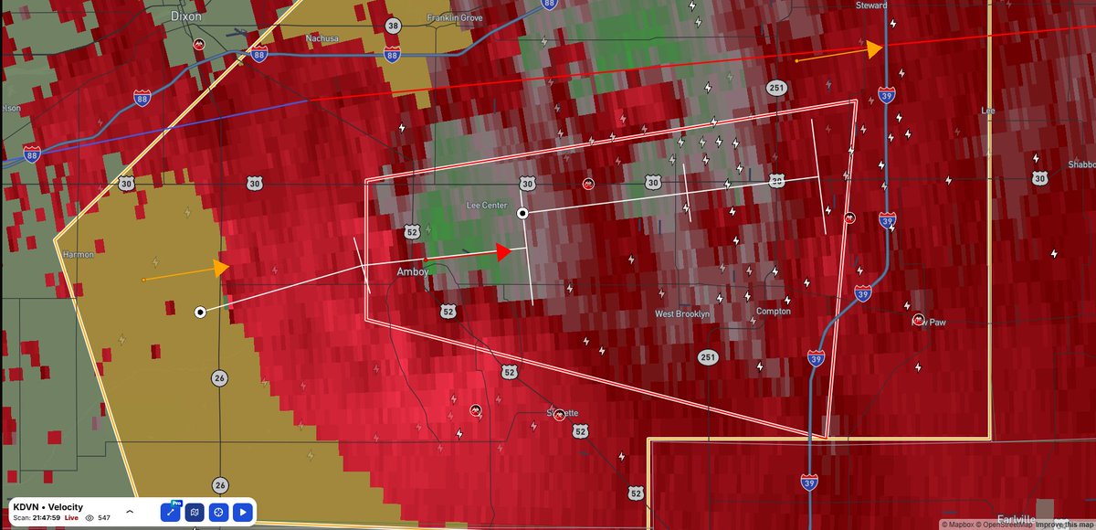
* At 948 PM CDT, a severe thunderstorm capable of producing a tornado
was located over Amboy, moving east at 25 mph.
#ILwx
Tornado Warning for...
East central Henry County in northwestern Illinois...
* Until 1015 PM CDT.
* At 933 PM CDT, a severe thunderstorm capable of producing a tornado
was located near German Corner, or 8 miles northeast of Cambridge,
moving east at 20 mph.
#IAwx#ILwx
...A TORNADO WARNING REMAINS IN EFFECT UNTIL 945 PM CDT FOR EAST
CENTRAL HENRY AND WEST CENTRAL BUREAU COUNTIES...
At 906 PM CDT, a confirmed tornado was located over Mineral, or 9
miles north of Kewanee, moving northeast at 25 mph.
#IAwx#ILwx
At 1204 PM CDT, a confirmed and extremely dangerous tornado was located over Menasha, or near Appleton, moving southeast at 40 mph.
This is a PARTICULARLY DANGEROUS SITUATION. TAKE COVER NOW!
#wiwx
Severe Thunderstorm Watch for portions of Central and Eastern South Dakota
THIS IS A PARTICULARLY DANGEROUS SITUATION
Primary threats include... Widespread damaging winds and scattered significant gusts to 100 mph likely Isolated large hail events to 1.5 inches in diameter
#sdwx
ACME is a highly collaborative, explosive team that brings new MRMS-based science into operations. Support the development of real-time severe weather warning applications! Apply for a rewarding career now: https://t.co/l5aSvFBAFn
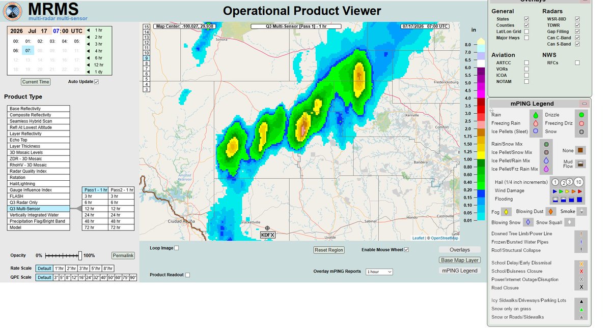
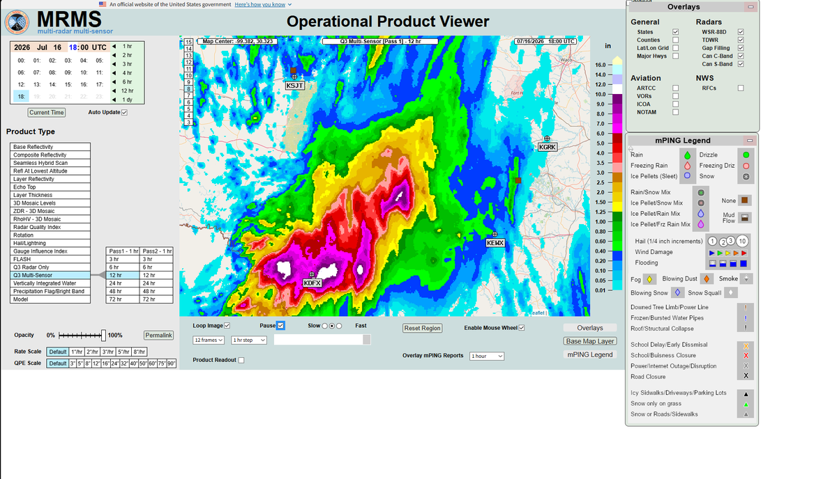
Over 2 inches of rain have fallen in the past hour near Real County, TX and Edwards County, TX Stay tuned into your local NWS for weather updates
#txwx
Teams used insight from the successful deployments in Pawhuska, OK, and St. Libory, NE, during LIFT to pull robust data from this Palmer, KS, storm. Researchers will use this data to create more advanced operational products for forecasters. This is our #2 LIFT moment!
In the past 12 hours over 12 inches of rain has fallen in southern TX Near Uvade, TX Utopia, TX, Kerrville, TX, and Fredricksburg, TX Flash Flood Emergency's have been issued.
As of 0900 UTC We've been tracking two of the Flash Flood E Turn around and dont drown make sure to tune into your NWS if your in the surrounding area
#floodwx#txwx
⛈️ MRMS: A GAME CHANGER ⛈️
MRMS is a tool that combines radar, gauges, satellites and other data to create one clear view of where and how intensely rain is falling. Critical info for forecasting and warning flash floods.
🧐 Learn more ➡️ 🔗: https://t.co/FfrqMKHFAd
Designed to capture HD 4K slow-mo film of hail in free-fall, @NOAANSSL technology captured hail near 3” diameter. iPhone video footage here also captures a rainbow during the storm. The field mission team was near Last Chance, CO, in our #3 LIFT moment.
The Babylon fire has burned 104,252 Acres and is now Containment 44% stay tuned into the news if your in the surrounding area
https://t.co/l2UfetkCCZ
#utwx#babylonfire#watchduty
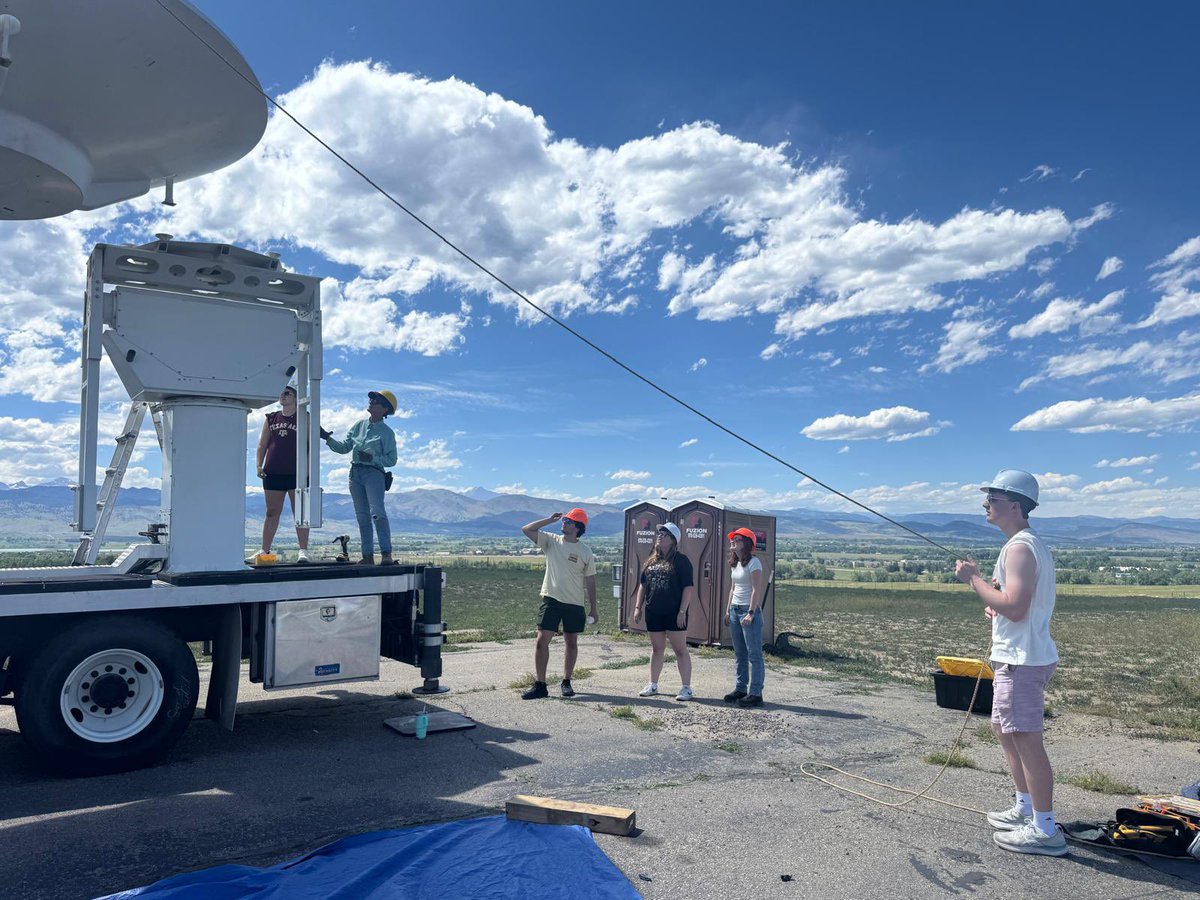
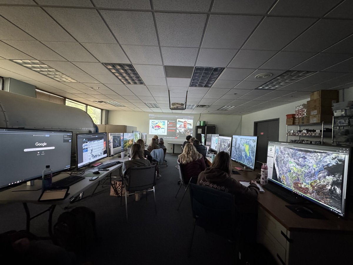
It’s a wrap 🎁🎬 on the 3rd FARM @NSF@UAHChargers Radar Institute! 7 days of guest talks, d/assembling the 🐮📡, collecting 🔥⛈️ data, presentations, 🍩 😁, and maybe some future 🌀 crew 😁. Thanks to all the enthusiastic participants for making this a great experience!