OKANOGAN – Lance Robert Bowers was found guilty of all five charges, including the murder of his wife.
1-Murder, 1st degree
2-Reckless burning, 1st degree
3-Unlawful poss. of a firearm
4/5-Assault, 1st degree
More info will be in the April 28 edition of The Chronicle.
From Okanogan County PUD: "We have a fiber break just south of Okanogan. Some broadband services are offline, while others have been redirected and should experience minimal impact. Crews are working on restoration processes now. We will share updates as they become available."
Updated: US 2 Stevens Pass is closed in both directions from MP 58 near Scenic to MP 64, at the summit. There is currently no estimated time for reopening.
Hazardous Weather Outlook https://t.co/hnO8FXMl8o
"Cold wind chills are expected Monday evening through Wednesday morning increasing the risk for hypothermia and frostbite for anyone exposed to the elements without proper winter clothing."
Weekend weather forecast via @NWS
Sat- H44, L21. Sunny to mostly clear, calm wind.
Sun- H41, L28. Mostly sunny to mostly cloudy, light & variable wind.
Enjoy the weather! See y'all on Monday!
Feb. 7, 2022 Burn Alert: Today, Okanogan-Wenatchee NF crews will be burning a large pile of forest debris at Goat Creek Sno-Park located a couple miles SE of Mazama, WA. This large pile may smolder for a few days with smoke impacting recreationists and local residents.
Hazardous Weather Outlook for portions of northern panhandle Idaho, north and north central Washington.
Freezing temps and light snowfall. Lowlands areas shouldn't receive more than an inch or two, Omak/Okanogan area not expected to get more than 1/2 inch.
https://t.co/8DSoXFcawp
Stay out of the water and away from the shore while the advisory is in effect.
NO evacuation orders have been issued.
Please watch this video and visit https://t.co/28gsMtn4gn for more information.
Guess who got another Hazardous Weather Outlook @NWSSpokane ? We did!
"A wintry mix of snow, freezing rain, and sleet will bring the potential for slick travel conditions across the Columbia Basin, Cascades, and northern mountains," via National Weather Service.
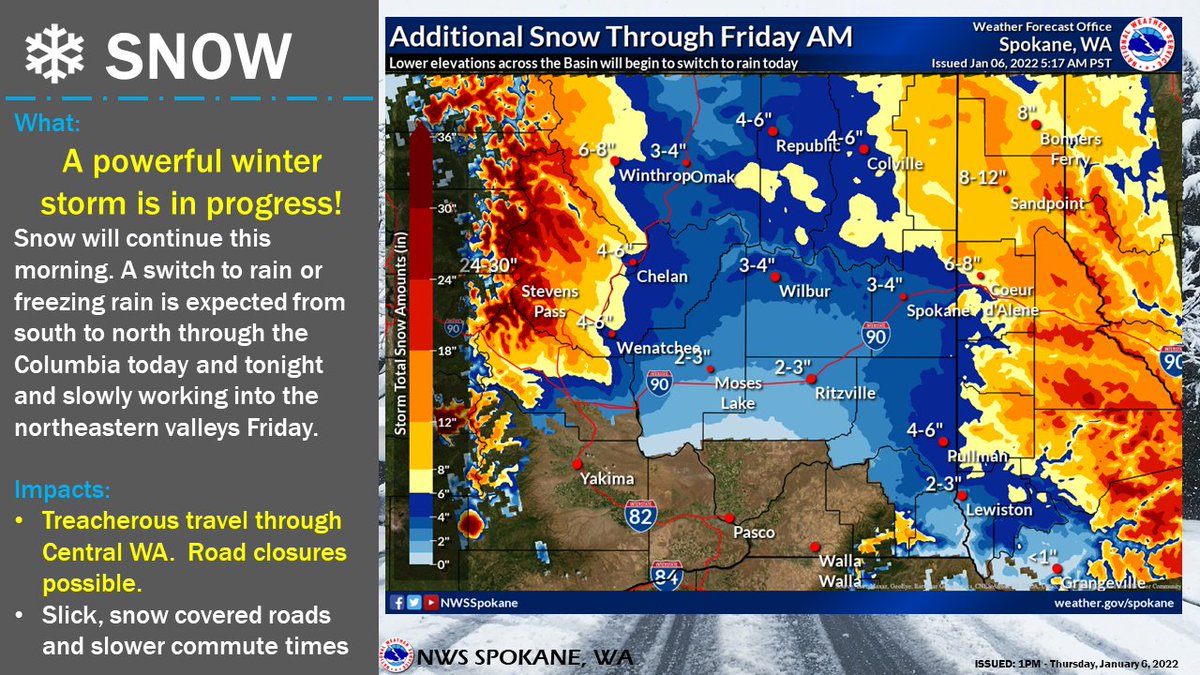
Here is a look at additional snow amounts through FRI morning. Many areas will receive this snow in the next few hours as warmer air begins to move into the Basin from the south bringing a threat for rain or freezing rain. #wawx#idwx
Be aware of the extra snow coming to your front door, backyard and driveway!
Especially for the morning commuters, don't want any of you all to be late (myself included).
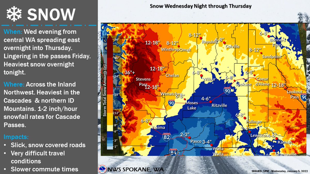
Here is our updated snowfall amounts for the upcoming winter storm. Expect difficult travel tonight through tomorrow, especially across the Cascades and the Idaho Panhandle mountain passes. Delay travel if you can. Check out our latest blog post: https://t.co/PLR70HNFvC
Looking at relatively mild conditions for today.
H:26 + L:19
50% chance of snow showers throughout today, 40% chance tonight.
Winter Storm Watch in effect for Wednesday evening into Thursday afternoon.
Winter Storm Warning through 1 p.m. today plus a Hazardous Weather Outlook through Friday.
Chances of snow ever day this week + cold temps = varying road conditions.
My (very local) street had 6+ inches this morning. Be aware of changing conditions throughout this week!
530am Monday Radar Update - Here's the current radar imagery showing precipitation spreading across eastern WA and northern ID. Several inches of snow have already been reported along & east of the Cascade Crest and over the higher terrain north of Spokane. #wxwx#idwx