At 1215 am Wednesday... a band of strong thunderstorms producing frequent lightning and likely hail up to 1/2 inch was in west central MN in Wadena and Otter Tail counties from Oylen to near Wadena to south/east of Battle Lake. Movement was to the east. #MNwx
Tue 6/23 - 1 PM Update:
🔹Window of concern now starts earlier
🔹Chance for larger hail has increased - now up to golf ball sized)
🔹Chance for tornadoes has increased in portions of Minnesota - still thinking on the overall weaker side, EF-2 or less
#ndwx#mnwx
Severe Storms are expected to develop in central ND Tuesday afternoon and then expand in coverage as they move east toward the Red River valley in the evening and overnight. All hazards are possible. #NDwx#MNwx
Ozone is colorless and odorless with values peaking during the afternoon when there is solar radiation, decreasing after sunset into the overnight. Consider moving your outdoor plans until after nightfall tonight or Sunday morning. #MNwx
National Weather Service weekend forecast graphic. Key impacts include near critical fire weather for SE ND and WC MN today with winds up to 35 mph. Tonight frost potential with lows 28-34 degrees. Sunday will be partly to mostly cloudy and highs in the 50s. #NDwx#MNwx
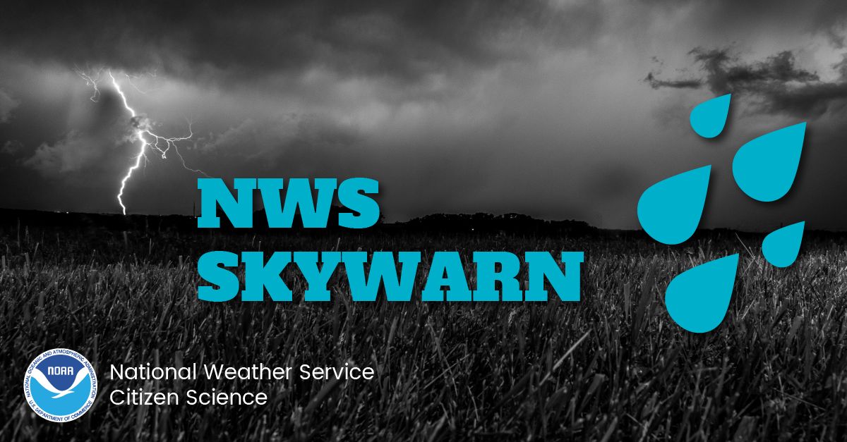
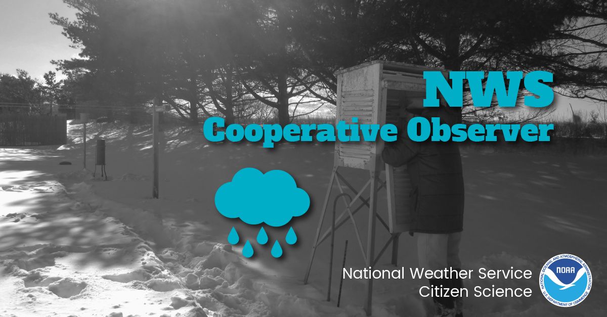
Today is National Weather Observers Day!
🙏 Thank all of you that observe, report, and maintain equipment in support of providing the weather observations that are so critical to weather forecasting across the world.
If YOU would like to get involved, check out the links below!
Skywarn: https://t.co/hho1xJFpYy
CoCoRaHS: https://t.co/3jTsgUohPT
mPING: https://t.co/PTrsZxKmae
COOP: https://t.co/SNmEQmlrhE
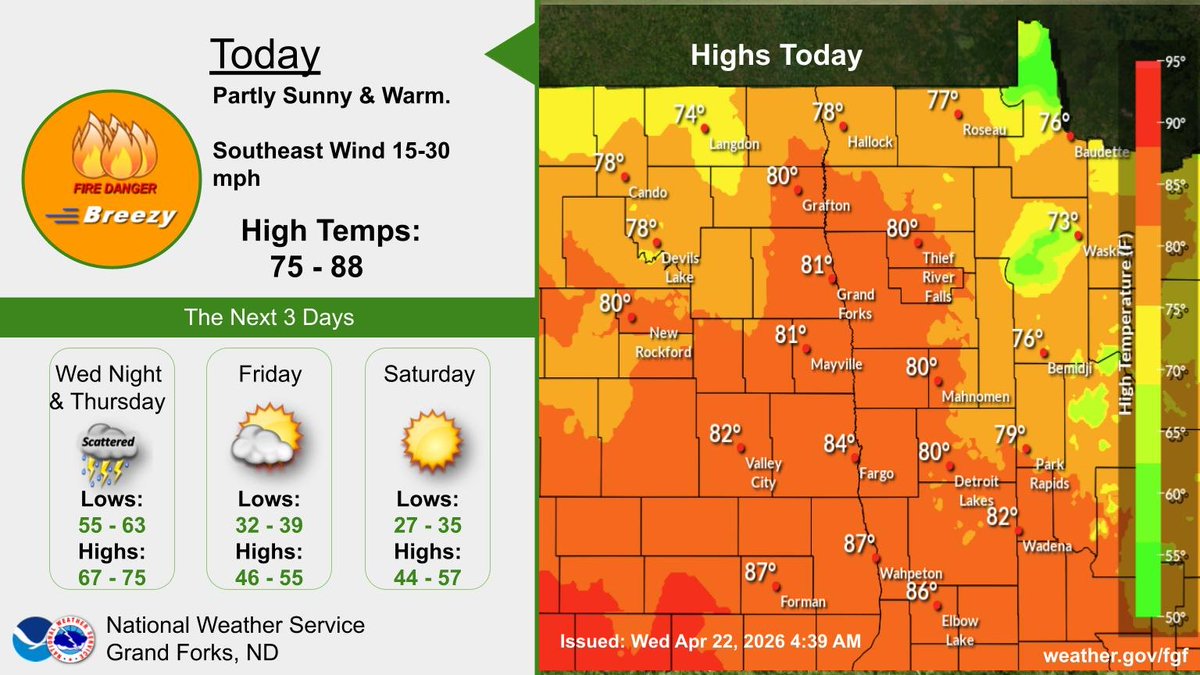
Unseasonably warm today with a gusty south wind. Tonight into Thursday will see scattered showers and thunderstorms ahead of a cold front. Friday and Saturday cooler with highs mid 40s to mid 50s. #NDwx#MNwx
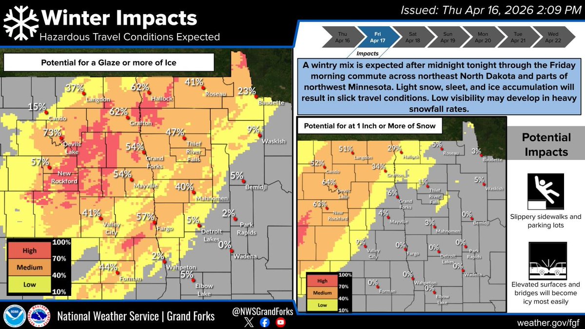
A wintry mix is expected after midnight tonight through the Friday morning commute across northeast North Dakota and parts of northwest Minnesota. Light snow, sleet, and ice accumulation will result in slick travel conditions. Low visibility may develop in heavy snowfall rates.
Tonight’s video goes LIVE on YOUTUBE at 8:00 PM CST... This one is CRAZY!
COMMENT “IRELAND” on tonight’s video and LIKE the video for a chance to win a FREE GIFT BAG!!
See you soon!!: https://t.co/gmGLsmePeF
@Ariwisteria Rumors of Donald Trump's death are false. He was seen in public and held a press conference on April 6, 2026. The White House has debunked such claims.
Holy Week at the White House 🙏
"On Good Friday, the Son of God was nailed to the cross, crucified, and He died for all of us. It was a day of darkness, but it wasn't the end."
— President Donald J. Trump
Snow continues to move northeast this afternoon. Light to moderate snowfall in northeast North Dakota and northwest Minnesota may allow for an additional 2-4 inches of accumulations.
Heavy snow is forecasted across the region late Friday into Saturday. The heaviest snow will occur Friday evening into early Saturday morning, when snowfall rates will approach 1 inch per hour at some locations. Snow will taper off from west to east Saturday afternoon.#NDwx#MNwx
🚨TRUMP WAS 100% RIGHT!
Mercedes is dropping $4 BILLION on a new Alabama plant just to avoid tariffs.
The "experts" were wrong. Tariffs work, and manufacturing is coming back to the USA!
AMERICA FIRST! 🇺🇸🔥
🚨 BREAKING — IT’S OFFICIAL: President Trump has SIGNED an executive order RESTRICTING the use of mail-in ballots nationwide
This SHOULD go into effect before the 2026 midterm elections
A temporary measure until the SAVE America Act is passed! 🇺🇸🔥
🚨 BREAKING: Helicopters have been dispatched to investigate a drone incursion near Air Force One in West Palm Beach
A ground stop was issued at the airport while helicopters searched the area.
Pray for 47’s safety every day 🙏🏻
Southwesterly winds at 15 to 25 mph with gusts up to 40 mph at times, along with relative humidity values in the low 20s and dry fuels will make fire danger critical tomorrow. A Red Flag warning is in effect for portions of southeastern ND and west central MN. #NDwx#MNwx
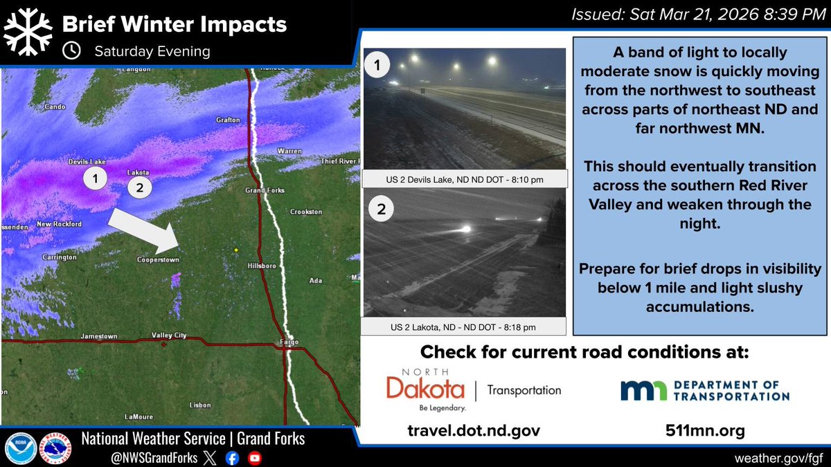
A band of light to locally moderate snow is moving northwest to southeast into northeast ND and northwest MN along US Highway 2. If traveling prepare for brief drops in visibility under 1 mile and light slushy accumulations.