@3sloth3@TerribleMaps Many of the ski resorts are located in North Michigan were there are considerable hills or small mounts. Mount Bohemia has an almost 1,000-foot slope and multiple triple black diamond tracks. Only a handful are decommissioned landfills.
@amazingmap One needs to consider the rural nature of areas such as Montana/Wyoming and the distance between hospitals. If one is in need of critical medical care following a collision in those rural areas, they may die before reaching help. No where in Europe compares to these regions.
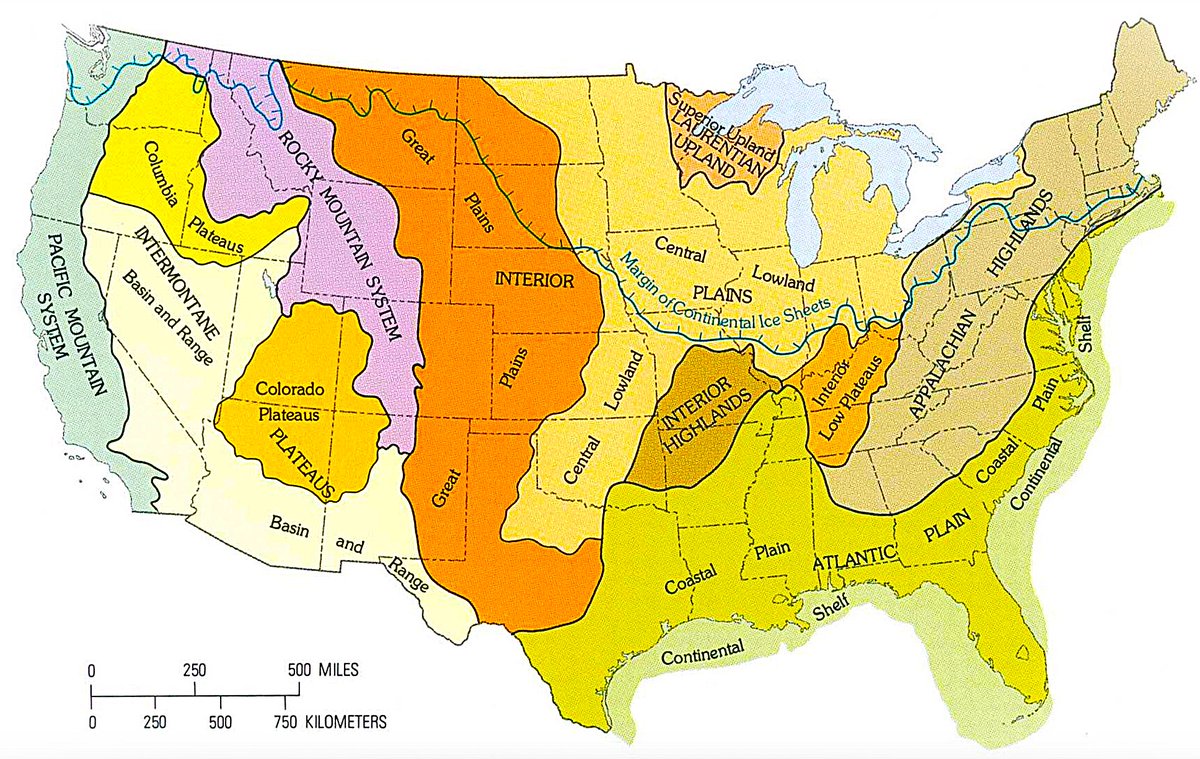
The "Central Lowland Plains" includes Northern Lower Michigan where a isolated upland reaches ~1,700 feet above sea level in multiple locations and the highest elevation in Ohio at ~1,500 feet.
@Arrell18 Have you considered one where Penny and Simon's girl friend are using adjacent stalls in a public restroom? Simon's girl friend would be embarrassed attempting to hide her bowel movements (perhaps by flushing) while Penny would proudly destroy the stall.
On this day 6 years ago, Redditor 'Mormislaw' posted the "Oh no! Anyway" meme in the /r/teenagers subreddit as a reaction to school responding to bullying.
Most world maps use the Mercator projection, first introduced by Gerardus Mercator in 1569 for marine navigation.
It keeps direction and angles accurate, allowing straight-line routes to match compass bearings. To achieve this, it stretches space away from the equator, distorting size and distance.
That is why two lines that look similar here represent very different real-world distances. High-latitude regions are expanded, while areas near the equator remain closer to true scale.
The only way to remove this distortion entirely is to use a globe, which preserves true distances, areas, and shapes. Flat maps always involve trade-offs. Other projections reduce specific distortions, but none can represent all properties accurately at once.