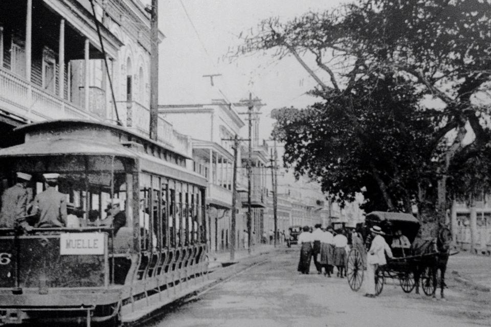
Wantzelius, Oliver & Co., Exportadores de café, en Playa de Ponce. Edificio con mural leyendo "Departamento de Café". Carril de tranvía en primer plano. Recopilación de imágenes como parte de investigación realizada por @Plusurbia
Tranvías de Ponce🚋
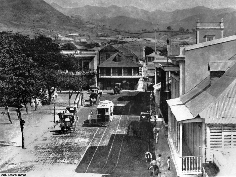
1. Tranvía de vapor frente a Plaza Las Delicias
2. Tranvía de vapor frente al Parque de Bombas
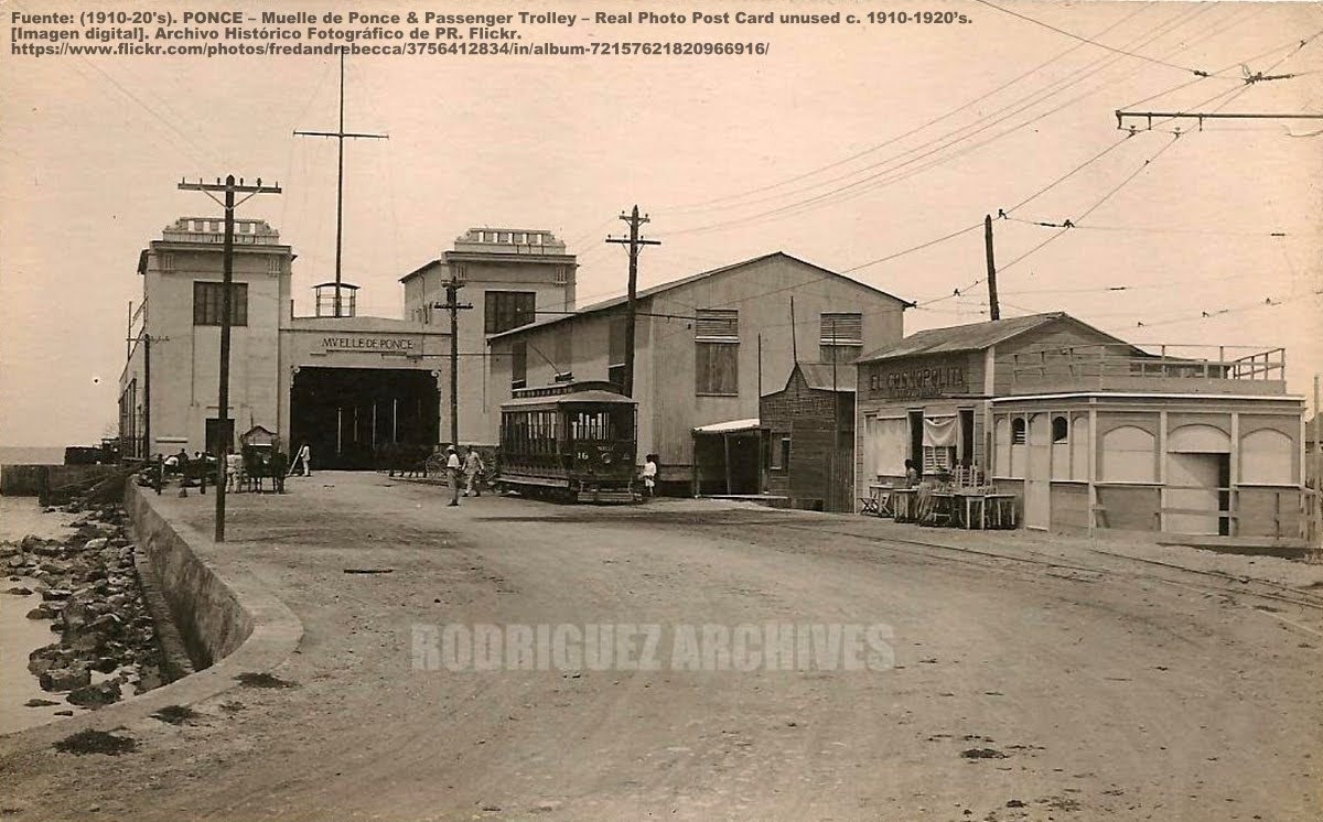
3. Tranvía eléctrico en el terminal del muelle
4. Tranvía eléctrico con destino al MUELLE
Dato curioso: Al muelle también llegaba el ferrocarril American Railroad
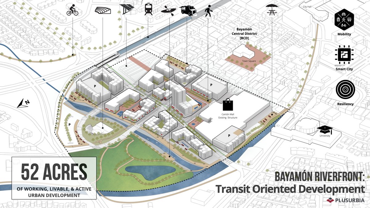
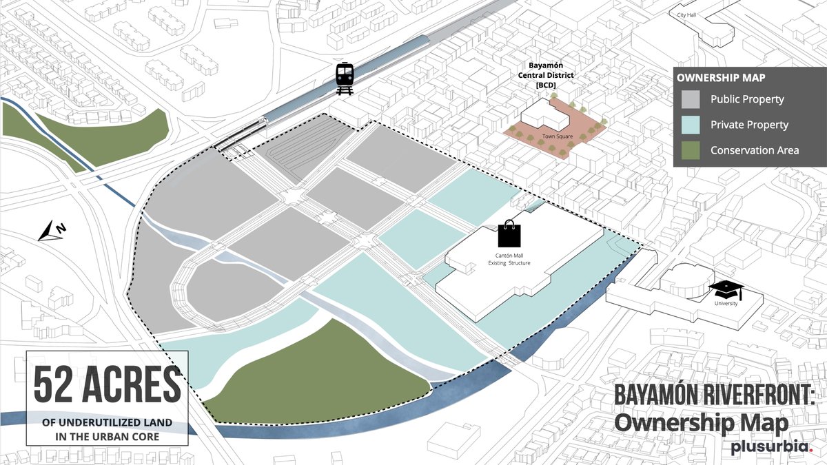
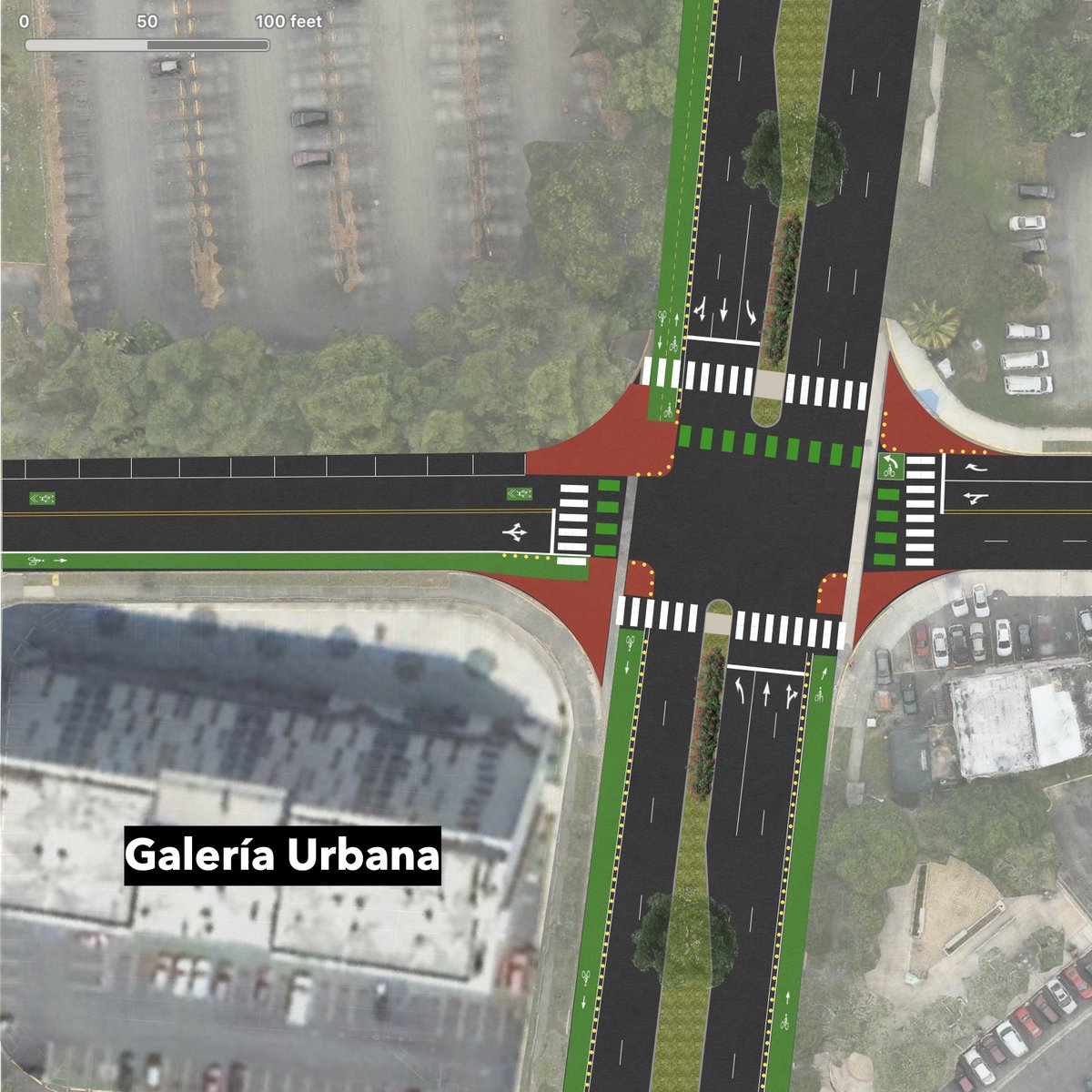
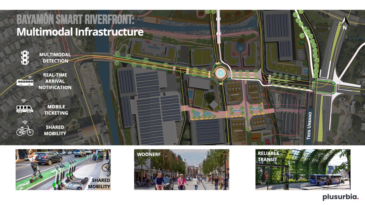
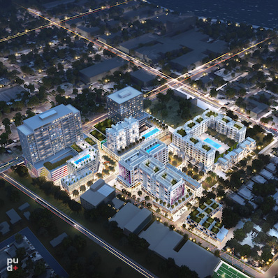
What could TOD and Tren Urbano look like?
Extending Bayamon's traditional grid for a transit-enabling design activates the riverfront with resilient open spaces. This new district will be the catalyst to attract new investment with the proposed Smart City vision and framework. 🏙️
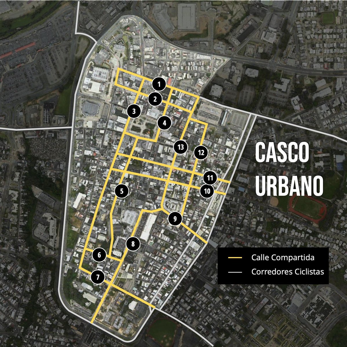
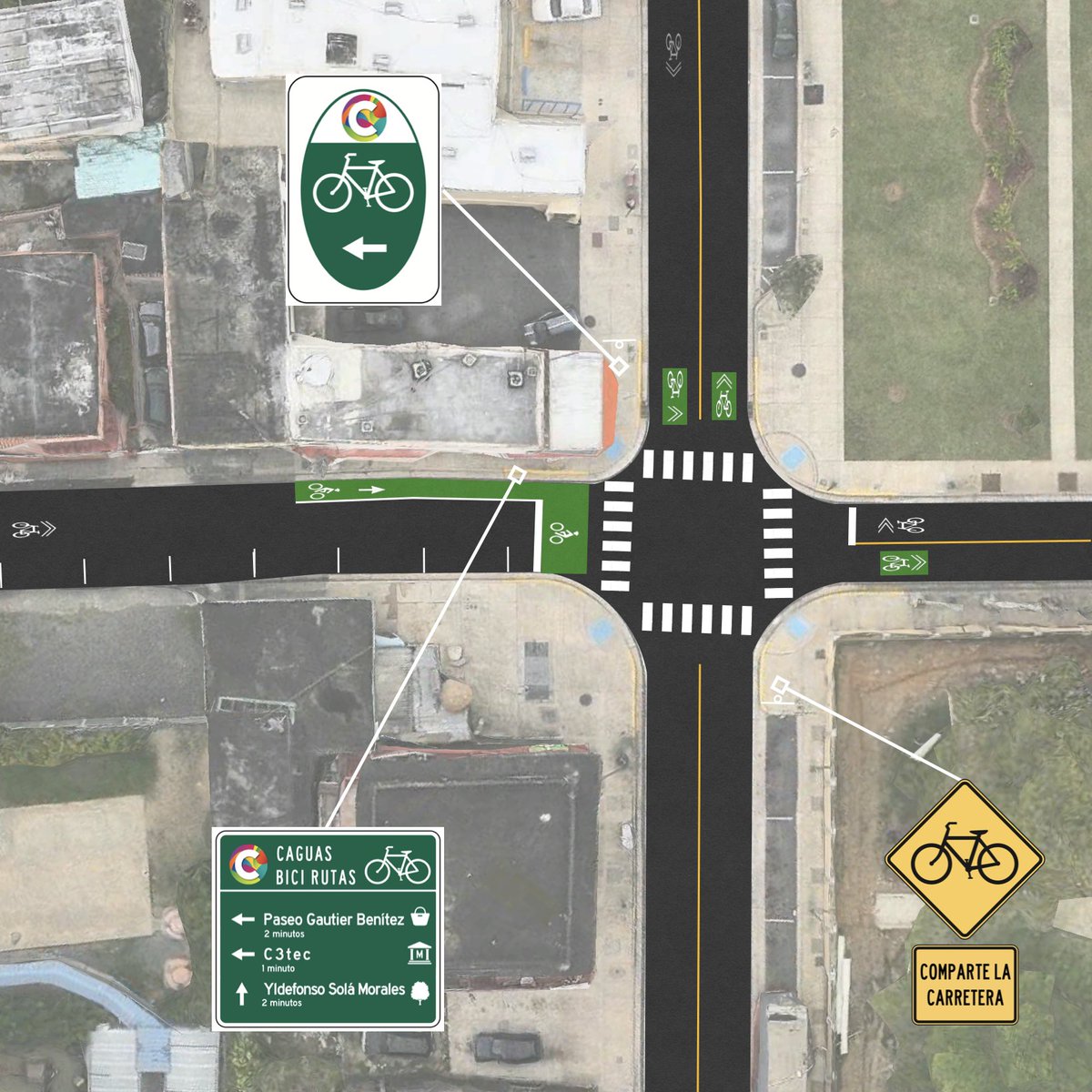
We assisted the @caguasgovpr in collaboration with @MueveteBiciPR in identifying short-term strategies to advance the Caguas Bicycle Network. This complete streets initiative was developed as part of efforts to promote public health in the face of the COVID-19 pandemic. 🚴♀️🚶♂️🚴👩🦽
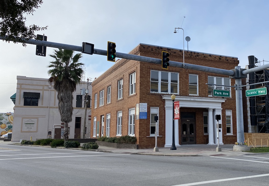
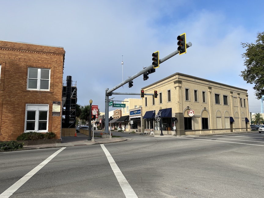
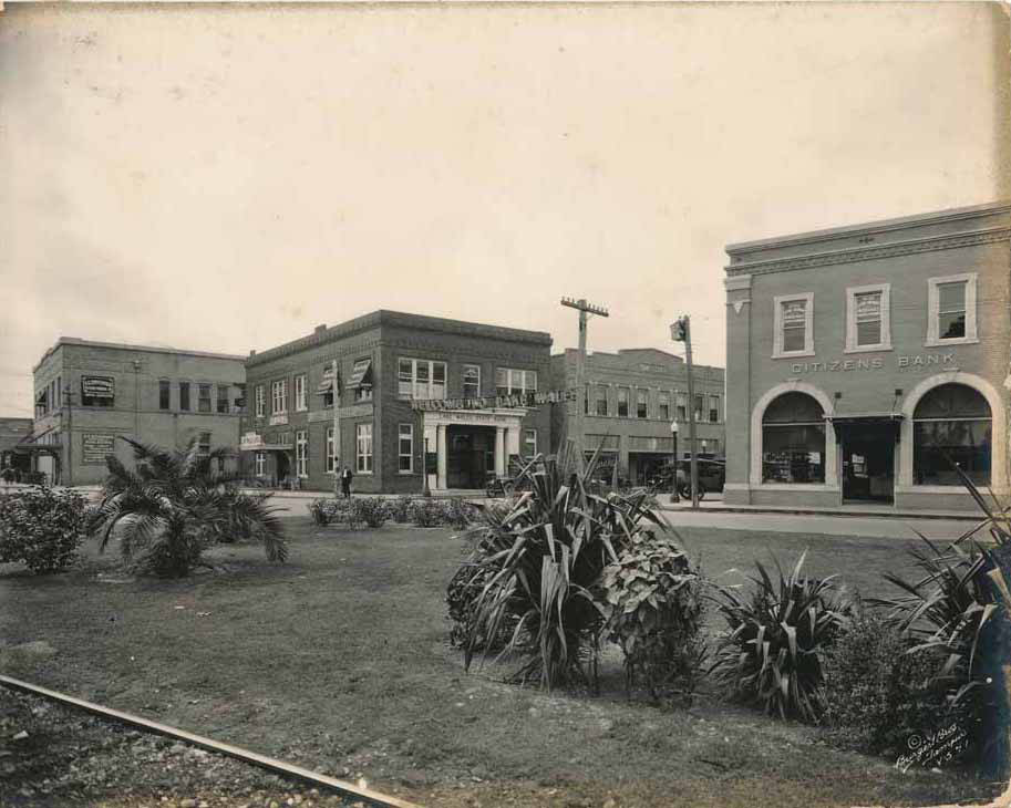
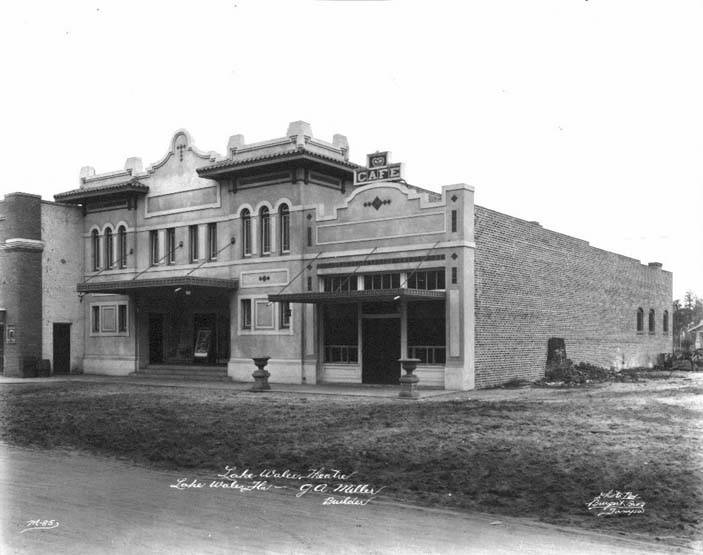
In Lake Wales, the 1920s saw the construction of the town’s most architecturally significant buildings. Most were high-quality brick Masonry Vernacular buildings, as seen in these 1920s photographs by the Burgert Brothers from the Hillsborough County Public Library.
The Lake Wales Land Company hired A.C. Nydegger to survey land near Lake Wales and create a plat for a new community. Below is a 1911 original sketch layout of Lake Wales from Nydegger's Survey Field Book, courtesy of the Lake Wales Public Library.
The NORA District proposes gradual transitional zoning, which acknowledges the need for and paves the path towards creating missing middle housing that bridges the gap between single-family residential enclaves and a dense high-rise downtown environment.
This proposed mixed-use district in West Palm Beach is a neighborhood revitalization project by Place Projects. Plusurbia worked on the major urban design and planning elements of the NORA District, with the goal of improving walkability, safety, and residential supply.
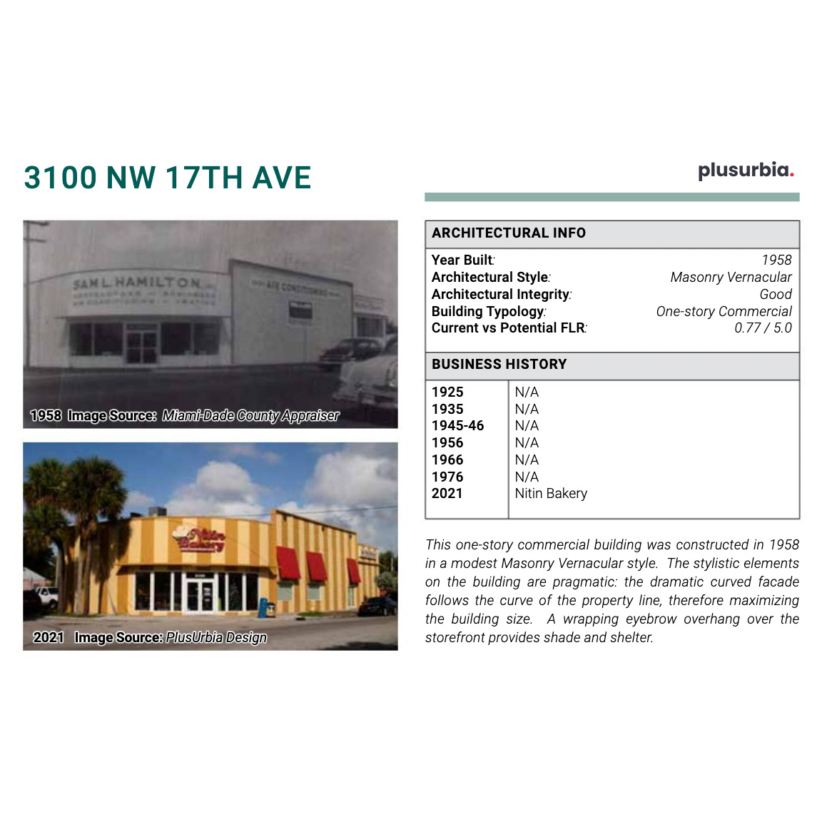
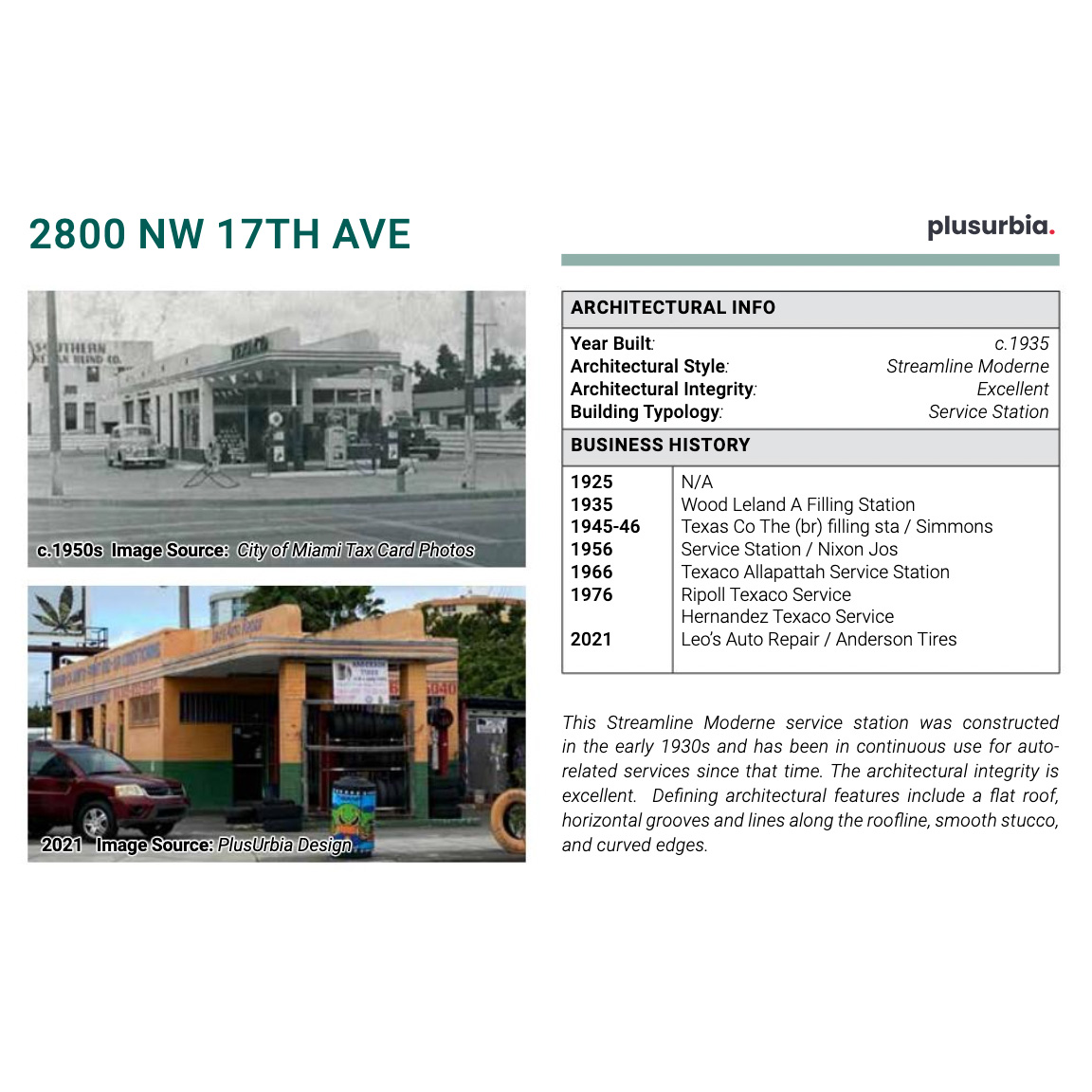
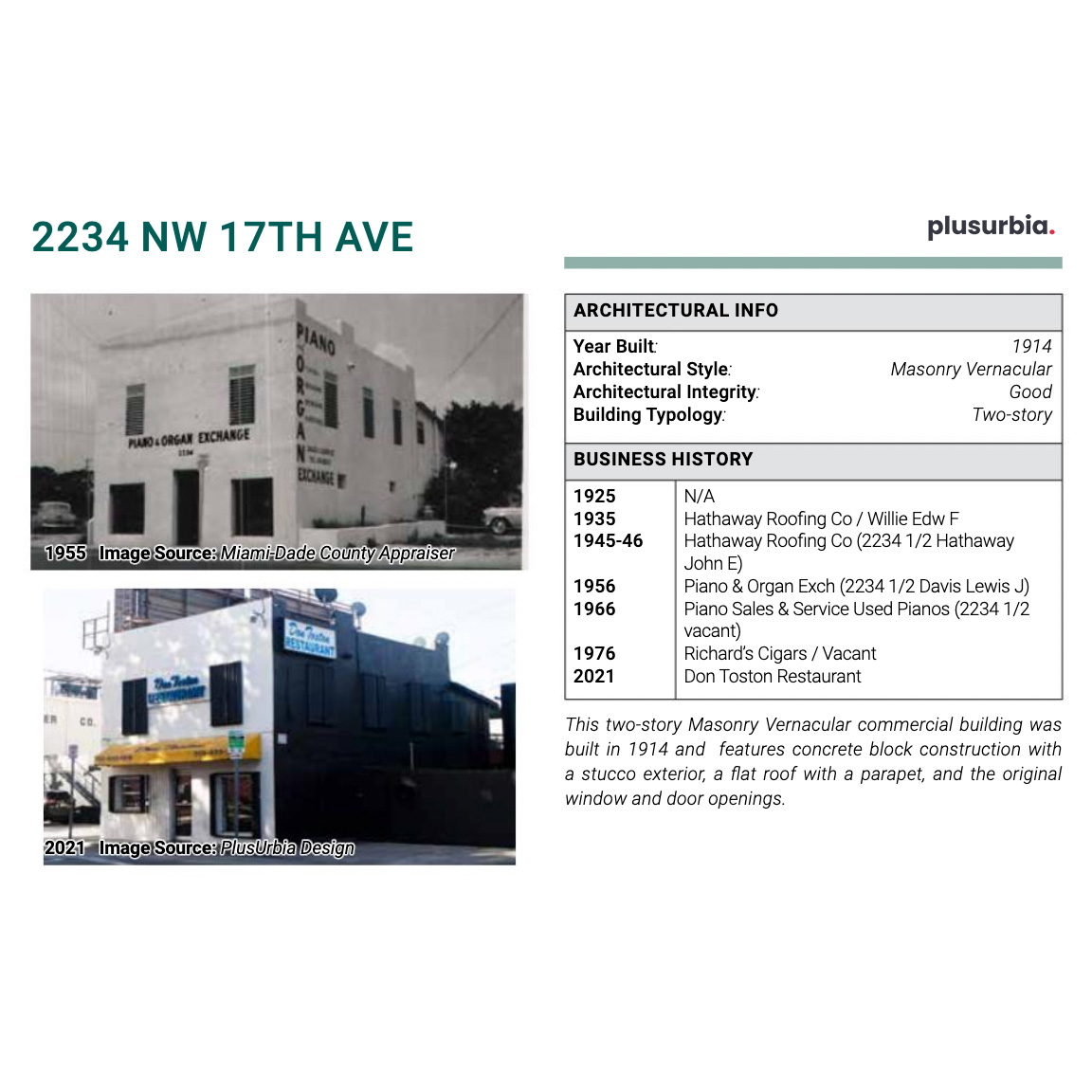
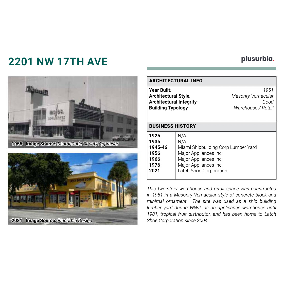
As part of this effort, @DHTrust commissioned a building inventory study of NW 17th Ave b/w NW 20th St and NW 36th St. This study provides a snapshot of history for each property along 17th Ave, including a historic photo, current photo, and a history of the various businesses.
Expanding on Allapattah, the neighborhood in Miami is a melting pot of residents from all across the Caribbean, Central America, Latin America more broadly, and African Americans who historically lived throughout the South.
In 2019, @DHTrust partnered with The Allapattah Collaborative to bring attention to the unique character of this thriving Dominican neighborhood, and to support the small, locally-owned businesses along 17th Avenue.
During the early 20th century, Allapattah Prairie was best known as an area of “truck farms,” which were small-scale farms growing winter vegetables and other produce. Pictured here is a wood frame bungalow that was likely an original farmhouse for a small truck farm.
The neighborhood that we call Allapattah today was originally a grassy prairie intersected by a creek that fed into the Miami River, forming the eastern edge of the vast Everglades system. It was part of the territory of the Native American Tequesta tribe.
It was Seminole tribe territory during the 1800s, as it was located along a direct trade route from the Everglades to the early white settlements at the mouth of the Miami River. The name “Allapattah” is attributed to the Seminole tribe with their name for “Alligator.”
The City completed a project in 2018 to dredge portions of Wagner Creek that are still open to remove sediment containing deadly toxins and pollutants. There are ongoing efforts by the Nature Conservancy to uncover and “green” portions of the waterway that were buried or filled.