Documenting all things Extreme Weather and Nature through Photography and Video and working to Protect Lives
and Property. NWS Weather Ready Nation Ambassadors
Heavy blowing surface dust being lofted along the OFB 1 mile SW of Felton, MN in Clay County @ 1:20pm. This was observed with the measured 54 MPH wind gust. @NWSGrandForks#mnwx
After overnight thunderstorms exit Minnesota early Wednesday morning, the atmosphere will recharge for another round of potentially severe storms this afternoon and evening. Here’s what to expect. https://t.co/054WNIWujX
Line of strong to severe storms extending across western & southern MN will continue to quickly move northeast across the forecast area. Attached below is an updated time of arrival graphic. Time of arrival for TC Metro: 3-4AM. Strong to severe wind gusts will be possible. #mnwx
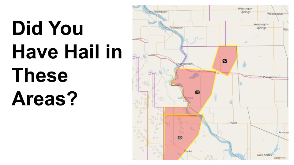
We need your help!
We're in the process of following up on last night's severe weather and are looking for reports of large hail or wind damage.
If you have something you would like to share, feel free to comment. Bonus points if you have a few pictures.
Thanks in advance!
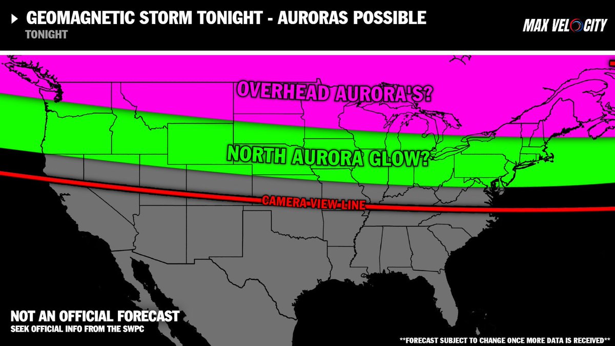
NORTHERN LIGHTS are possible tonight due to a possible geomagnetic storm!
This could lead to auroras being visible as far south as Kansas with a camera. If you live in Canada, your odds of seeing Northern Lights are increasing. Severe storms will increase cloud cover across the Northern Plains and Midwest tonight, so this could disrupt viewing.
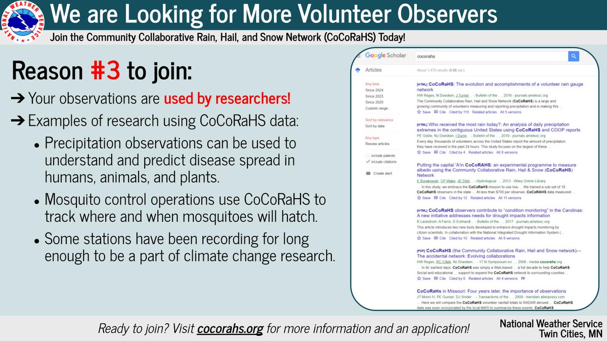
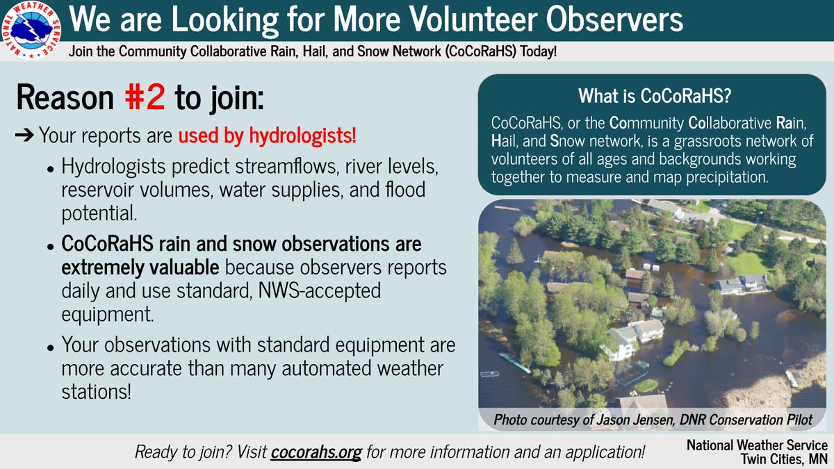
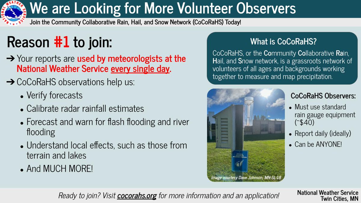
We are actively recruiting new observers for the Community Collaborative Rain, Hail, and Snow Network (CoCoRaHS).
Need that extra push to join? Check out these four reasons why you should!
If you're interested in joining, go to https://t.co/tah2bMdGPV today!
#MNwx#WIwx
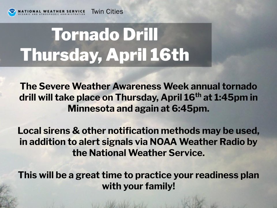
The annual Severe Weather Awareness Week Tornado Drills will occur tomorrow, with the first at 1:45pm and a second at 6:45pm.
More info at https://t.co/4tO1pb9yTt #Drills#mnwx#wiwx
A strong cold front will move through Friday and bring another chance of severe weather to the region. The greatest threat for severe will be across western Wisconsin. All severe hazards will be possible including large hail, damaging winds, and a few tornadoes.