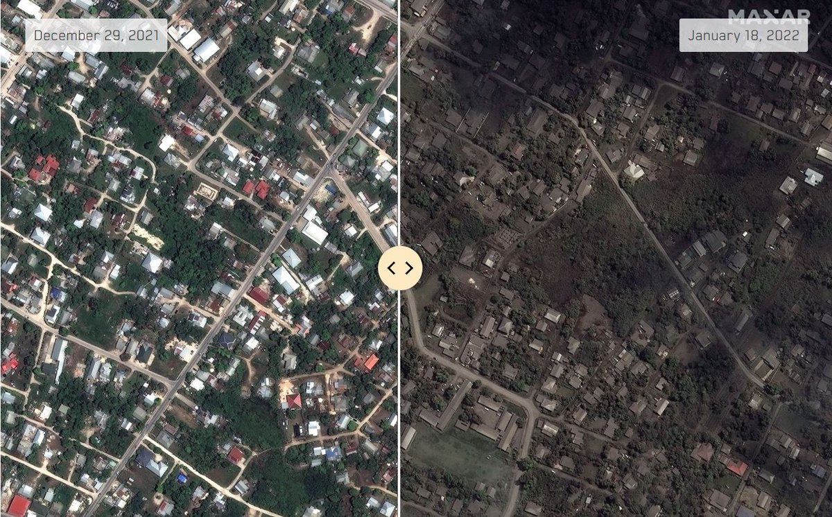
Last few days has been fight with the time to provide data on the extend of the damage in Tonga. All data is now freely available to everyone as part of @Maxar Open Data Program https://t.co/QrdcrCcK7K
#Tonga#Volcano#HungaTonga#PGRSC#Disaster
@OPObservations Urban Greening Platform is a game changer providing environmental insights and decision making intelligence to plan and build future sustainable cities. Glad to provide @Maxar support and data to power this initiative. #smartcities#sustainability
Meet the winners of TakiWaehere: The New Zealand Geospatial Hackathon!
The AUNTS took the 24hr challenge and tackled the very real issue of managing emergencies. Find out more here: https://t.co/qaXdiZnO2Y
Proudly partnering with the Centre for Appropriate Technology in Alice Springs, to bring satellite data down to Earth. Australia’s first Aboriginal-owned-and-operated ground station is supporting the #CSIROspace NovaSAR-1 national facility and Aussie Earth observation science.
Have you registered for the #EODashHack?
Don't miss your chance to use #EarthObservation data to solve challenges related to the environmental issues or COVID-19 pandemic. The weeklong hackathon begins June 23 and registration is still open. Sign up at https://t.co/VSBswECCyI
Check out @Maxar new Resource Hub! A new way to explore Maxar’s capabilities. Watch new videos, download #samples, explore interactive #maps and discover new #products. All within our newly launched Resource Hub. https://t.co/TpZDn8fNk7
Photon is going to Mars! Two Photons to be exact. We’ve been awarded a contract by @UCBerkeley to design two Photon spacecraft for @NASA’s ESCAPADE mission to Mars. Learn more: https://t.co/r3YKpx60Df
@nzspacegovt This is long term vision, which requires more structured academic curriculum than current engineering and IT, only few talented individuals get jobs in those fields. How about solving short term needs by offering Global Talent Visa like Australia has done ?
Proud to be leading @Maxar disaster response to flooding in Canterbury and activating high resolution satellite capture over flood affected areas just hours since the event happened #disasterrecovery#disastermanagement#disasterresponse#flood
https://t.co/1GA0bTSs6T
Have a closer look at @NASAEarth new #EarthSystemObservatory program, which will collect critical observations to provide better understanding of our planet and its changing climate: https://t.co/og1vmCcvls https://t.co/4iVO0Ehtxy