Happy to have been involved in the Rice Village building documentation project. This landmark is 14.8 acres and every inch of it was scanned using Terrestrial laser scanners and Vehicle-based LiDAR.
#ricevillage#buildingmeasurements#architecture
https://t.co/18ujDs9Cm3
What does Biden's $2 Trillion Infrastructure Plan mean for the Architecture, Engineering and Construction industry? The large allocation of roughly $1.3 trillion toward construction projects will nearly double the budget for what was allocated in 2019 https://t.co/GvFeNx2Xl2
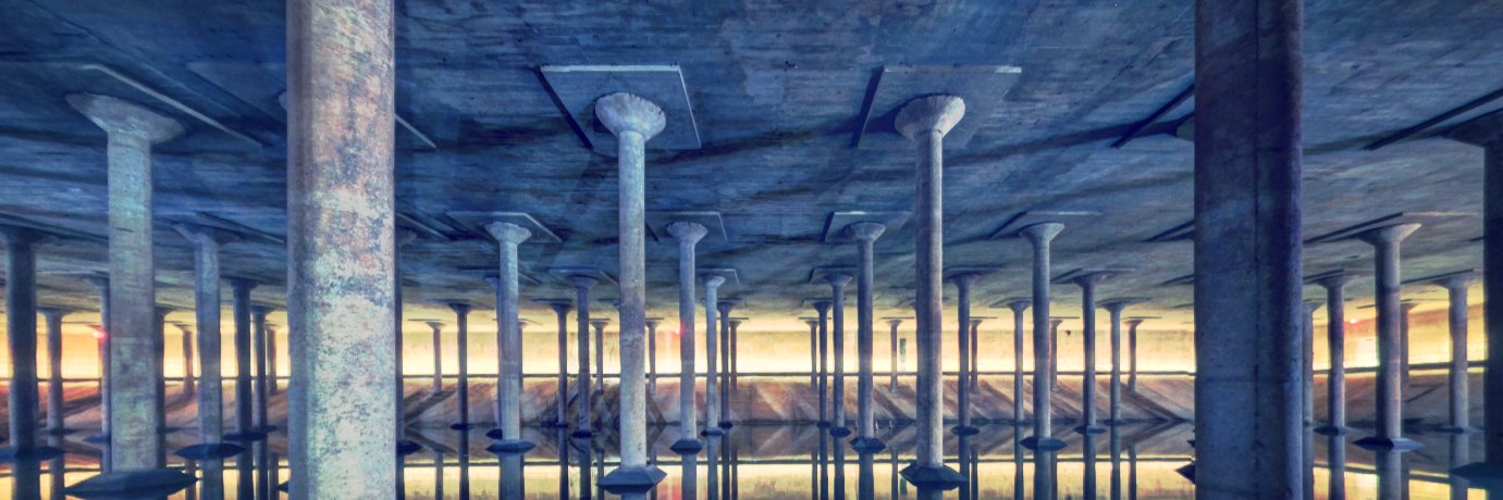
"The result was millions of points in 3-dimensional space,that mapped out all the details of the façade." Take a closer look at how @RealityImt helped document the LULAC Council 60 Clubhouse in Houston https://t.co/nVk7Fk2NVR
We're honored to have been selected by @Microsoft, @Intel, The City of Houston and @IonHouston among 10 startups with a vision for smart city technologies. More info to come soon at https://t.co/h98GFsJSop.
In 2020, Mississippi reached flood levels that had not been seen in more than 35 years. See how car-mounted lidar is changing risk assessment for insurers. #lidar#flooding https://t.co/Y3d6IRp2Ft
"The result was millions of points in 3-dimensional space,that mapped out all the details of the façade." Take a closer look at how @RealityImt helped document the LULAC Council 60 Clubhouse in Houston https://t.co/nVk7Fk2NVR
Generating a Digital Elevation Model (DEM) & Orthomosaic Imagery is becoming a standard deliverable of Site Surveys. Very Exciting... #dem#3dmapping#gismodeling#lidar https://t.co/0BPKW2Z97V
HARC's Platinum certification is the highest environmental building achievement attainable by the U.S. Green Building Council (USGBC), making HARC the first LEED Platinum building in The Woodlands and Montgomery County. Sample 3D p…https://t.co/puvzv67DyJ https://t.co/i3MwEOYk9w
A much needed effort set forth by @Skynetwest_AZ. to advance a good cause. If you are involved in Commercial UAS/UAV, I would recommend you participate. https://t.co/fHPBQaHyBa