⚠️Important Heads Up⚠️A potentially significant Winter Storm may impact the region middle of next week. Lots of uncertainty with the storm track which will make a huge difference with precip types and amounts over the area. Stay Weather Aware!
#OHwx#PAwx#NWS#Cleveland
Today is all about the pivot of heavy snowbands across eastern New England. Yellows are 2"+/hr rates
There will be subsidence, or sinking air, with lower rates and totals between the bands
In western New England they'll say "what storm?"
2" in last hour in Islip, NY. Watch those bands of snow intensify north of the upper low as it intensifies. You will see incredible snow amounts this afternoon across southeastern New England.
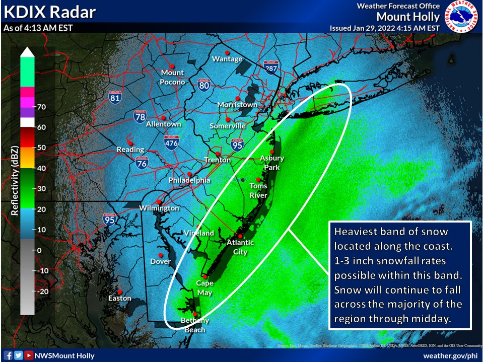
Snow spreading northward now... road conditions deteriorate through the morning, especially south.
I'm LIVE on WMUR with team coverage throughout the day. Join us for an update on this January nor'easter. #WMUR#nh#nhwx
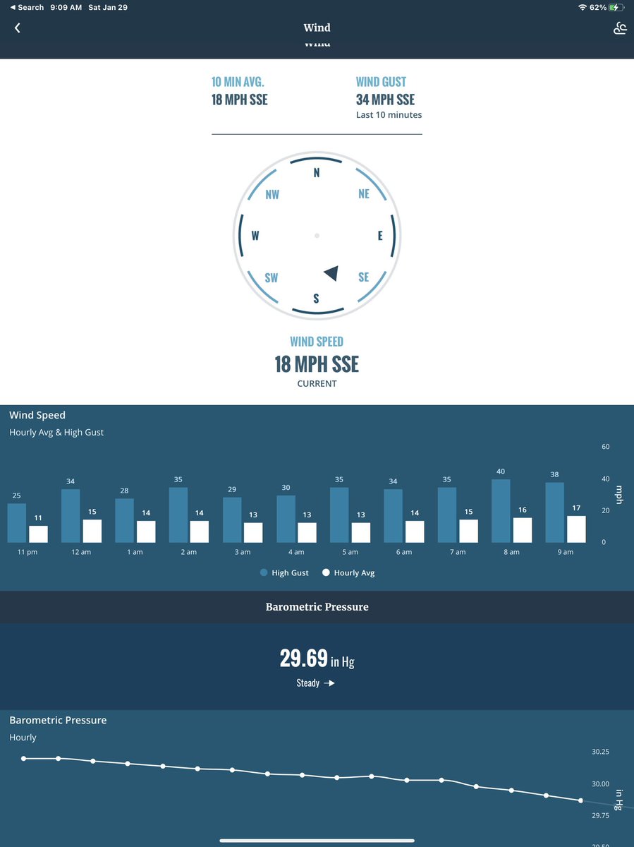
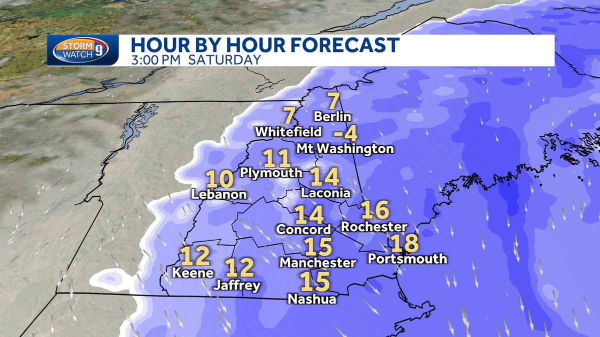
Here we go...snow intensity & wind picks up through the day as nor'easter makes its closest pass later this PM. Snowfall rates in SE 1/2 of NH at 1-3" per hour at times making travel very difficult in the southern 2/3 of NH. It all wraps up between 7-11pm this evening. #WMUR
[5:45am] Heavy snow continues through the morning across Long Island with snowfall rates of 1-2 inches per hour and near blizzard conditions at times.
Avoid travel! #NYwx#CTwx#NJwx
https://t.co/oSWvIv8A2P
Snow starts off light and then becomes heavier late morning through the afternoon with the wind ramping up too. We're looking at near white out conditions especially towards the coast.
Hunker-down today if you can #WeatherWarn@WGME
Height of this storm for us in NH will be between 11am-6pm...snowfall rates between 1-3"/hour in the SE half of NH with some wind gusts over 40 mph reducing visibility greatly...tough travel this PM until everything winds down between 7-11pm tonight. #WMUR