RedFox is a Geographic Information Systems (GIS) and Remote Sensing company specializing in custom software engineering and AI for geospatial applications.
Free, Machine Learning Crash Course from Berkeley:
https://t.co/BIdaJHeN7x
No registration, no bullshit.
Just go to the site, and start learning from the very beginning!
GEE Tutorial 114 - How to create near real-time global 10-m land cover maps with #geemap and Dynamic World
Video: https://t.co/MTBZ4oGu86
Notebook: https://t.co/5Na4FqIxqx
App: https://t.co/iTQgz7sYGA
#EarthEngine#eochat#geospatial#data#opensource
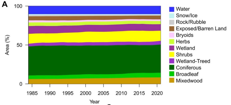
@mikewulder From the graphic it appears as if there has been a notable though gradual increase in mixedwood, a decrease in shrubs, and a recent increase in conifer cover.
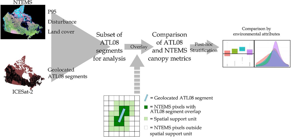
📢New: How can spaceborne #lidar inform, augment, improve national maps of canopy height from #Landsat and samples of airborne lidar? 🤔
Mulverhill et al. Evaluating #ICESat2 for monitoring, modeling, and update of large area forest canopy height products.
https://t.co/0F33ZsqBkb
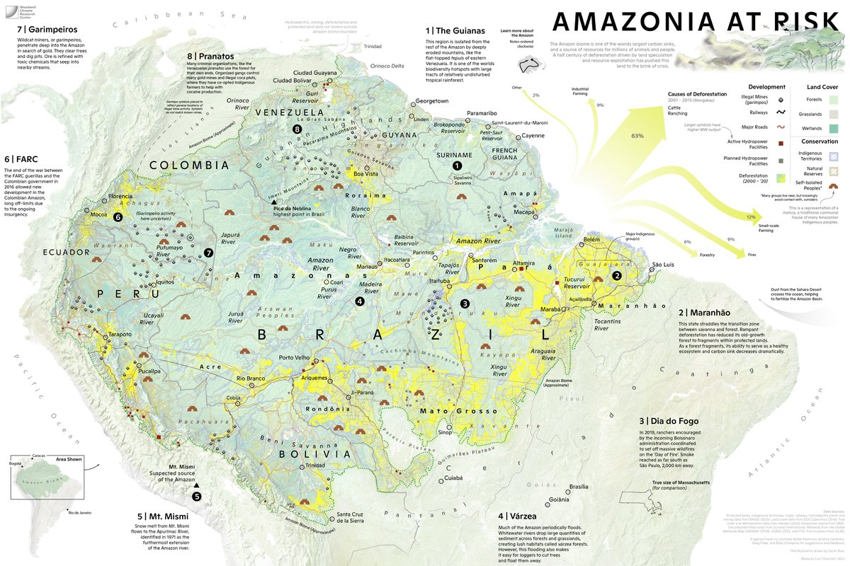
So excited to share a (downsized for twitter) #map I have been working on, with illustration work by @The_Ruizium. A picture of the #Amazon region in crisis. Not only the struggle to deal with #deforestation, but its geography, cultures, and political divisions.
I spent 500+ hours on Kaggle competitions last year and just became a Kaggle Master.
Over those many hours, I learned a systematic process you can use to train any model on any dataset.
6 steps to train any model 🧵
@Kate_J_Fuller For me, it depends on the use. I usually convert all vector files to Geopandas Geodataframe objects for analysis. GeoPackage is my preferred file format. Postgres db when trying to optimize speed on massive datasets.
Wow - this is awesome! Full interactive functionality of #geemap and #leafmap in Colab notenooks! As someone who works almost exclusively in a browser with cloud services, this is huge.