Periods of light to moderate wintry precipitation this afternoon will give way to heavier snow/sleet this evening/overnight. Snow will be heaviest in a band from western, central, into north-central OK. A glaze to 0.2" of freezing rain is expected near the Red River. #okwx#txwx
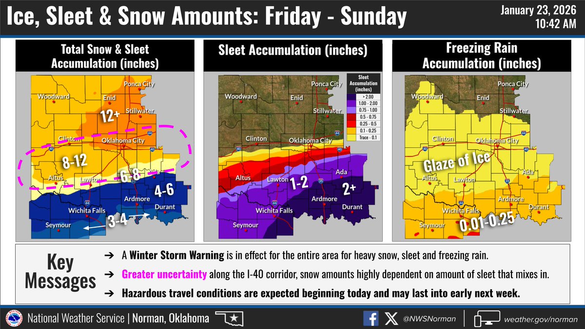
*Forecast Update* - Snow amounts are trending up across north-central and central OK, though greater uncertainty remains across the I-40 corridor as the amount of sleet that mixes in could raise/lower snow amounts here.
@filmguy1974@MichaelMelton30 @Bdrumm_Rivals GFS operational has been the true outlier. GEFS ensembles even disagree with the op runs. EURO/NBM are bullish