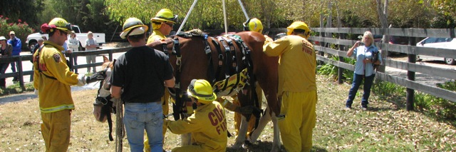
HEET is a non-profit, public service organization comprised of volunteers trained to evacuate and shelter horses during a disaster in San Luis Obispo County
HEET remains active in the #GiffordFire mutual aid evacuation of livestock for both Santa Barbara and San Luis Obispo county residents. Regardless of your evacuation status, please call our dispatch number if you are in need of assistance. #centralcoast#slocounty#sbcounty#heet
Update: The county Horse Emergency Evacuation Team is on scene working with USAR and County Fire to assess the viability of the horse and an extraction plan.
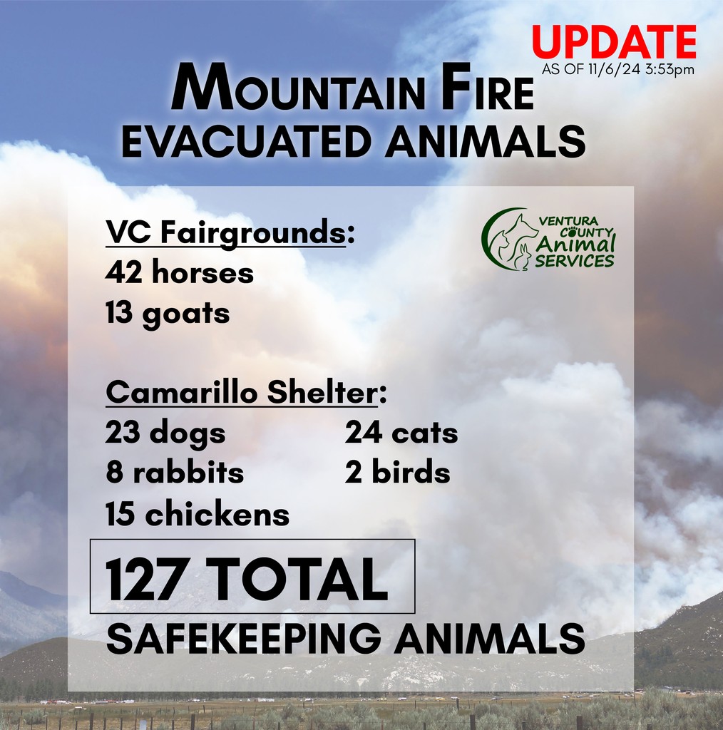
#MOUNTAINFIRE UPDATE: 127 total animals in safekeeping at VCAS. Large Animal evacuations can go to the VC Fairgrounds and small domestic animals to the Camarillo Shelter at 600 Aviation Drive.
General Fire Info: https://t.co/MmQwy98SCD
Emergency Shelter Line: (805) 387-8911
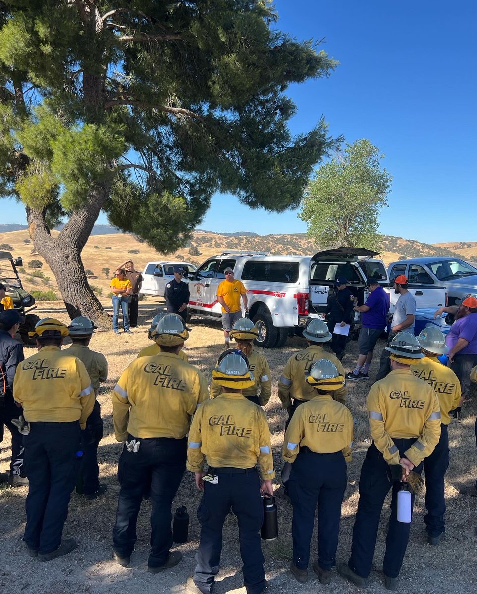
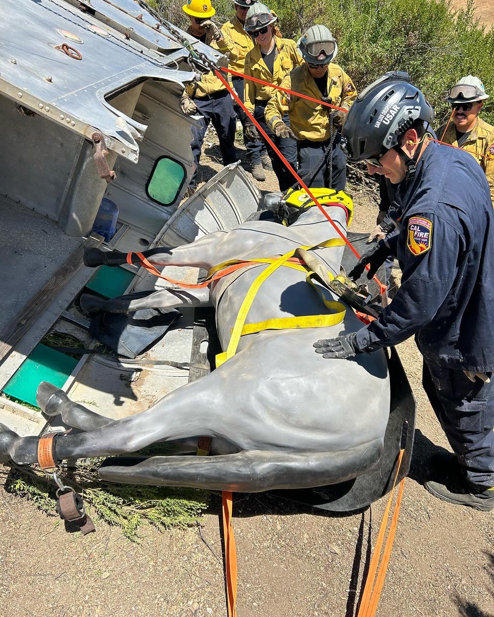
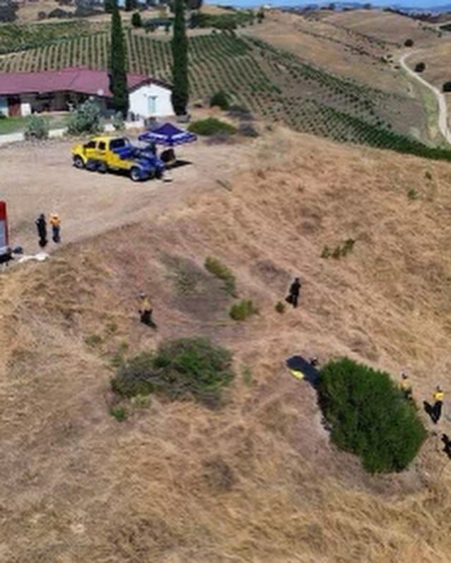
#Training SLO County USAR Large Animal Rescue #Drill in north county on Monday. Participants included USAR members, Nacimiento Fire Center crew Nacimiento Crew 1, Horse Emergency Evacuation Team (HEET), & John Boys Towing . #Slocountyfire#calfireslu
Red Cross shelters are open to everyone, regardless of race, religion, sexual orientation or citizenship status. All disaster assistance is free.
Stay safe with these tips:
◼️ Be ready to evacuate.
◼️ Keep your emergency kit nearby.
◼️ Follow local authorities for evac updates.
#LakeFire: The @RedCross has opened an evacuation shelter at Solvang Veterans Memorial (1745 Mission Dr, Solvang, CA 93463) for evacuees affected by the #LakeFire in Santa Barbara County.
⛑️ Safe shelter, meals and snacks, water & additional resources are available to all.
🚨 Red Flag Warning Issued 🚨
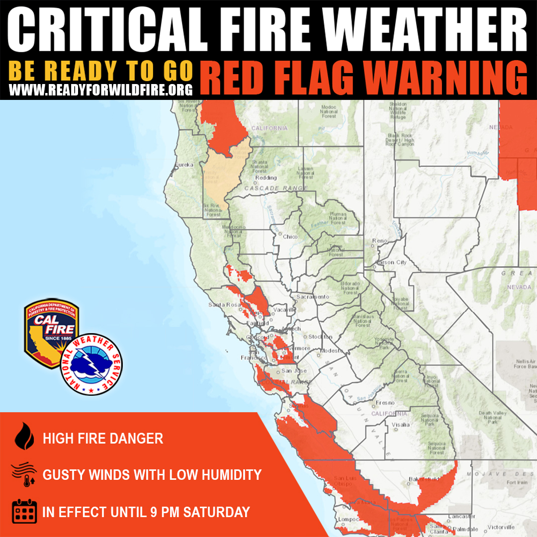
Due to high fire danger from gusty winds and low humidity, a Critical Fire Weather Red Flag Warning is in effect until 9 PM Saturday for much of the Central Coast, East Bay, and Northern California.
🔥 Stay vigilant and take extra precautions:
Avoid activities that can spark a fire
Ensure your home and property are prepared
Follow any local evacuation orders and updates
Let's all do our part to keep our communities safe. One Less Spark means One Less Wildfire.
#RedFlagWarning #CALFIRE #FireSafety #StaySafe #WildfirePreparedness 🔥🌲🚒
Potential Public Safety Power Shutoff (PSPS) starting Friday for multiple areas in northern SLO County! Don't be caught off guard - stay information and ensure you have a plan in place. For more info visit https://t.co/akEcHMguOA
Storm Prediction Center issued a rare marginal risk for severe storms across Central Coast valid Sun-Sun night. Main threats include potential for isolated severe wind gusts over 60 mph and possibility of a brief tornado and waterspouts. #LAWeather#cawx#SLOWeather#LArain
The Sheriff's Office would like to remind everyone to follow the law and abide by road closures. Don't put your life or the lives of others at risk by circumventing warning signs. Let’s work together to stay safe during these storms! For a list of current road closures and delays visit: https://t.co/gG34oXBDEL
National Weather Service has extended the Flood Advisory issued for San Luis Obispo County today 12/20/23 until 9:45pm tonight. For more info, go to:
https://t.co/ZkQ85Dgmrh
Do you know your evacuation zone? It's important that you do, taking a minute to know your zone can save your life during an emergency. Visit https://t.co/O1uTvxHm00 and enter your address, keep your zone name nearby in case of emergency. https://t.co/Jsb0r3Sbam
Watch out, Central Coast, showers and thunderstorms are moving through the area. Gusty winds to 50 mph and small hail are possible under these showers. #CAwx
Rain returns tomorrow with the largest amounts falling on Tuesday. We remind residents to remain diligent. Lopez Reservoir is expected to spill which will increase the amount of water in AG Creek and potential for flooding with additional rain. https://t.co/qlIOdIC1IV