GIS Consultancy, DBMS, Web Mapping and Land Surveying Services including LiDAR, Bathymetry and Photogrammetry
[email protected]
0709150757 / 0758537952
Every location tells a story and holds untapped potential. At SPM Geosolutions, we help MDAs and individuals unlock that potential through cutting-edge GIS solutions.
Contact us today to get started;
📩 [email protected] , (0709150757 / 0758537952)
#GIS#SPMGeosolutions
GIS is getting hot and technology is turning up the heat. 🔥🌍
From AI and drones to digital twins, cloud computing and real-time data, new technologies are expanding what we can do with location.
The future of GIS is smarter, faster and we're here for it.
#GIS#GeoAI#SPM
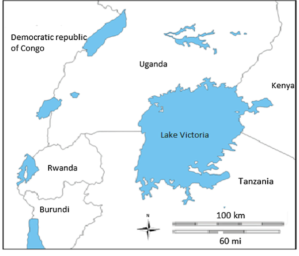
Lakes support ecosystems, livelihoods and communities.
GIS helps us protect them through mapping, monitoring and understanding changes affecting them.
This World Lake Day, we celebrates the role of geospatial information in protecting our lakes. 🌍💧
#WorldLakeDay#GIS
GeoLibre v2.7.0 is here!
GeoLibre is a free and open-source, lightweight, cloud-native GIS platform for visualizing, exploring, and analyzing geospatial data. It runs everywhere you do, in the web browser, on the desktop, on mobile, and inside Jupyter notebooks, all while keeping your data local and private.
This release is about building analysis instead of typing it: a visual Model Builder for processing workflows, a STAC browser that can add every asset type the app can draw, and a Chrome extension that opens the data on any web page in one click.
97 pull requests merged in 9 days, from 11 contributors besides me, 9 of whom sent their first contribution to GeoLibre in this cycle. Thank you all.
What's new in v2.7.0
- Model Builder, a visual canvas for processing: drop tools as nodes, wire one tool's output into the next tool's input, and save the graph as a model that re-runs as a single job. The whole graph is validated before anything executes.
- Your AI assistant can build one for you: describe a workflow in plain English, and it authors a validated model and opens it for review before it runs. Any model copies out as a runnable Python script.
- Open data in GeoLibre, a Chrome extension now on the Chrome Web Store: it finds the dataset links and map services on the page you are viewing, including services inside embedded maps, and opens the ones you pick together on one map.
- The STAC browser adds everything: PMTiles, GeoParquet, and Zarr with a variable picker join the COGs it already loaded, Icechunk repositories are read through their own manifest, and private Planetary Computer assets are signed for you. A static catalog can now be walked as a tree, not only searched.
- Select features by drawing on the map: click, rectangle, polygon, freehand, and radius gestures, with Shift and Alt combining into the selection you already have. No more describing features in an expression to pick a handful of them.
- Apache Iceberg tables load as vector layers, read in the browser through DuckDB, from a metadata location or a REST catalog, with the row count reported before anything is scanned.
- Encoded polylines are a first-class format, with a codec, an interactive preview, processing tools, layer export, and Python support.
- New vector tools: merge layers, extract vertices, and generate points along lines and polygon boundaries, all running client-side.
- An activity log for shared projects and collaboration sessions, so a project owner can see who opened and edited their work.
- Plugins and processing tools are now translatable too, closing the last gap where a non-English interface still read half in English.
Try it out
- Launch GeoLibre Web: https://t.co/8gMtkVtfnm
- GitHub: https://t.co/VXq8c1o2Nd
- Documentation: https://t.co/7VA2AQoCUc
- Release notes: https://t.co/BNj9Mo6E3e
#GIS #Geospatial #OpenSource #MapLibre #GeoLibre
The future of mapping isn’t just visual, it’s interactive. Maps are evolving from something you simply look at into something you actively interact with.
Interactive maps let you Search, Explore, Filter, & Query spatial data in real time.
#GIS#Interactivemapping#SPM
With the wide range of spatial data collection tools available today, choosing the right one matters.
The quality of your data directly influences the quality of your analysis and the reliability of your final outputs.
#GIS#Datacollection#SPM
Open source or proprietary?
There’s no one-size-fits-all answer.
At SPM Geosolutions, we help you choose what fits your needs, budget and goals, and deliver quality geospatial solutions using either approach.
The right technology is the one that works for you.
#GISSoftware
Imagine having your spatial data at your fingertips; on your phone, tablet or computer despite where you are!
That's the power of WebGIS!
We turn your location- based data into accessible web solutions that help you visualize, analyse, edit and share it.
#WebGIS#SPM