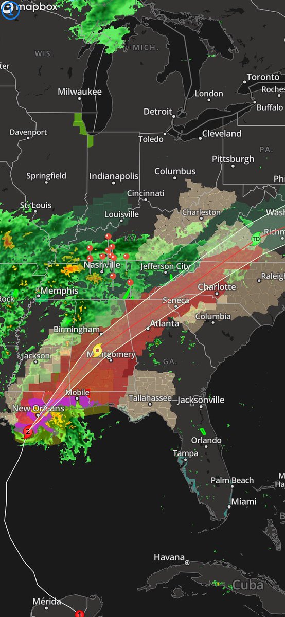
Here is a look at #Zetas fast forward speeds.. meaning that there is a higher risk for wind damage farther inland.
The red means tropical storm warnings..
And just look at how far this stretches from LA to southern Virginia!!! This looks like something 2020 would pull
SOAKING RAIN!!! Here is a check of radar right now ... hurricane #Zeta Will help bring some of the rain our way... Laronta Barbee Weather has the latest on the track of the storm this evening on the @Local12NewsHD this evening at 4/5/6pm #TNWX#KYWX
SOAKING RAIN!!! Here is a check of radar right now ... hurricane #Zeta Will help bring some of the rain our way... Laronta Barbee Weather has the latest on the track of the storm this evening on the @Local12NewsHD this evening at 4/5/6pm #TNWX#KYWX
We’re going from Zeta to a very potent cold snap 🥶... it is definitely going to be a wet and a very crazy roller coaster ride for the next few days
Here is a look at what to expect!
#Zeta should become a hurricane by daybreak on Wednesday I’ll have the latest starting at 4am!
We’re going from Zeta to a very potent cold snap 🥶... it is definitely going to be a wet and a very crazy roller coaster ride for the next few days
Here is a look at what to expect!
#Zeta should become a hurricane by daybreak on Wednesday I’ll have the latest starting at 4am!
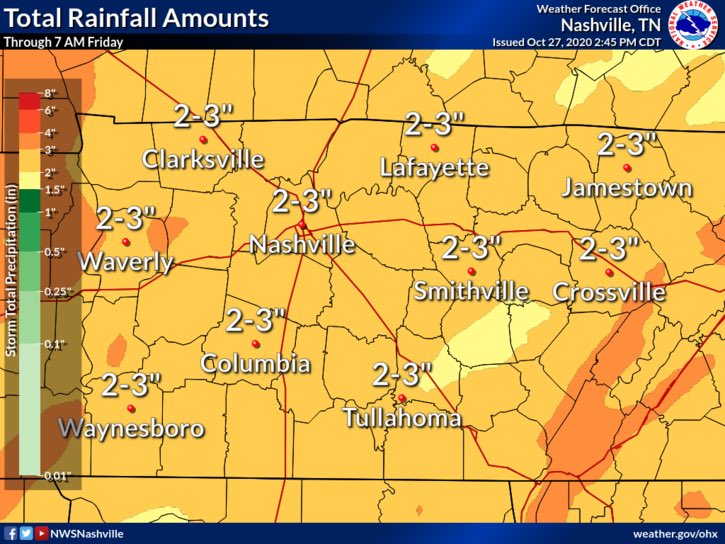
Well here goes our train ride.. 2'-3' of rain is expected for us from Wednesday through Thursday night as we continue to watch the remnants of hurricane #ZELTA move past the mid state.. ill have more in your full forecast tonight at 10PM
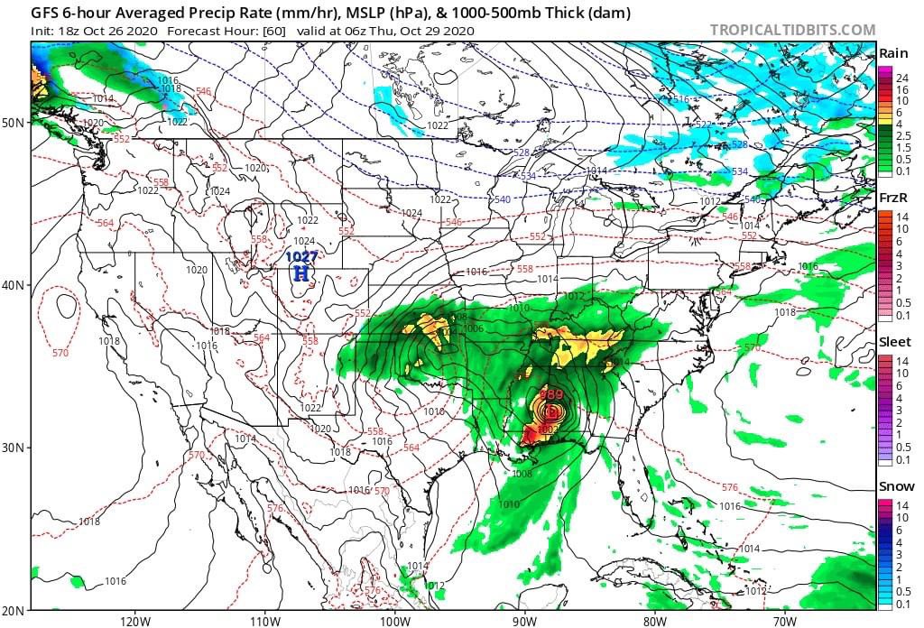
PLEASE SHARE: Ok this is a little insane!! Tropical depression 28 has formed today.. it is expected to continue to intensify as a CAT 1 hurricane ZETA in the central gulf by early next week with making potential landfall along the LA Coast on Wednesday.
#LeaveLouisanaAlone
PLEASE SHARE: Ok this is a little insane!! Tropical depression 28 has formed today.. it is expected to continue to intensify as a CAT 1 hurricane ZETA in the central gulf by early next week with making potential landfall along the LA Coast on Wednesday.
#LeaveLouisanaAlone
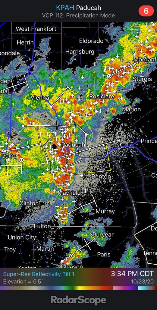
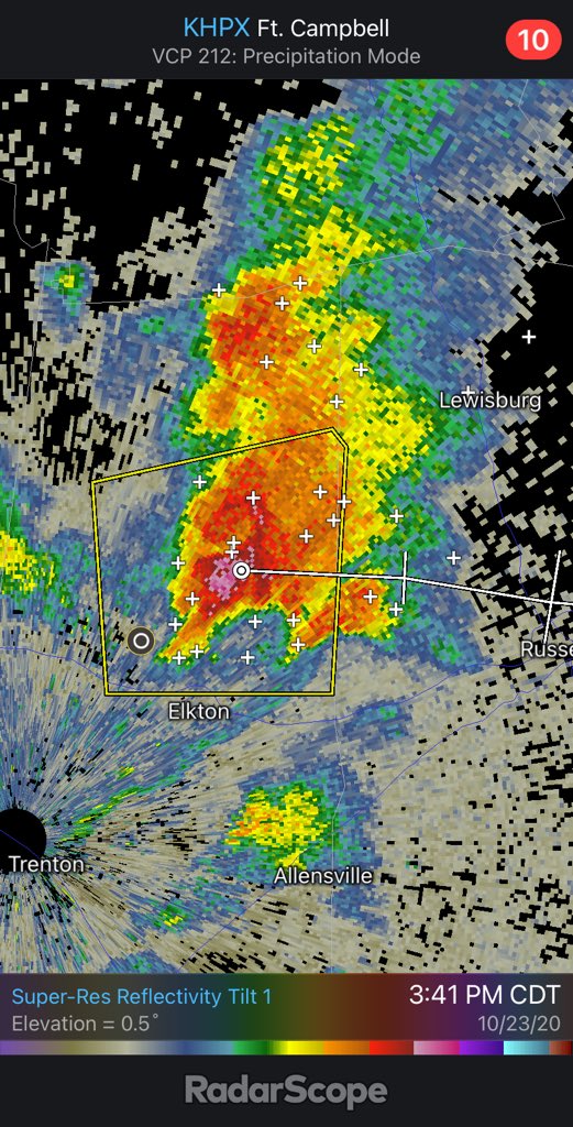
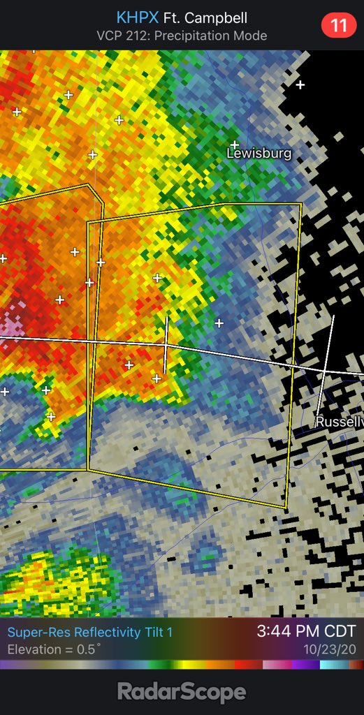
West of Christian and Trigg counties.. I have been noticing some signs of rotation with this storm so I will continue to keep a close eye on it!!!
This storm is moving due East at around 40mph severe thunderstorm warning continues until about 4:15pm #KYWX#STORM12ALERT