This CSIRO #Wheatcast national wheat yield forecast is based on data to 1 Oct. Median expectation for 2025 is 2.24 t/ha. With 12.7 Mha sown (ABARES est.) forecast production is 28.5 Mt. Map shows expected distribution of water-limited yields. For more see https://t.co/Pd1uPznF3B
This mid-season CSIRO #Wheatcast national wheat yield forecast is based on data to 1 Sept. Median expectation for 2025 is 2.27 t/ha with a 100% chance of an above average yield. The map shows the median expected water-limited yields. For more details see https://t.co/Pd1uPznF3B
This mid-season CSIRO #Wheatcast national wheat yield forecast is based on data to 15 August. Median expectation for 2025 is 2.21 t/ha with a 91% chance of an above average yield. The map shows median expected water-limited yields. For more details see https://t.co/Pd1uPznF3B
Northwest cloud bands more consequential than this one may lie ahead if moisture resulting from a negative Indian Ocean Dipole can link up with a few decent cold fronts. https://t.co/JS44qFVER9
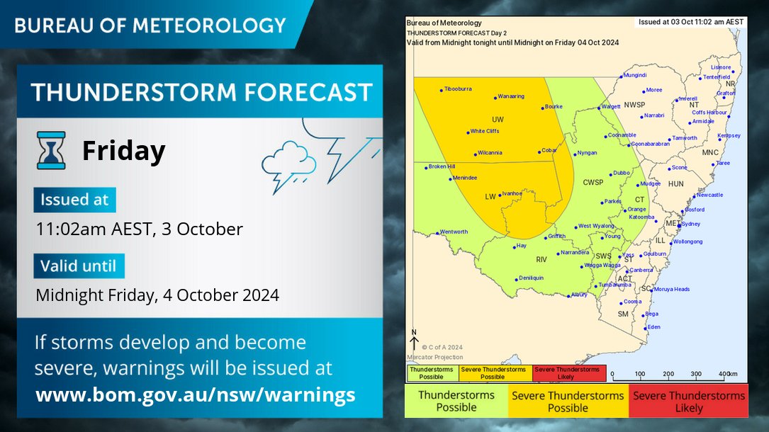
🌩️ Thunderstorm forecast for FRIDAY (4/9): thunderstorms are possible from the western plains to the far west on Friday afternoon and evening. Severe storms may produce damaging winds over northern and central parts of inland #NewSouthWales.
https://t.co/UqlGxUsuBw
Upper-level low over northern NSW directing moist, unstable air over central/eastern parts. Areas around Jervis Bay have had 100 - 200 mm of rain over the last 24 hours.
Sydney and central NSW's run of showery May days has come to an end. Further coastal showers won't be far off though, until the subtropical ridge moves north.
Christmas weather is looking dynamic over south east Australia, with forecast models showing a low pressure system that would produce widespread showers and thunderstorms.