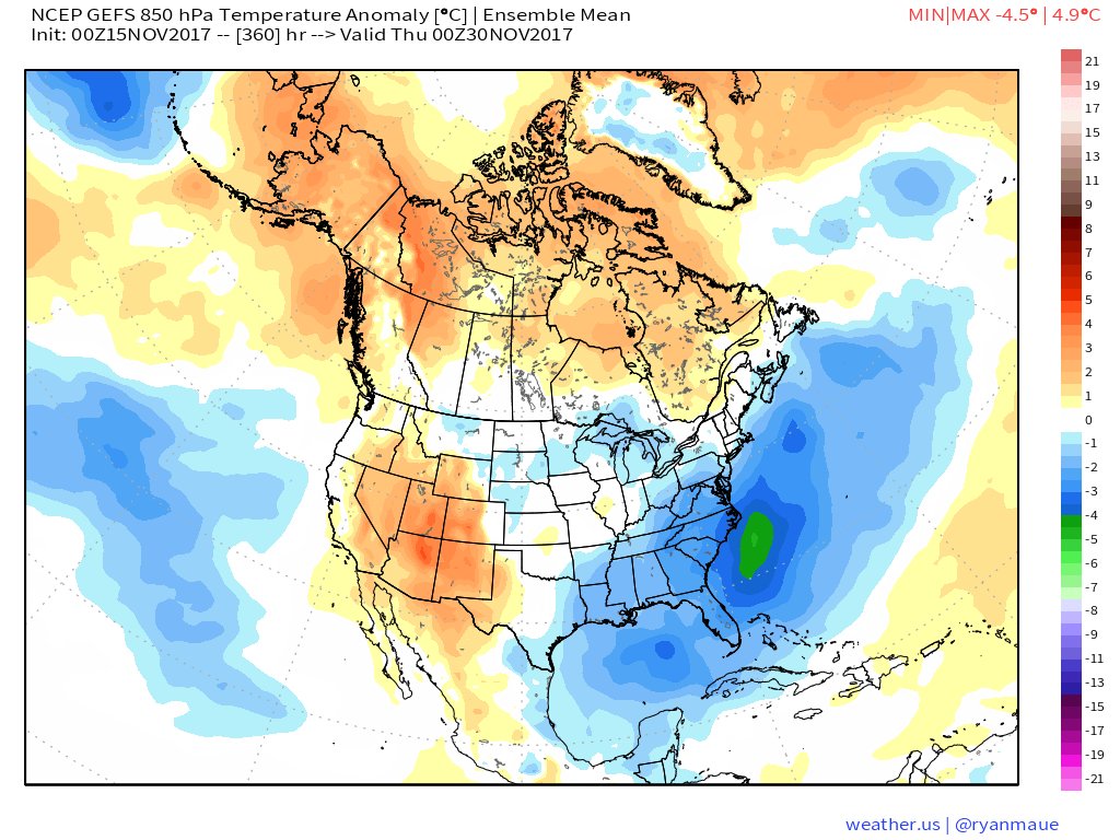
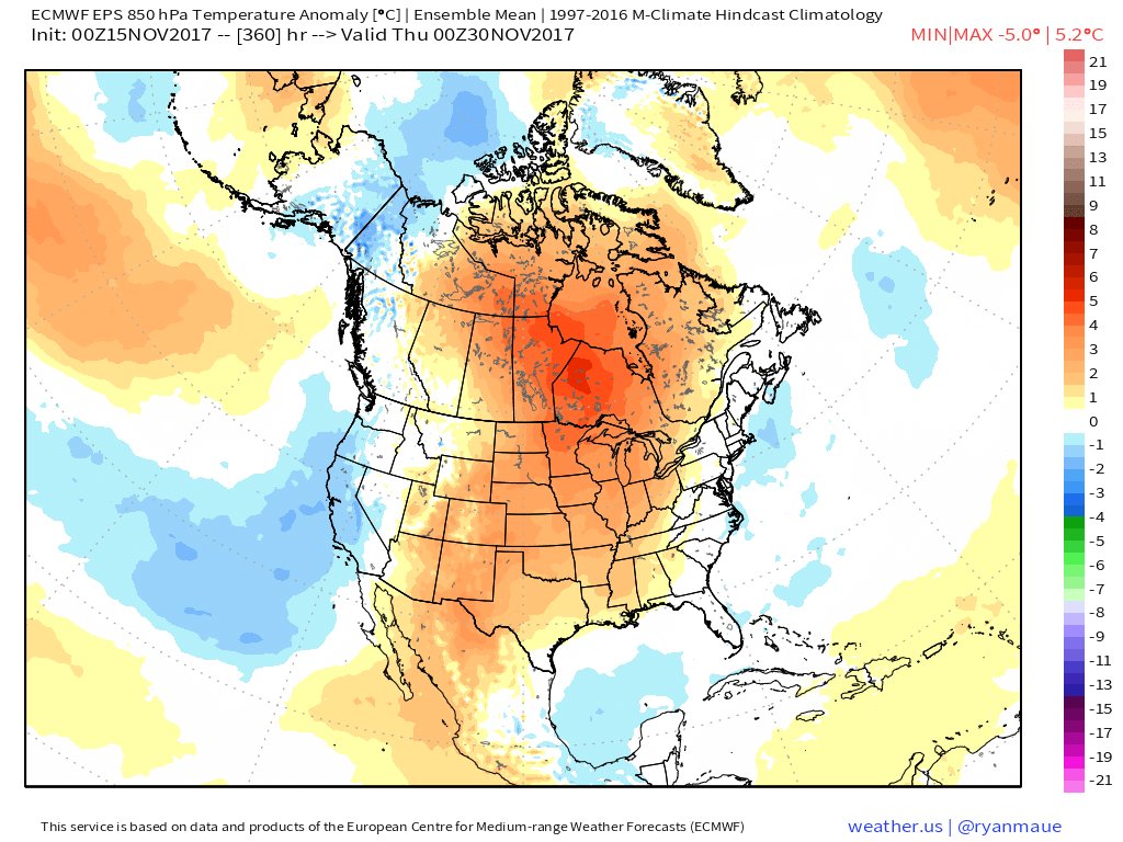
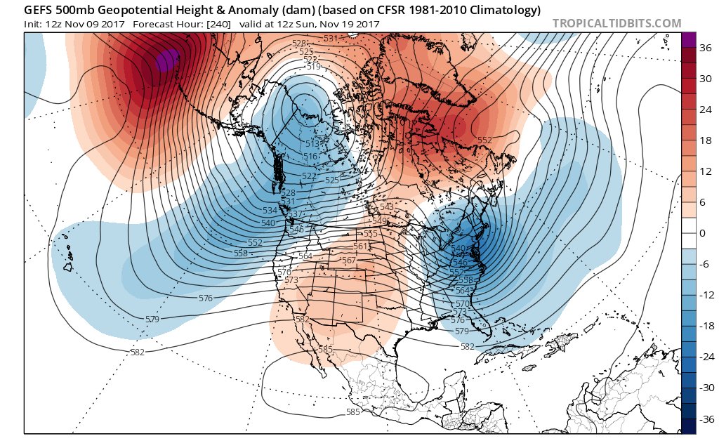
Large spread in ensemble guidance in the longer range. EPS here at Day 15 kills the high latitude blocking, returns zonal flow and gives the toasty wx again. GEFS keeps it around and continues cooler wx for Eastern USA. #AgWx
That said, extend of cold and who gets what type of precip is still very much in question and unknown this far out. Just an idea for now. Will be monitoring close.
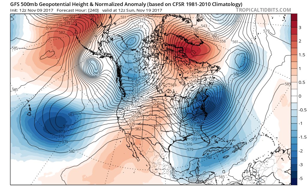
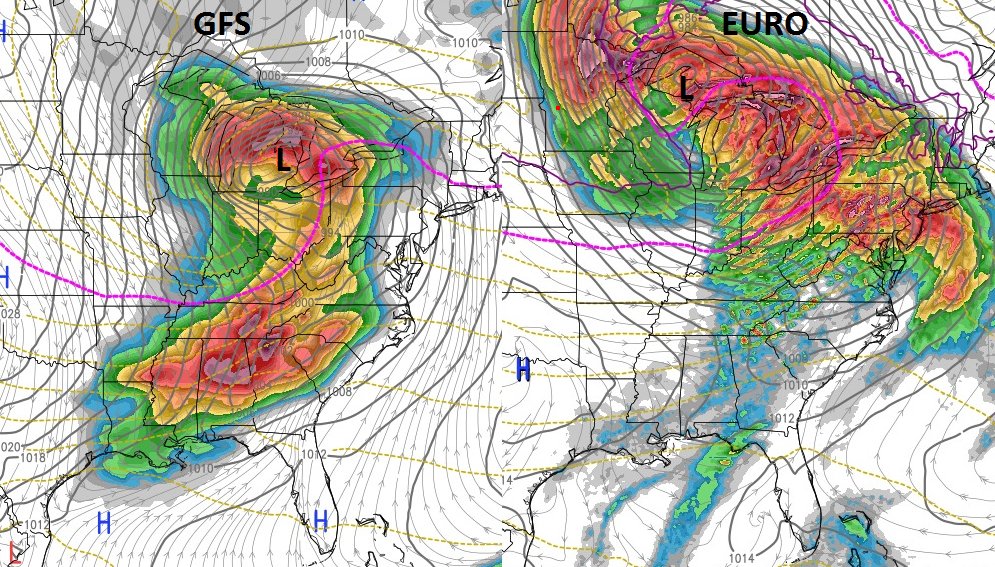
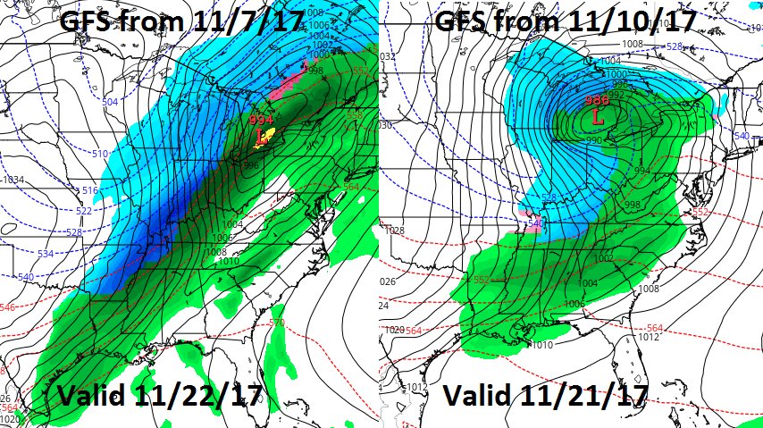
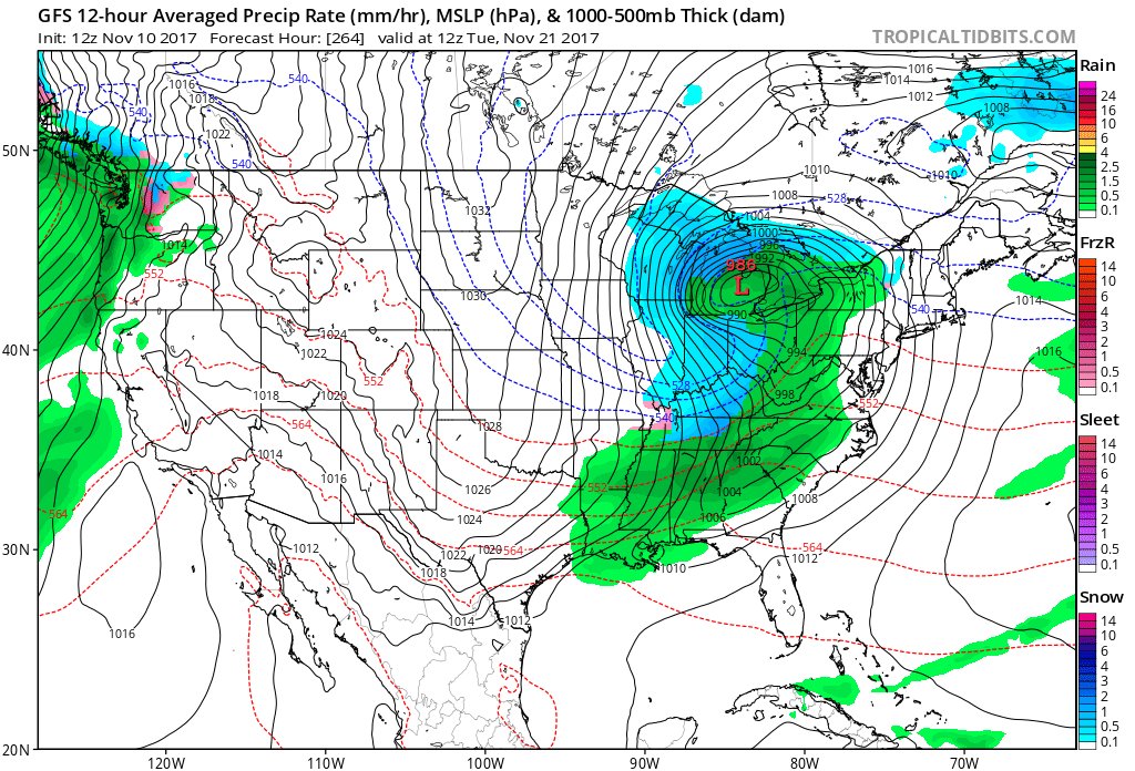
Sometimes GFS likes to throw a random storm in there for fun in the long range. And often they don't show up in subsequent runs. This time, GFS has hinted at a storm right before Thanksgiving for a few days. 2 separate runs on 2 different days have shown a similar position. #AgWx
Could be a bumpy back half of Nov for Eastern US. Significant storm likely coming around Nov 20-22 timeframe. Placement of cold & precip types are still unknown, but GFS & Euro both keep hinting at it. Worth monitoring. #AgWx
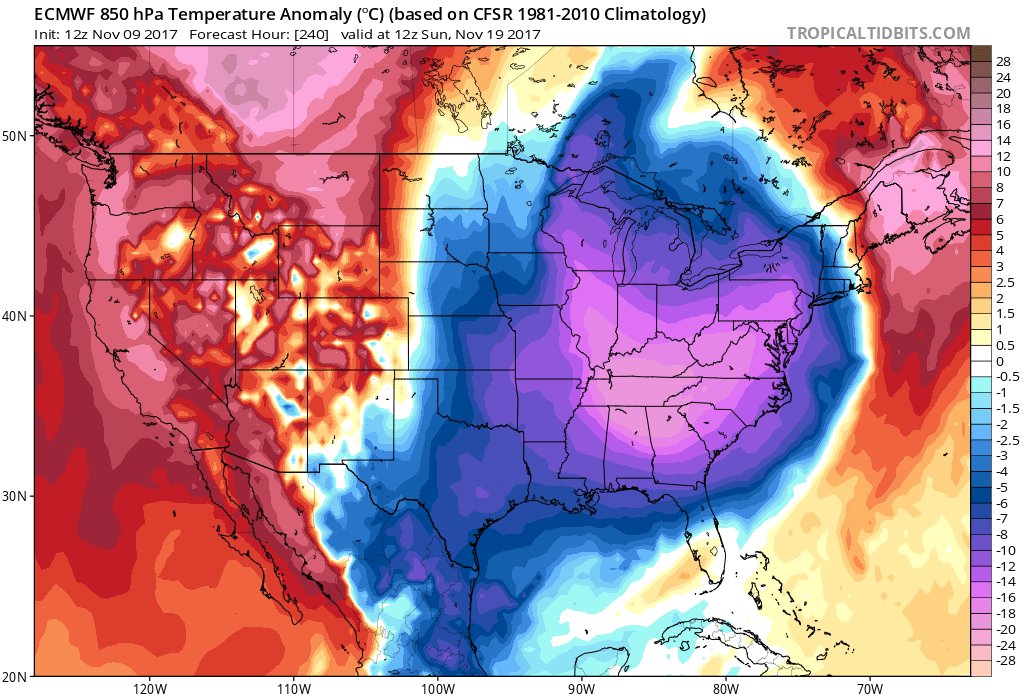
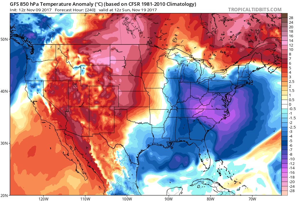
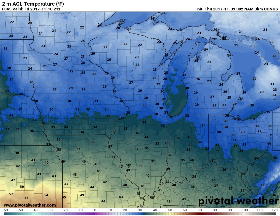
Temp anomalies late next week with this upcoming cold blast. Euro is being very bullish with the cold. GFS not far behind. Will see what upcoming runs say. #AgWx
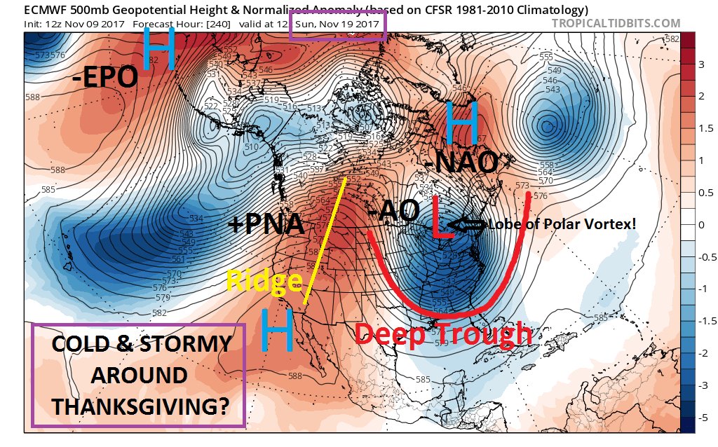
Could be a very cold and storm time coming right around Thanksgiving. Major models on board with a lobe of the polar vortex coming to visit Eastern USA. Winter storm? Possible, but extend of cold and exactly where storm goes is still to be determined. #AgWx
@themayorquimby For those in the northern tier of states, yes. Could also mean SE Ridge that warms good chunk of the southern US. Lower Midwest likely become a big battleground.