⛔ Don't waste time going through mountains of data looking for meaningful insights. Our APIs condense millions of daily #ADSB messages in real-time into the simplest and lightest JSON response offering high-value #airtraffic insights you can instantly use https://t.co/yxNmsEX3aP
Our latest global analysis uncovers where aircraft are spending the most time in holding patterns — and the results are telling:
🇺🇸 US airports dominate with 40%
🇬🇧 UK: 7.5%
🇮🇳 India: 6.7%
🇹🇷 Turkey: 4.4%
🇨🇳 China: 4.3%
Surprisingly, no EU or African airports made the list.
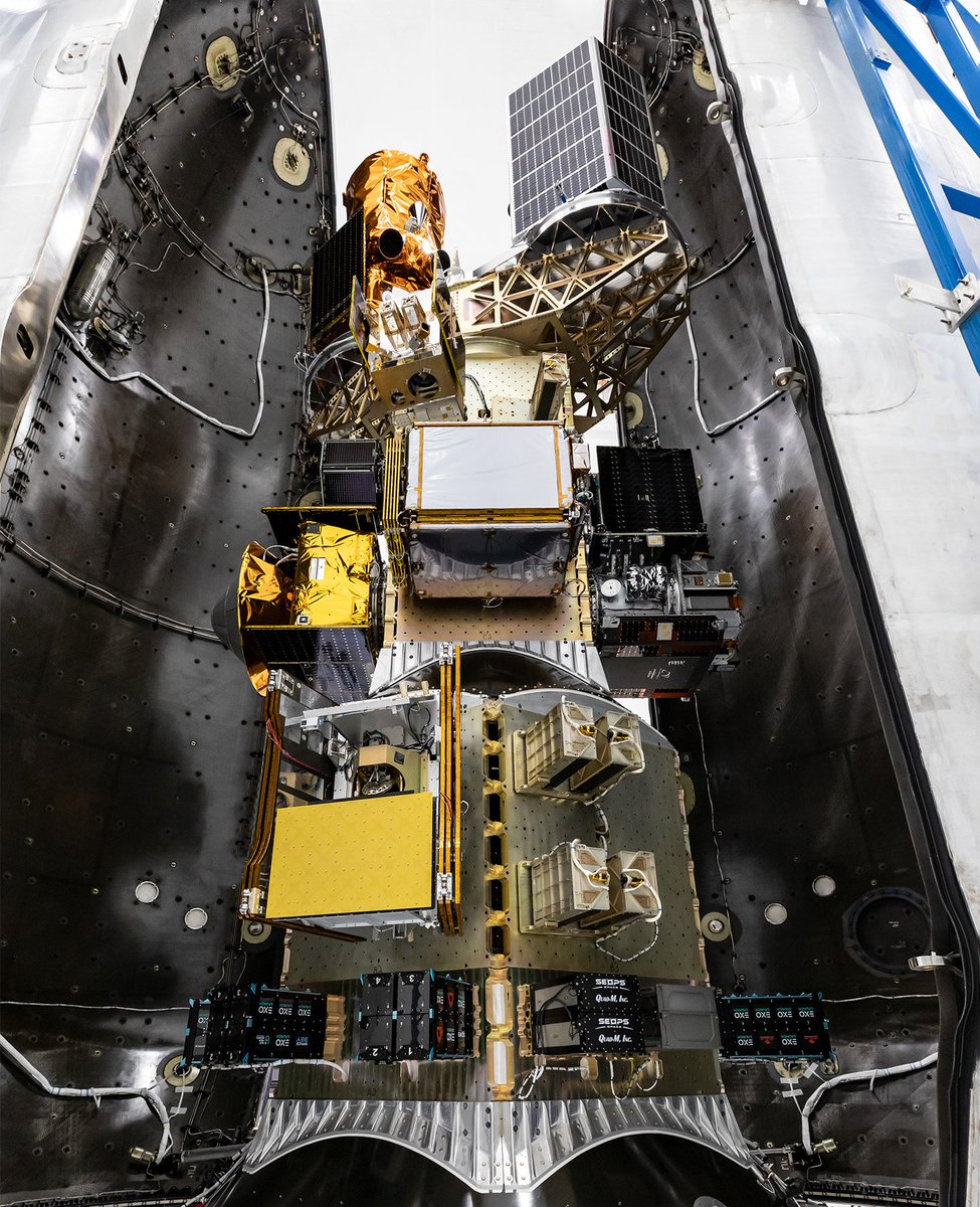
We’re happy to share that all seven of our satellites on the @SpaceX Transporter-13 launch deployed successfully!
Learn more about the satellites at the link ⤵
https://t.co/TtecZ5GMuP
Image credit: SpaceX
It's launch day! 🚀 Seven Spire satellites are set to launch aboard @SpaceX Transporter-13.
Tune in today at 23:39 PDT to watch live: https://t.co/AiAlq4Dg8l
Can you spot the Spire satellites? 👀
Tracking #helicopter flight paths over #Japan, highlighting the low-altitude aircraft actively engaged in #firefighting operations during one of the country’s largest wildfires in recent years: 7x AW139, 1x EC145 T3, 1x Bell 412EPX and 1x Cessna 560 Citation Encore private jet.
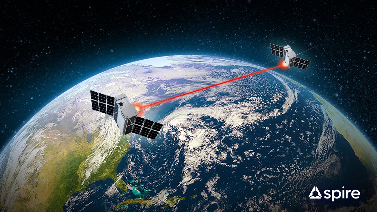
Spire's latest advancement: Two-way laser communication in space. This breakthrough allows satellites to communicate over distances as large as New York to London, all from a payload as small as a tissue box.
The result? Faster, more secure data transmission.
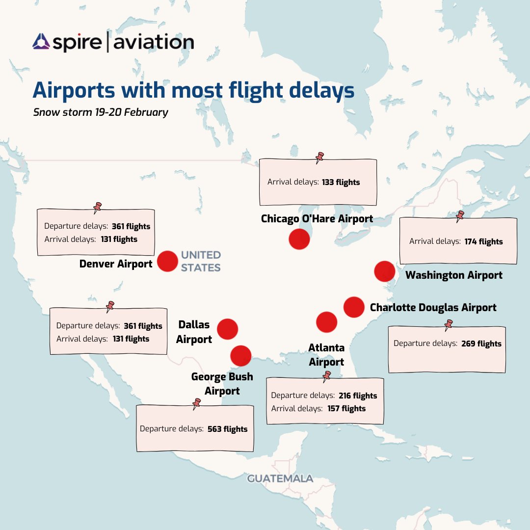
February’s winter storm caused major travel disruptions across the U.S., leading to widespread flight delays and cancellations. Our latest visualization maps out the hardest-hit airports, showing where departures and arrivals faced the biggest setbacks.
Exciting developments are underway at Spire Aviation 🛰️ We're committed to driving innovation and advancing technology to ensure secure, resilient, and reliable aviation data.
You thought the sky was the limit?
Wingbits is going to space 🚀 thanks to a strategic partnership with @SpireGlobal, leader in space-based data and operator of the largest multipurpose satellite constellation. 🛰️
Together we’re launching a new satellite that will act as a validator of Wingbits’ ground data, increasing the security and reliability of our global flight tracking network.
The satellite is scheduled for launch on the @SpaceX Transporter-13 mission.
We’re proud to announce a $72M CAD contract for the @csa_asc’s WildFireSat mission.
The satellite constellation will monitor wildfires across Canada from space—helping to protect communities, resources and infrastructure.
🔗 Read more: https://t.co/lZzuRDDJlf
See #SuperBowl2025 from a whole new perspective—through the eyes of space-based signals! Below is a dynamic visualization of aircraft movement over New Orleans before and during the big game. White trails represent aircraft below 15k feet, while violet lines those soaring above.
We tracked areas of clear air turbulence across the U.S. over the past few days, using our weather & aviation data. Light blue represents severe turbulence, while dark purple indicates extreme turbulence. ⛈️
✈️ Did you fly through any of these regions?
We’re happy to share that all six of our satellites on yesterday's @SpaceX Transporter-12 launch deployed successfully!
Learn more about the satellites and their missions ⤵
https://t.co/YisGOuNW3i
Image credit: @SpaceX
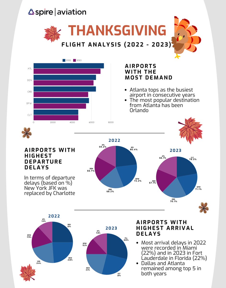
With the busiest travel days of the year just around the corner, we’ve analyzed our ADS-B data to uncover key trends shaping holiday air travel #Thanksgiving
🎯 GPS powers so much of our daily lives, from finding the quickest route to work to navigating the skies. But what happens when GPS signals are tampered with? Explore our latest blog post for an in-depth analysis and interactive map 👉 https://t.co/SHPu50aq4x
@imperialcollege used Spire’s ADS-B historical flight trajectories and weather data from the @European Centre for Medium-Range Weather Forecasts to develop the Global Aviation emissions inventory based on ADS-B (GAIA): https://t.co/ggilH3hW2p
Spire Aviation team has landed in Amsterdam! 🛬Find us at the #WorldAviationFestival booth 1-434 and experience satellite-powered aviation analytics & intelligence.
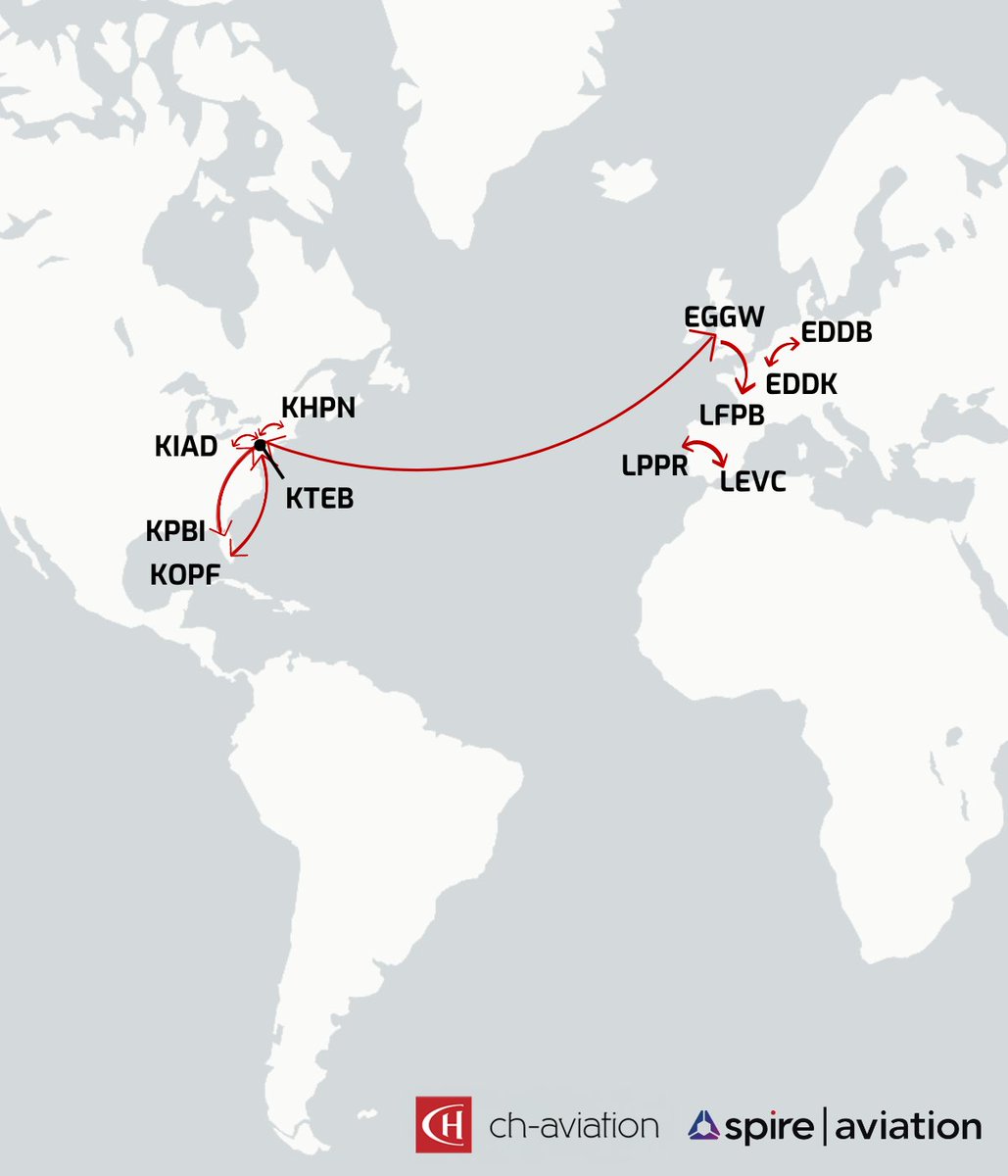
With the recent integration of @chaviation fleet data into our satellite database, you can now get unmatched insights into business aviation aircraft, like spotlighting #Global6500 jet's Top 15 routes from Jan-Sep 2024, deepening your grasp of aircraft's operational dynamics.
Last week at the @DLR_en's #SatelliteCommunications Conference in Bonn, our #EURIALO Program Manager, Dave McGuire, took the stage to spotlight a critical issue: the rising threat of GNSS jamming and interference for the aviation sector.
🌍 Where are you heading for the next holiday weekend? Check out our latest data from @SpaceADSB to see how Labor Day travel trends shaped up in the US. 🚀