Spatiality is running a campaign for the adoption of ArcGIS Online. In this first blog post, we give you 5 compelling reasons for using ArcGIS Online from today.
#ArcGIS#CloudComputing#Spatiality https://t.co/GyhV7vhoJh
ArcGIS Pro has excellent tools for classifying Lidar data and extracting 3D buildings. County Governments can leverage these capabilities for development control and revenue collection #ArcGIS#lidar#geospatial#3D
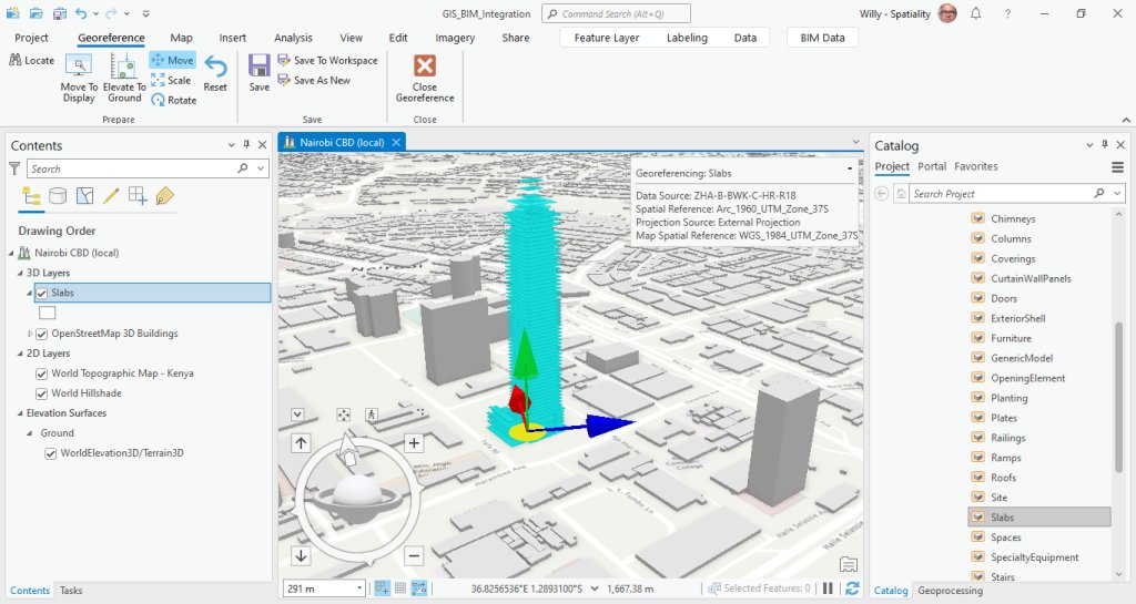
Revit models can be added to ArcGIS Pro without conversion. Other 3D formats can be added to Multipatch or 3D Object feature layers #ArcGIS#AEC2022#geospatial
Esri's pre-trained deep learning model for building footprint extraction in Africa is doing a reasonable job in Kisumu, Kenya #DeepLearning#ArcGIS#geospatial
🙏We appreciate your presence during #5thAfriGEOSymposium today.
Join us tomorrow same time ⏲️1:00Hrs EAT. To register, click here https://t.co/DQcDSGXXCz
You missed the sessions? Click here; https://t.co/s21q4qsX8j -Food & Agriculture and https://t.co/4ooXoNtWvN Industry Track
Are you using ArcGIS AppStudio to build cross-platform mobile applications? Contact us if you need help in getting started.
#ArcGIS#Mobile#applications#GIS https://t.co/hpAAJaWFWw
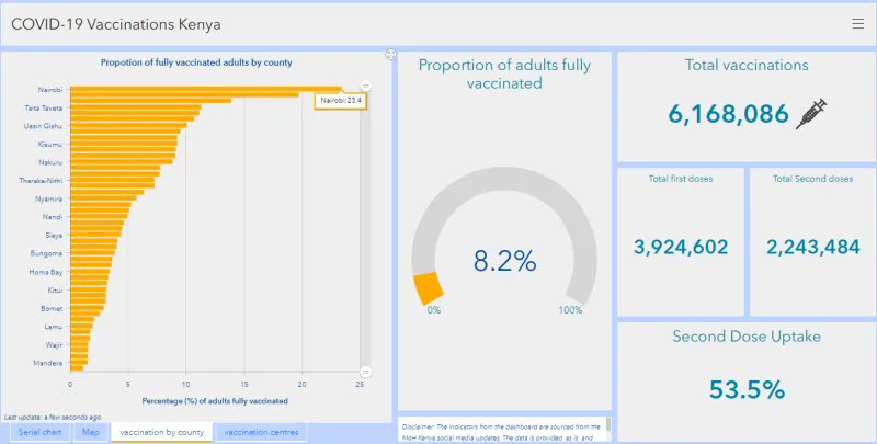
At Spatiality we are keeping tabs on the jabs! Nairobi's full vaccination rate is nearing 25%.
#COVID19#vaccination#Nairobi#Spatiality https://t.co/W8GeWURM8X