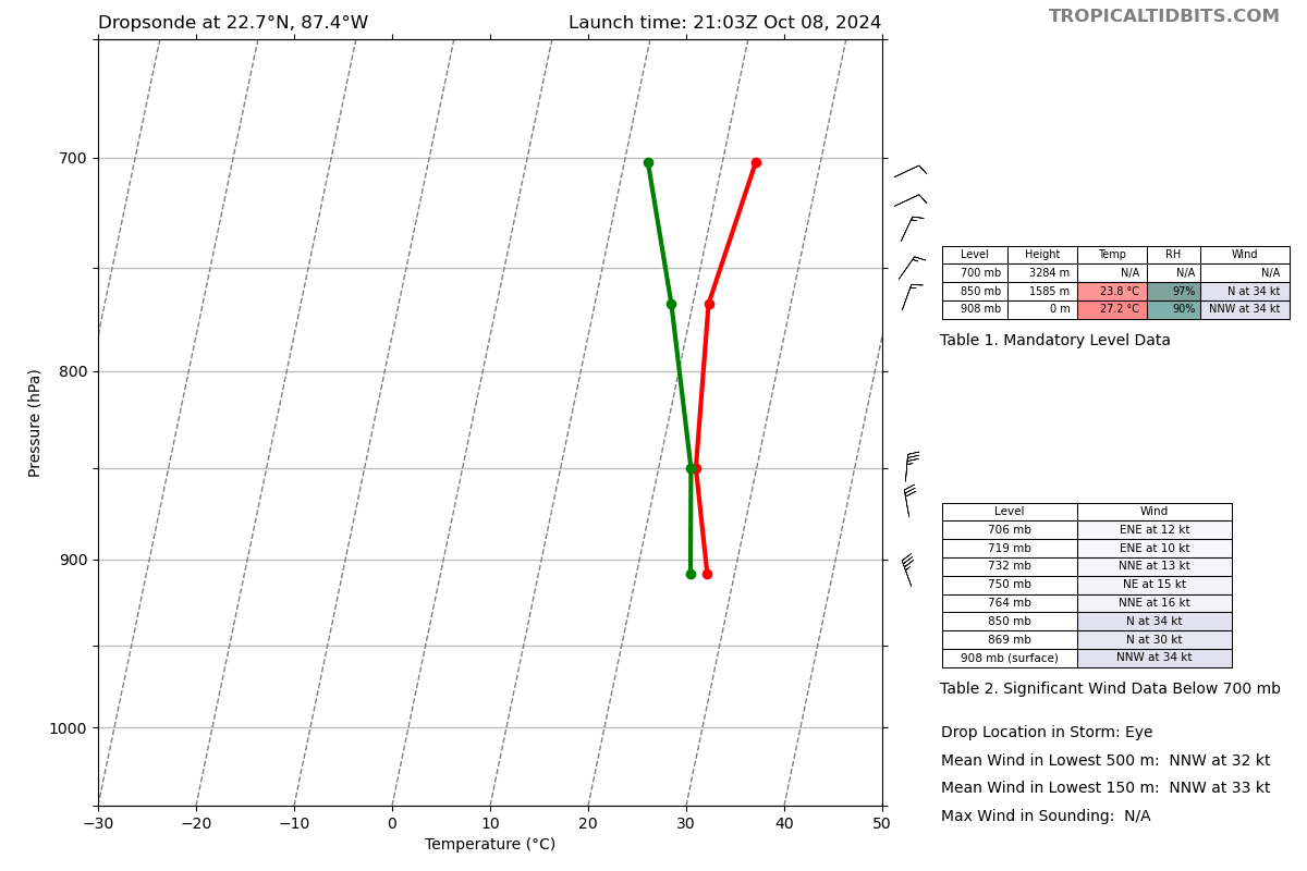
Hurricane Hunters confirm that Hurricane #Milton has re-intensified this afternoon, with max winds ~165 mph and minimum central pressure ~905mb, nearly equivalent to Hurricane Katrina (2005)'s peak in a similar part of the Gulf.
#Milton will likely intensify a little further later this evening into the overnight as it moves over the loop current & receives favorable ageostrophic divergence from a jet streak over the SE US.
Take this storm seriously if you're in Florida.
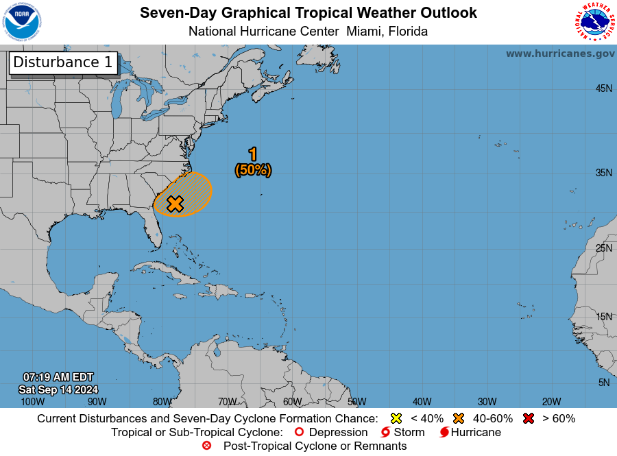
8AM EDT Sep 14: We continue to monitor an area offshore the southeast U.S. coast, this disturbance has a medium chance (50%) for subtropical or tropical development early next week. Stay up to date through the weekend into early next week at https://t.co/tW4KeGe9uJ
@TroyRubert Because the graphic you sent me with the precipitation information is more confusing for our users to view and understand. We show only their tropical formation outlook and it’s much easier to decipher where tropical cyclone formation may occur.
@SamASchreier 12Z models are showing more precipitation for the mid-week system. I am thinking a 2-4" snow for the Pikes Peak region. For Sun/Mon the EURO is showing another couple inches.
@PAULDROGERZ Y’all do a heck of a cover and we’re so glad that George honors Tom Petty, but we sometimes wish for other songs or Folsom again! Would like to hear something different sometime. Merry Christmas!
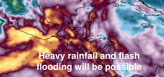
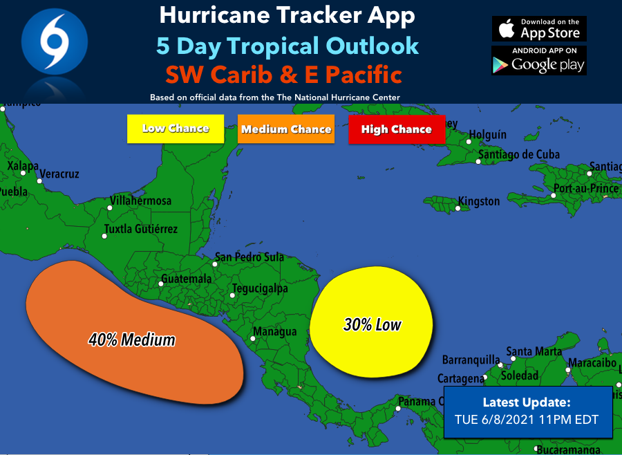
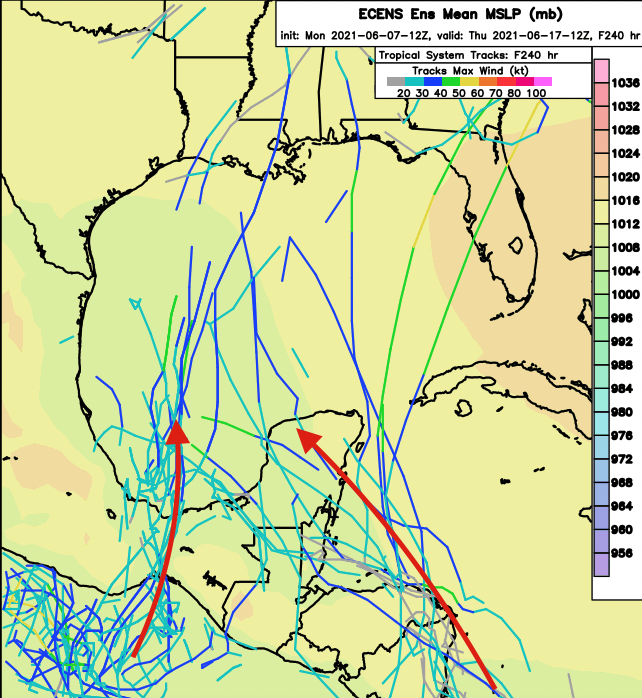
With a Central American gyre lurking, development will be possible in the Eastern Pacific/Gulf/West Caribbean regions. Uncertainty is high and any development will be sloooowwww with this type of setup. Regardless, lots of rain for Central America and SE Mexico. #tropics