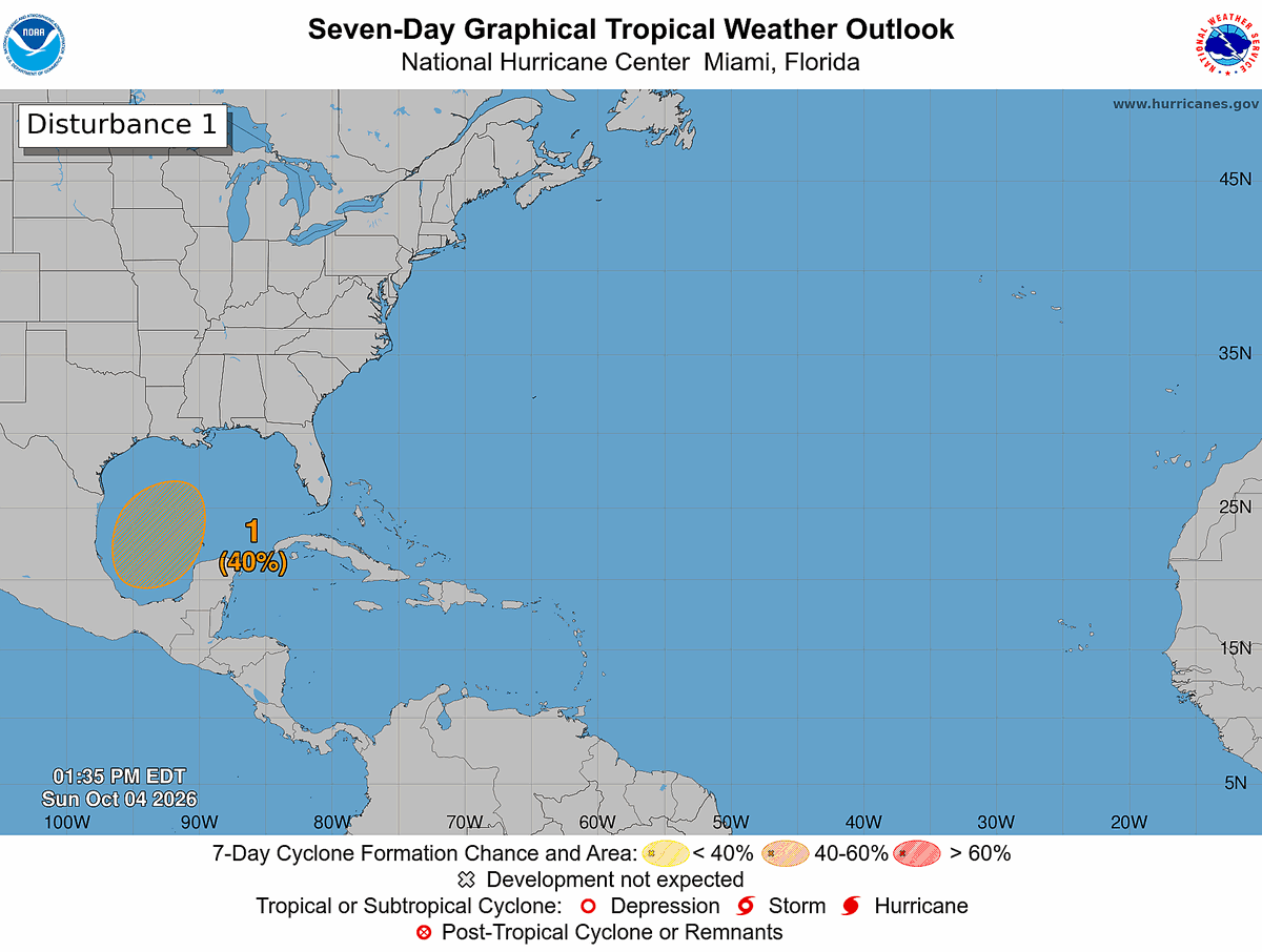
2 pm EDT Oct 4 --- An area of low pressure is likely to form around the middle of the week over the southwestern Gulf of America. A tropical depression could form late this week while the system drifts northward. Visit https://t.co/GrztW6nozt for updates.
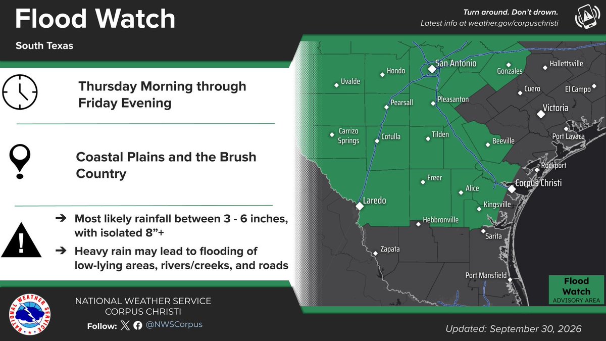
Heavy rain Thursday & Friday is expected to increase the risk of flash flooding. Areas across South Texas could see 3-6" of rain with isolated amounts up to 8". Please continue to pay attention to the forecast, the Flood Watch could be expanded.
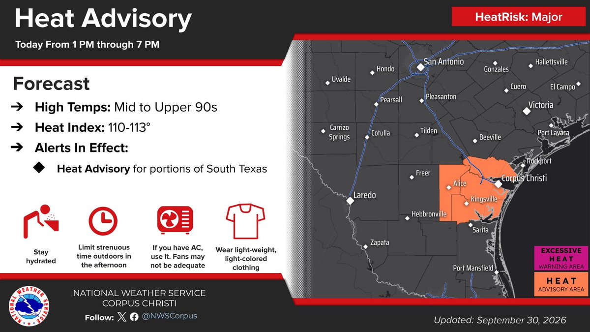
🥵 Dangerous extreme heat is currently ongoing across South Texas. Heat indices are ranging from 110-125 across the region, this map taken from observations around 1 PM CT today, June 18th. Please limit outdoor exposure, look before you lock, and drink plenty of water!
Tropical Update 4PM CT: Potential Tropical Cyclone One is still expected to become a tropical storm near the NW Gulf coast through Wednesday. Main threats remain heavy rainfall/flooding, gusty winds, and coastal flooding.
Tides are currently hovering around high tide with portions of the Middle Texas Coast having water reach the dunes. A Coastal Flood Advisory remains in effect through 9 PM tonight but has been removed for the bays. A HIGH risk of rip currents remains in effect this weekend.
The Freeze Watch has been upgraded to a Freeze Warning for late tonight through Sunday morning. Temperatures are forecast to drop below freezing across inland locations. Wind chill values will drop as low as 18°F in the northern areas, leading a Cold Weather Advisory. Bundle up!
Today we had the opportunity to gather with some of our local broadcast partners. It was a great lunch discussing plenty of weather. Keeping our partnerships strong is an important step in keeping the people of South Texas safe!
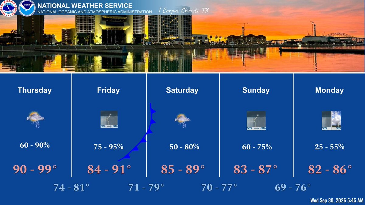
An approaching front Wed will increase rain chances across S TX through Fri. Most likely rainfall during this time will range from 1-2 inches, but could reach as high as 4+ inches in the reasonable high-end of the spread. If you come across a flood: Turn Around, Don't Drown!
Summer rainfall (June, July, August) at San Angelo ranked as the 6th wettest on record, with 11.92 inches. The wettest summer on record is 13.93 inches set in 2007. #sjtwx#txwx
Flood Watch for all of west central Texas from 4 pm today through 7 pm Sunday. Expect rainfall totals of 1 to 2 inches in most locations. Locally higher amounts of 3 to 5 inches are possible across portions of the I-10 corridor and the Concho Valley. #sjtwx#abiwx#txwx
Update 753 PM: We've issued a Flood Advisory for the north & northwest sides of San Angelo until 945 PM. Street flooding has been reported in the vicinity of North Chadbourne & Grape Creek Rd. Please avoid driving into any area where water covers the road. #sjtwx#txwx
We'll be watching for the possibility of a complex of showers and thunderstorms to move into our area Sunday night into Monday evening. This could lead to heavy rainfall and localized flooding especially across the Big Country and Heartland. #sjtwx#txwx
* Important update 715 PM. There is *potential* for storms to develop between 10 PM & 1 AM, to expand north and west in coverage later tonight & early Sunday morning, with very heavy rainfall which could lead to significant flash flooding. Keep weather aware. #sjtwx#txwx
A Flood Watch will be in effect for late Saturday afternoon through early Sunday afternoon. Storms are expected to move into the Big Country and then expand south overnight. Once storms start, stay vigilant and, if possible, keep off the roads. #sjtwx#txwx
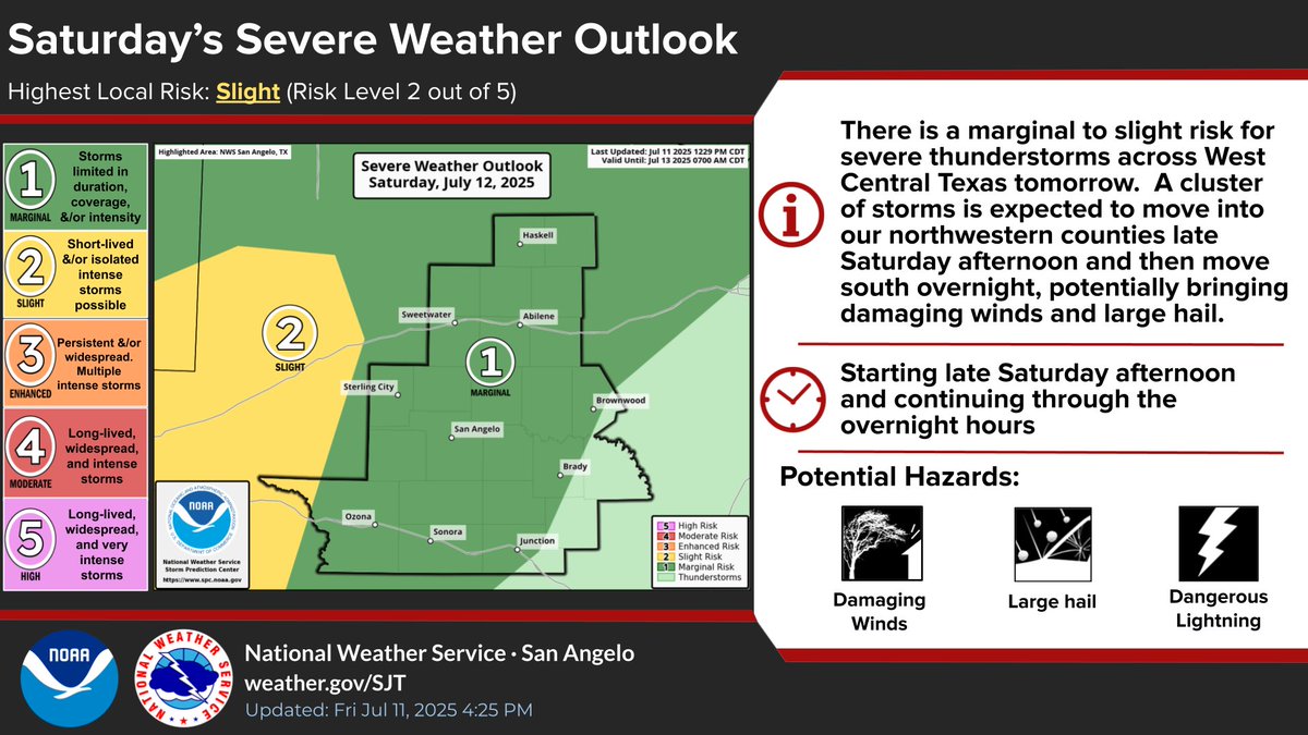
Storms tomorrow & tomorrow night could pose a threat for severe wx as well as for flash flooding. The main severe hazard will be damaging winds, however, we could also see some large hail. Make sure you have multiple ways to receive warnings and stay tuned to the forecast! #sjtwx