Im milden Westen liegt kein Schnee, sonst gibt's jedoch vielerorts eine Schneedecke, in einem Streifen vom Münsterland bis zur Oberpfalz mit über 10 cm - die Schneehöhen-Messwerte von Samstagmorgen (zum Ablesen in die Länder/Klick auf Zahl).
/PH
https://t.co/oVkC1eJfGQ
Deutschland liegt seit Tagen genau im Übergangsbereich von milder Luft (im Westen Europas) zu sehr kalter Frostluft (im Osten Europas). Die Unterschiede bleiben bestehen und verstärken sich sogar - zum Ablesen in die Länder/Klick auf Zahl.
/PH
https://t.co/DKW21nFu5l
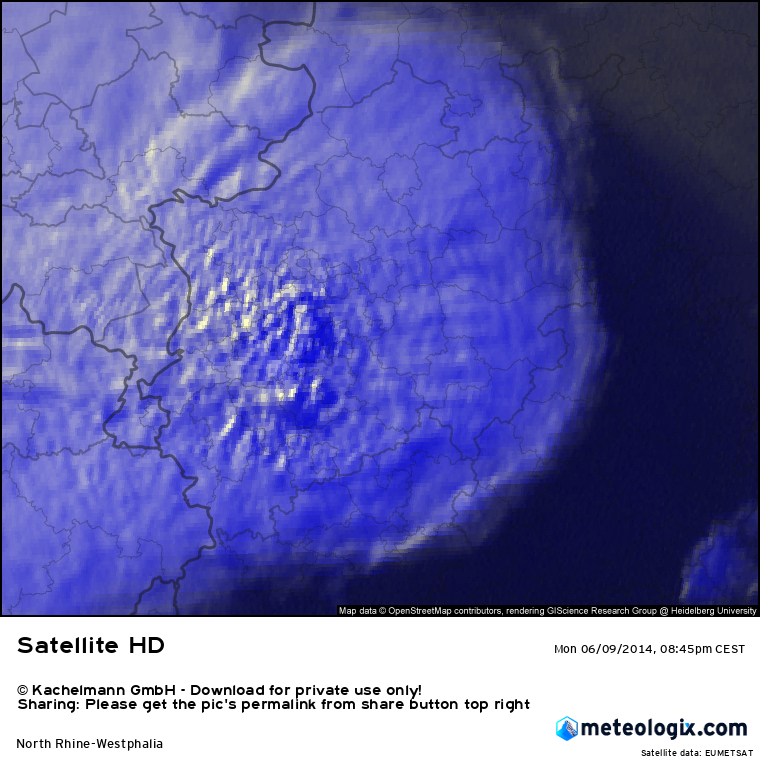
Today was also a Monday and a Whit Monday in 2014. That day saw a significant severe weather event in central Europe. Archive images here show a severe thunderstorm reaching Cologne, Germany in radar and satellite data at the time.
https://t.co/3yEVuolBvc
TT
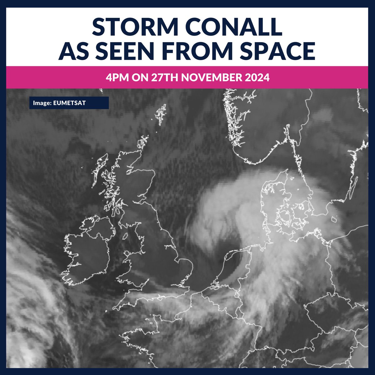
Here is Storm Conall, as seen from space at 4pm today.
It deepened (shown by hook shape) over the southern North Sea, after bringing southern areas rain overnight.
It'll bring very windy weather to The Netherlands in the coming hours.
The immense Pacific Bomb Cyclone has exploded into a sub-950 MBAR beast as twilight descends on the West Coast. This is an absolute Spiral Galaxy of a storm. #BombCyclone
#tropicswx |
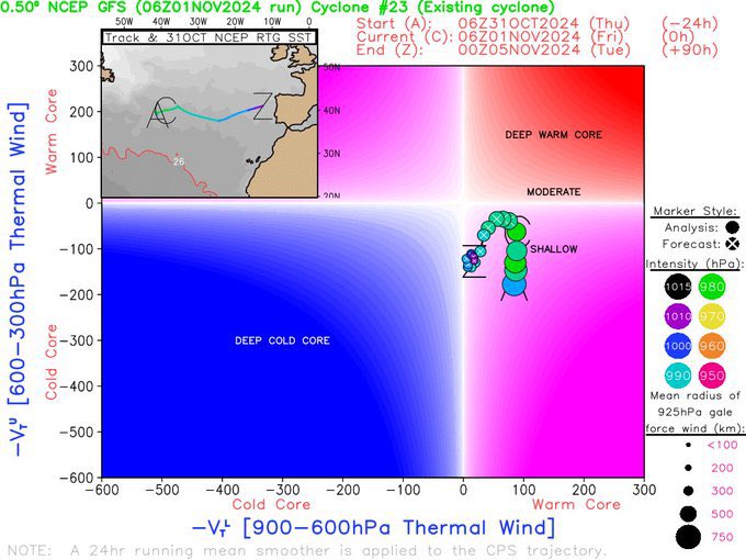
So I don’t know if yall are aware but there’s a potential subtropical cyclone developing in the N Atlantic & it could be one now. It looks detached from the front & convection on its center is increasing to form an eye-like feature. For whatever reason, the NHC kept it at a 10% formation chance. It’s not even invest yet.
On November 1st, 1995, what may have been the most intense tropical cyclone ever recorded in World History reached her ~180 mph, <879 mbar peak intensity as a churning tub of intumescing, convective spray foam. Ranking higher on the Dvorak scale than Typhoon Tip (the current record holder for the World’s most powerful cyclone) at peak strength, Angela would go on to consume the Philippines’ Bicol, Calabarzon, and Metro Manila regions in Category 5 chaos, taking the lives of over 900 people there as a result of violent winds, storm surge, freshwater mudslides, and even a dam failure. At 160 mph, she was the strongest Typhoon to strike the Philippines in a quarter of a century.
(Sat-image credit: American Meteorological Society Journals).
Hochdruckwetter open end. Die prognostizierten Gesamtniederschlagsmengen über viele Modelle hinweg bis Ende nächster Woche zeigen: Da passiert in nächster Zeit gar nichts. Die blockierende Wetterlage hält noch lange an, Tiefausläufer haben auch weiterhin keine Chance. /V
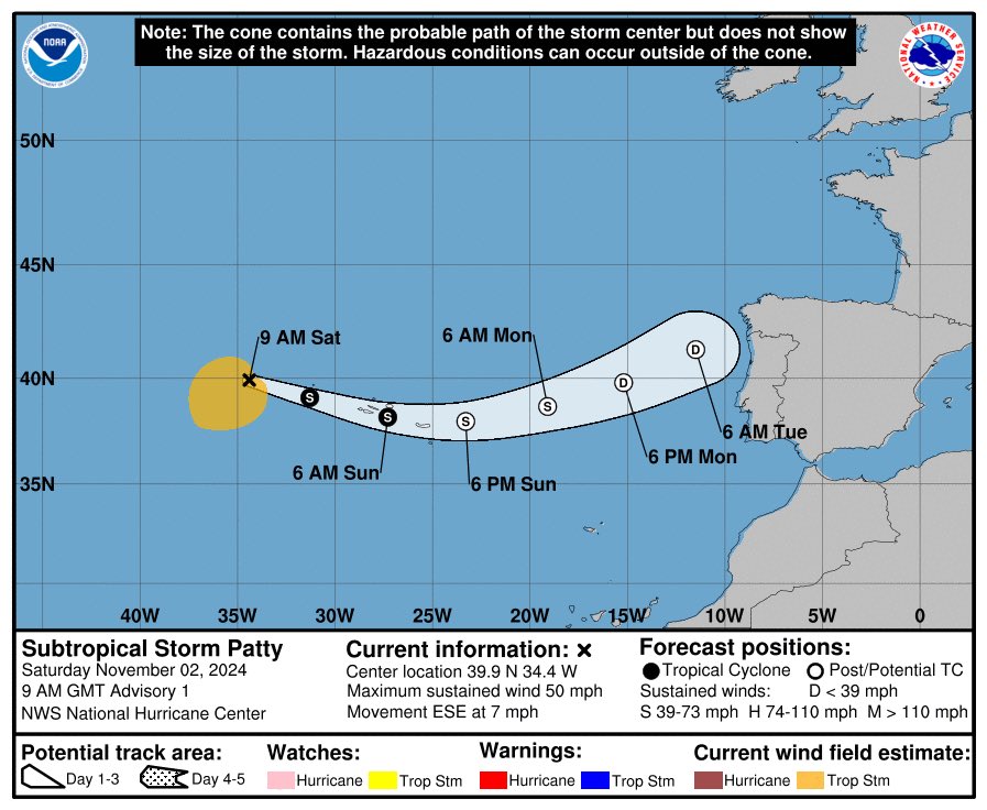
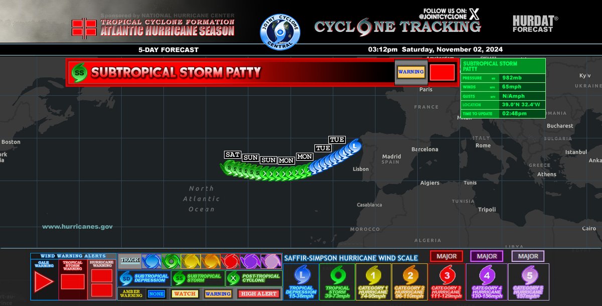
#Patty is finally here near the #Azores who has just recently just issued a TS Warning. Patty should bring some light impacts before continuing to the rest of #Portugal & NW #Spain. #tropicswx#ESPwx#PRTwx
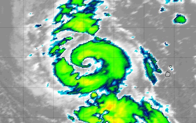
Auf dem Atlantik ist der Sturm PATTY entstanden, er trifft noch an diesem Wochenende auf die Azoren. Interessant ist die Entstehung über nur 19 bis 21 Grad warmem Wasser und die Ausbildung eines Auges:
https://t.co/lj9rQNf4lL
#Patty#Sturm#Azoren#Flores
65 mph Subtropical Storm #Patty has formed in nearly the northernmost quadrant of the Atlantic Basin, becoming the 16th named storm of the 2024 Atlantic Hurricane Season. Shockingly enough, this 982 mbar system isn’t actually a “fish storm”, as she is affecting the 230,000+ inhabitants of the Azores Islands today.
(Sat-image credit: tropicaltidbits)
A violent storm is currently underway in the Baltic Sea region with the highest gusts in Finland at the moment. Winds are particularly violent under convective showers that are rapidly moving southeastwards.
https://t.co/nWETTe4J3R
TT
As Hurricane #Milton became the 5th strongest Atlantic hurricane on record, our crews were collecting critical data to help refine the forecast and provide warnings to those in its path.
Take a look at our mission highlights!
🕑 97+ hours flown
✈️ 16 missions flown across #NOAA42 #NOAA43 and #NOAA49
⛈️ 22 eyewall passes
⬇️ 319 dropsondes deployed
See more info about this storm at https://t.co/q7cmytBxiu
#FlyNOAA
#SubtropicalStormPatty Advisory 2
Max Winds: 65mph
SSHWS: SS
MSLP: 982mb
#Patty strengthens, expected to bring tropical storm conditions to the Azores tonight and Sunday...
Large tropical cyclones with large eyes rarely manage to clean themselves up enough to look "good", but #KongRey in the West Pacific seems to be pulling it off as very cold convection wraps uniformly around its warming eye!
Typhoon #KongRey is titanic. At 150 mph (240 kph) and 925 mbar, he is a near-historic specimen of a cyclone. It’s very rare to see a storm of this size sustain such an extreme and dangerous intensity, and it’s even more unusual for a Cat 4 Typhoon to track as far north as #Taiwan in late October.
(Sat-image credit: weathernerds)