Scattered showres after the noon hour on Wednesday, but t'storms become likely in the late afternoon and evening. Heavy downpours are expected, and there is a minimal risk for a few severe storms.
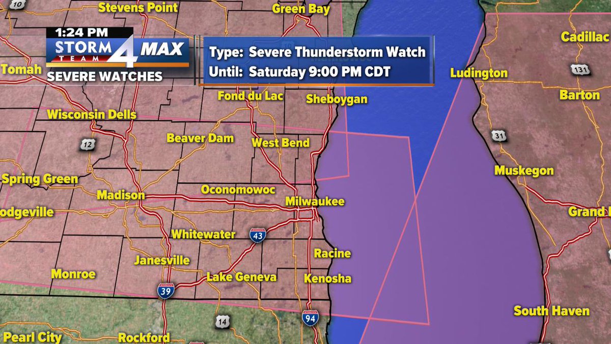
A Severe T-Storm Watch is in effect for all SE WI until 9:00pm.
A line of storms expected later this afternoon could produce damaging winds and an isolated tornado. #WIwx
As expected, the storms weakened and the Severe T'storm Watch for Walworth, Racine & Kenosha counties has been cancelled.
We are still expecting t'storms with frequent lightning and downpours overnight, but large hail and damging wind no longer a threat
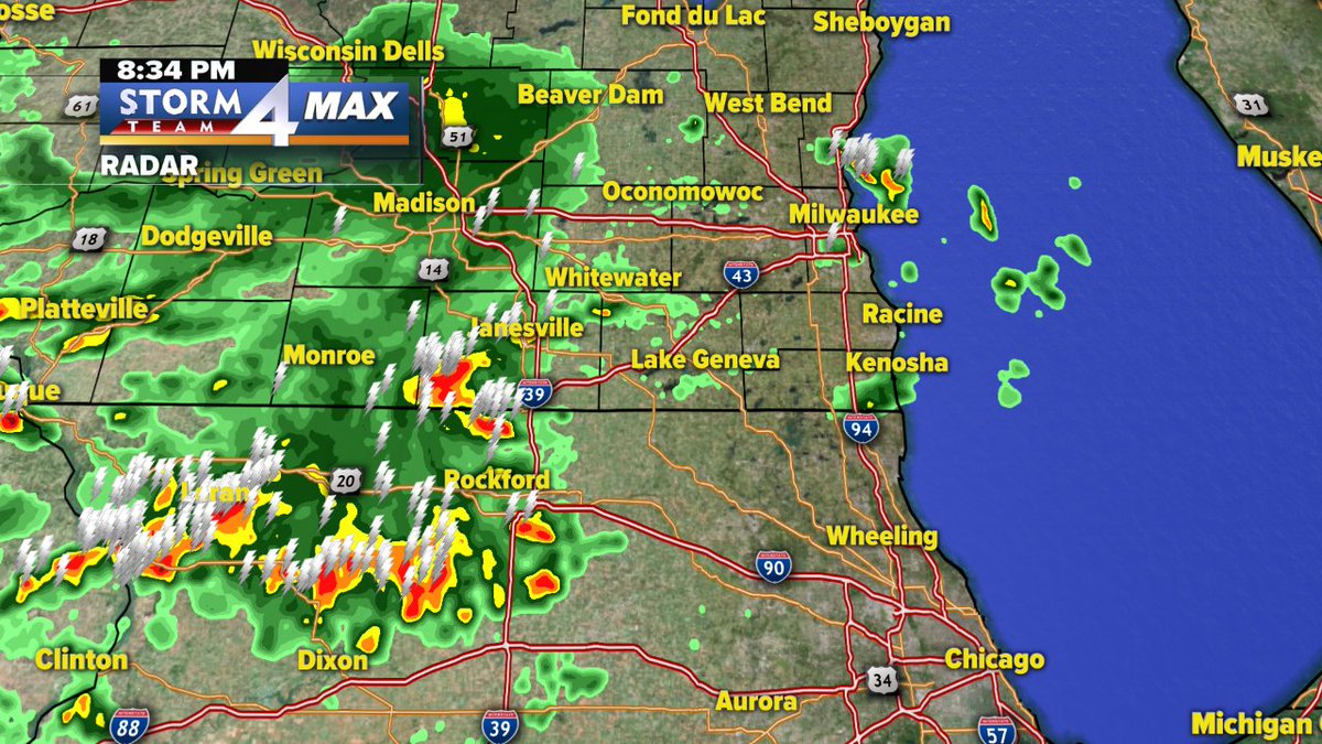
T'storms are weakening as they move closer to SE Wisconsin. Heavy storm near Janesville was severe an hour ago with large hail but has weakening conisderably. Expect more wisespread t'storms overnight with heavy rain at times.
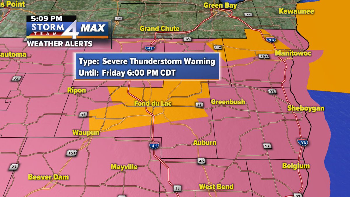
Severe T'storm Warning until 6pm for Fond du Lac County. Main threats...hail larger than a quarter, 60 mph winds, frequent lightning, and downpours. Moving east at 20 mph.
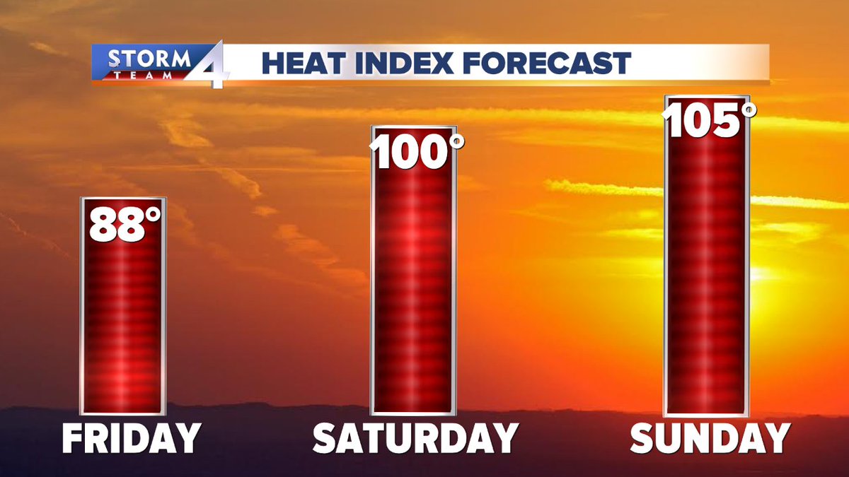
Here we go! Our first Heat Advisory has been issued for pm Saturday til pm Sunday for Fond du Lac, Dodge, Jefferson, Walworth & Rock counties. Expect heat index values of 100+.
#wiwx#thatshot
Get ready for some serious heat! Heat indices will reach 105 by Sunday. Be sure to use extreme caution if you're going to be outside for a long time.
#wiwx
We'll be close to the record high temperature for Memorial Day but a bit of a lake breeze should prevent that from happening in Milwaukee even with the sunshine that has pushed the clouds away. Still a hot and incredibly dry day compared to average! #wiwx
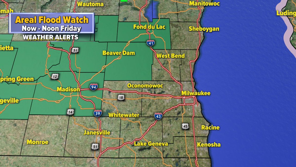
Most spots pick up 0.75" to 1.25" of rain this evening through Friday morning but Dodge & Fond du Lac county may see another 1.50"-2.00" on top of what has already fallen so an Areal Flood Watch is now in effect for localized flooding. #wiwx
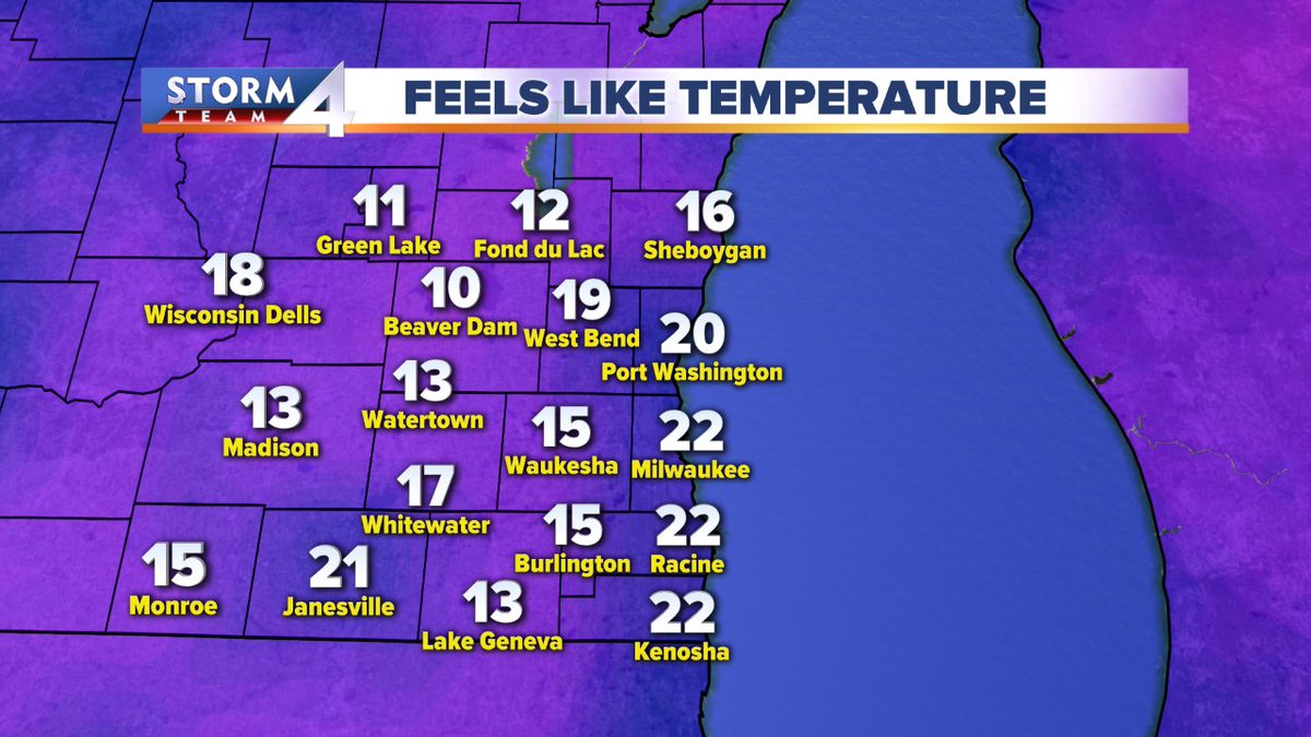
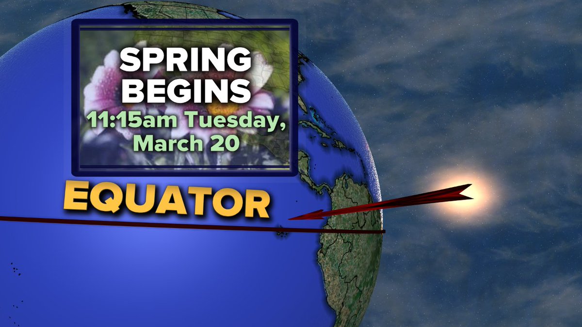
The vernal equinox was at 11:15am when the sun's most direct rays crossed the equator. Mother Nature missed that memo as our wind chills are in the teens & twenties. It could be way worse... or better: this is what March looks like in Wisconsin!
Big temperature drop from Sunday's 50s but we aren't done cooling down yet. Find out how chilly it will feel for the vernal equinox (certainly won't feel like the 1st day of spring) in the Storm Team 4cast on @tmj4. #wiwx