🌍 Introducing the Map2Earn Program!
Starting April 1st, the Content Creator Program officially evolves into the Map2Earn Program, a simplified and inclusive reward system designed to incentivize all mappers.
Just map and unlock bonuses. 🧵👇🏼
@nanoverse101@OVRtheReality You're very welcome, yeah both options are a huge time saver especially after mapping for hours who has energy for that?! 😅
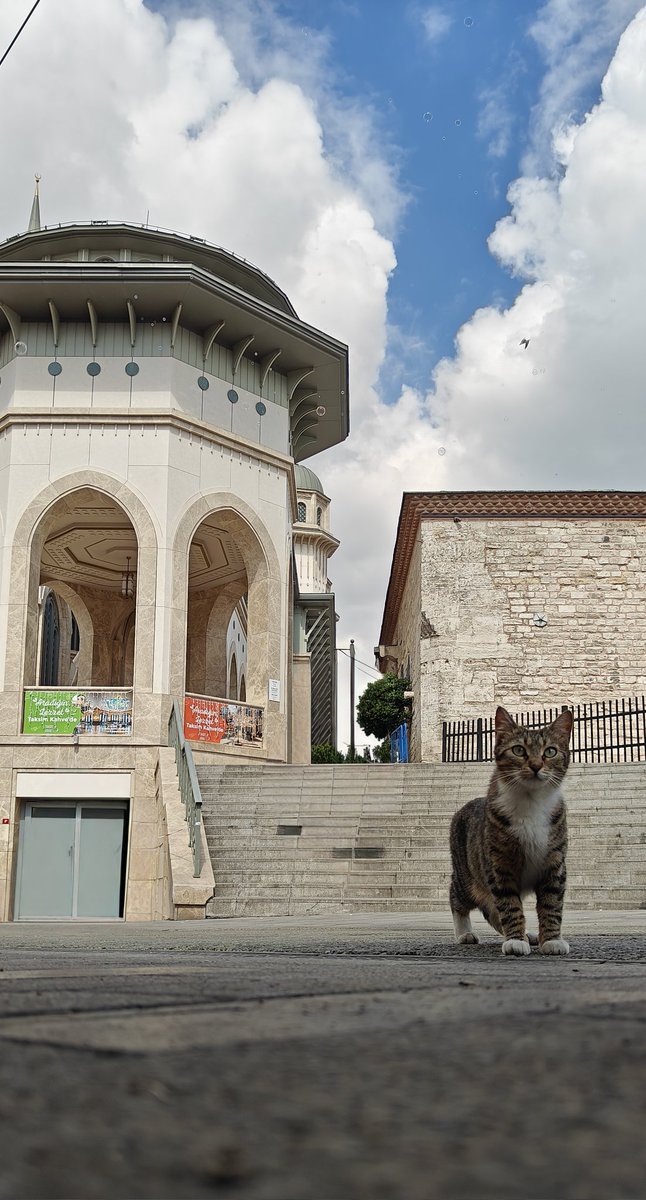
While mapping for @OVRtheReality, I’ve learned that not all locations are created equal. Some areas are just brutal to deal with. So much so that I avoid them unless I have no choice.
Here are 3 of the most challenging spots to map:
A thread 👇🧵
One of my maps got featured! Always nice to be appreciated for your work. Especially when you're enjoying a city trip at the same time 😊
#maptheworld#depin#map2earn
Wild!!
The exact spot I mapped on @OVRtheReality yesterday was featured in Red Dead Redemption 2.
Game designers spent 8 years building a replica of New Orleans. In the future, they could just use the OVRmap.
Are you starting to get it now??
Big news from OVER! 🚀
We're expanding our Visual Positioning System (VPS) globally integrating open datasets from Mapillary & Panoramax. Precise AR re-localization everywhere. Yes, EVERYWHERE!
🗺️ @mapillary & @panoramax_ offer over 2 BILLION geolocalized images under CC-BY-SA license. Mapillary (recently acquired by Meta) covers the globe, while Panoramax specializes in France.
These datasets beautifully complement OVER's community-driven OVRMaps. While they're less dense (about 1-2 orders sparser), their scale is massive. Check out Mapillary’s global coverage here: https://t.co/NrTwiUUxNT
But leveraging such sparse, varied data isn't easy—think limited overlap, camera distortion, and no metric scaling. Yet, we've cracked the code!
💡 Our recent breakthroughs combining our VPS pipeline with cutting-edge Large Geospatial Models (LGMs) allow us to build accurate 3D digital twins and offer reliable VPS services using these sparse datasets.
📍 Accuracy might be lower than our detailed community maps, but it still blows GPS out of the water!
This is HUGE for OVER. It means we’re extending our coverage WAY beyond the 110,000+ locations already mapped by our community. Web3 DePIN + Open Source beats Web2 giants like Niantic!
And that's not all—we're also unlocking exciting new possibilities soon:
1️⃣ Faster and easier mapping through our Map2Earn program using 360-degree camera integration.
2️⃣ Integrating datasets from new DePIN partners—like our recent partnership with @NATIXNetwork the OVER ecosystem.
Stay tuned! The future of AR Spatial Computing and decentralized mapping is here, and it's open, collaborative, and unstoppable!
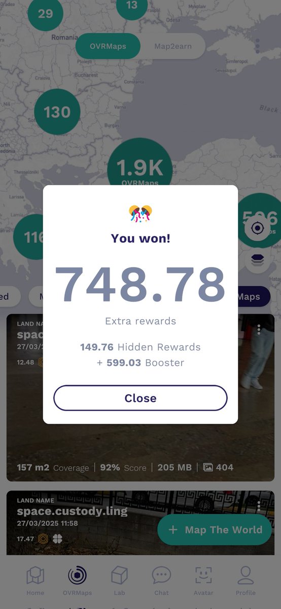
I received 748 $OVR from 9 hidden rewards! That's around $85, and with the direct rewards it must be around $100! Mapping 9 OVRlands took me less than 20minutes! #maptheworld#depin#map2earn
Google 3D Maps aren’t as accurate as you think.
Everyone knows Google dominates mapping—but here’s what they won’t tell you. Their 3D maps are built with car-mounted cameras, capturing images every ~10 meters. That’s fine for basic navigation, but it’s nowhere near enough for AR, robotics, autonomous systems, or AI-driven spatial intelligence.
Now, imagine a map so detailed it captures the world at sub-5cm accuracy. That’s OVRMaps.
🌐 OVER 3D maps are built with 400-1,000 images per 300 sqm, taken from multiple angles at pedestrian level.
The result? A new era of hyper-precise localization that changes everything.
Why does this matter?
↳ VPS that actually works – Real-world AR anchoring, digital twins, and AI-powered spatial computing with pinpoint accuracy.
↳ Next-gen precision – Essential for ride-sharing, robotics, smart cities, and asset tracking—where even a small error makes a huge difference.
↳ AI-Driven Spatial Intelligence – Our maps fuel Large Geo-Spatial Models (LGMs), the AI revolution enabling machines to understand, navigate, and interact with the real world.
↳ The Spatial Computing revolution – Merging immersive experiences with real-world precision, unlocking applications beyond what Google’s dataset can support.
OVRMaps are built for the future. 🌍 Start mapping today: https://t.co/9l72vtATFb