So proud and honored to receive the @ametsoc Certified Broadcast Meteorologist distinction. You have to pass a rigorous 100 question exam as well as have your on-air work reviewed. Just over 800 #meteorologists have this across the US! #AMS2020#AMS100#AMSCBM@AMSBroadcastCon
DANGEROUS #FLORIDA HEAT🥵
The heat and humidity are really going to put stress on your body today. We have an EXTREME heat risk so be sure you don’t overdo it outside! Feels like temps could get to as high as 110 this afternoon.
#heatwave#orlando#summer#summertime#flwx
you asked, we listened...Retro Weather Channel is officially back and here to stay! It’s available now on both iOS and Android. To experience the ultimate throwback, update your Weather Channel App, sign in, and unlock retro forever! 💙🎷🌥️ Click here to unlock! 🔓
https://t.co/E2LTRwIihZ
HEADS UP, DUST INBOUND
A plume of #SaharanDust is on it's way to #Florida and the impacts could be a bit worse thanks to the concentration. Vibrant sunsets and sunrises expected late this week into the weekend, and we could come some air quality issues too.
#flwx#weather
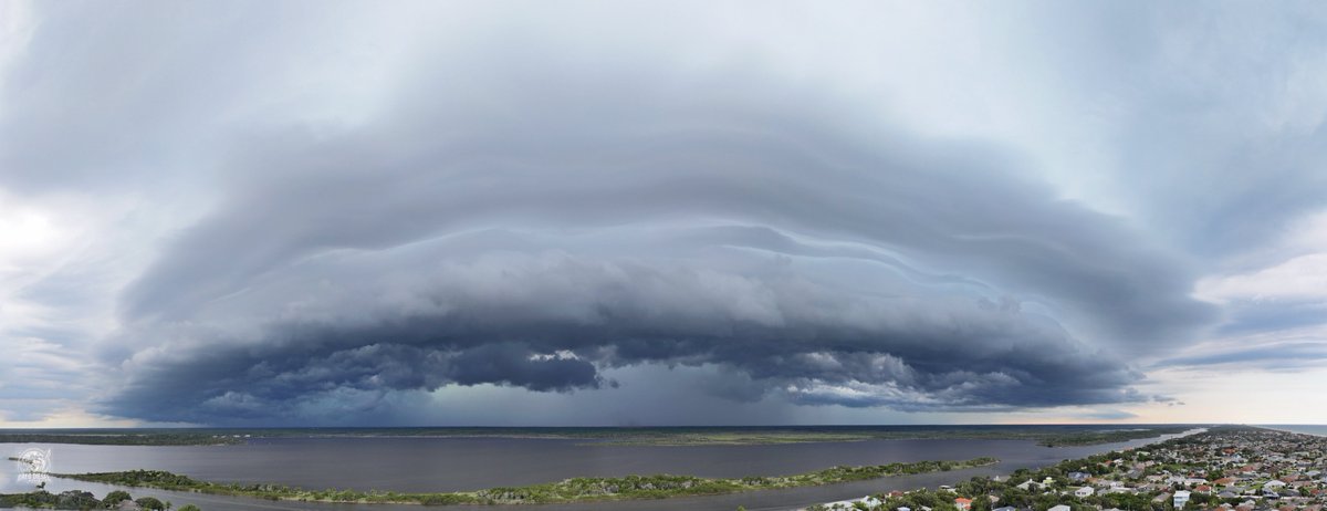
NUMEROUS STORMS ⛈️: Once the sea breeze collision happens this afternoon, we'll see widespread storms igniting. A few could be strong with torrential rain, gusty wind, and small hail. Keep your eyes to the sky into the evening. #flwx#weather#weatherupdate#florida
HOTTER IN #PHILLY THAN #FLORIDA🥵
A ridge of high pressure is continuing to dominate the eastern half of the nation. A major to extreme heat risk is in place for millions as feels like temps surge past 110° in some locales. Check out DC! #flwx#weather#weatherupdate
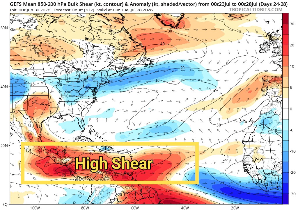
As we enter July, models anticipate the Atlantic to remain generally quiet hurricane-wise. El Niño is dominating the current and forecast conditions in the tropical Atlantic, manifesting as high shear in the Caribbean and less thunderstorm activity than normal.
By contrast, the eastern Pacific is expected to spring to life, supported by the El Niño background state. Watch the continuous cyclone activity (orange blobs) in this 35-day GEFS forecast, versus the rather docile Atlantic.
We can't guarantee no Atlantic storms in July, especially with the always-present risk of so-called "home grown" development along old cold fronts that drape across the SW Atlantic and Gulf region. But things seem likely to stay in check for a while.
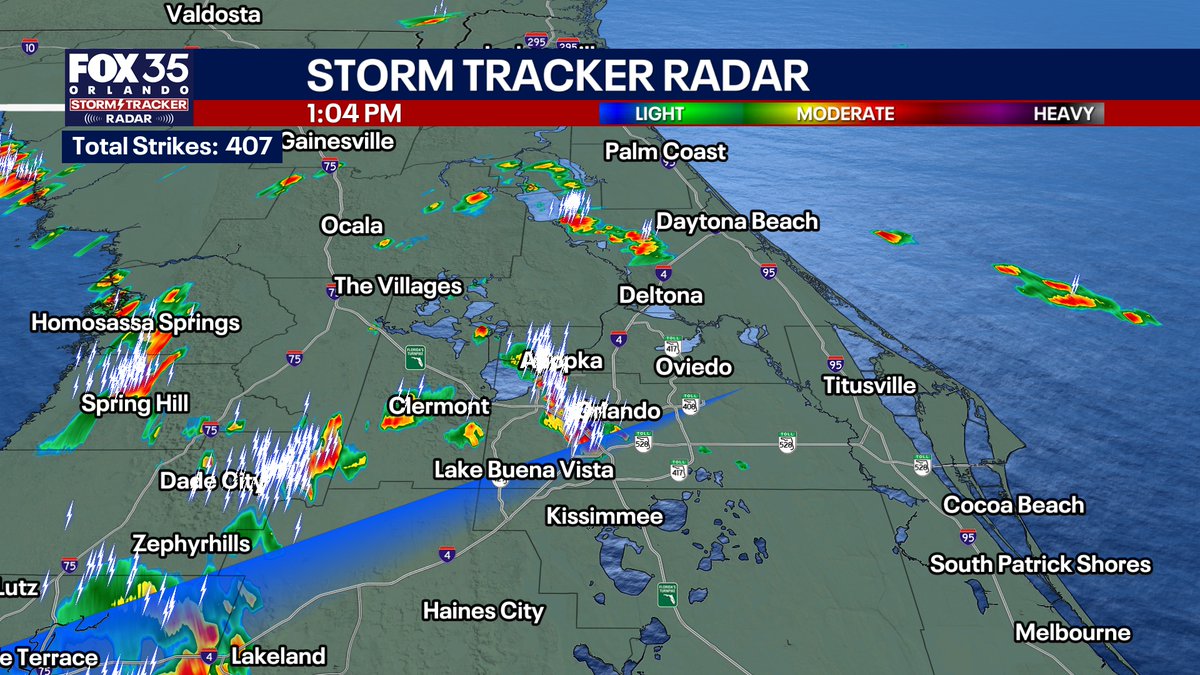
TRACKING #STORMS: As this weak front works into the region, storms are firing! A few are working across the metro with torrential rain, frequent lightning as well as gusty wind. Coverage looks to pick up as we progress through the the afternoon. #flwx#weather#florida
BEAUTIFUL #FLORIDA#SUNSET: Check out the gorgeous view overlooking some I-Drive! ☀️ This is all thanks to that Saharan Dust in the air. We're going to continue to see vibrant #sunrise and #sunsetviews as another plume is working our way. #flwx#weather#sunsetphotography
Dangerous, record-breaking heat will intensify across most of the central and eastern U.S this week. Dozens of record highs are expected later this week across much of the Northeast.
Heat indices will likely exceed 100 degrees. Heat is likely to continue across the eastern U.S. through the Independence Day holiday weekend.
Check your forecast at https://t.co/qk3BcVP5M8.
STORMS IGNITING: The sea breeze is working inland and we're seeing storms firing near and out ahead of it. Watch for lightning, torrential rain, and gusty wind in any stronger storm. We're seeing some rain getting really close to Downtown #Orlando. #flwx#weather#WeatherUpdate
The American Bald Eagle population has more than quadrupled in the lower 48 states since 2009. Thanks to federal protections and habitat restoration, numbers skyrocketed from roughly 72,000 birds to over 316,000 individual eagles.