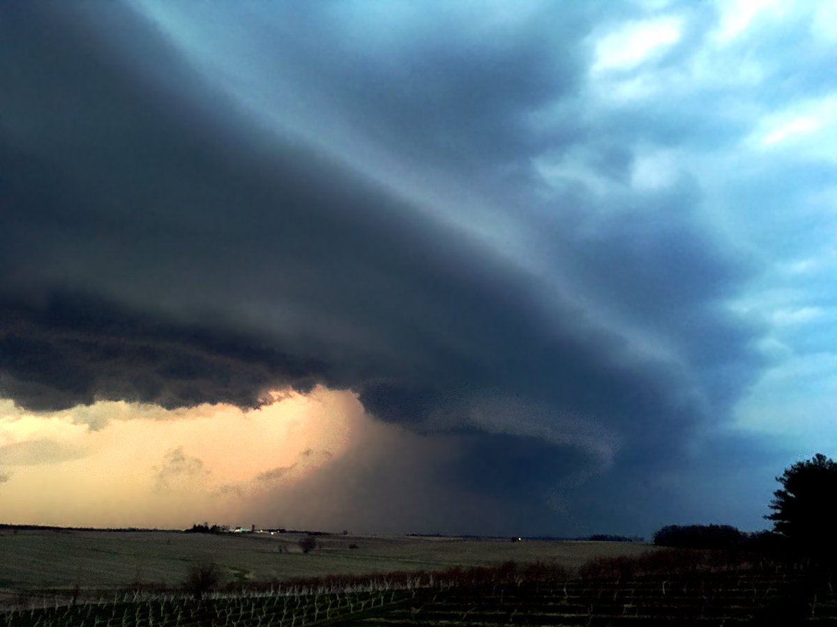
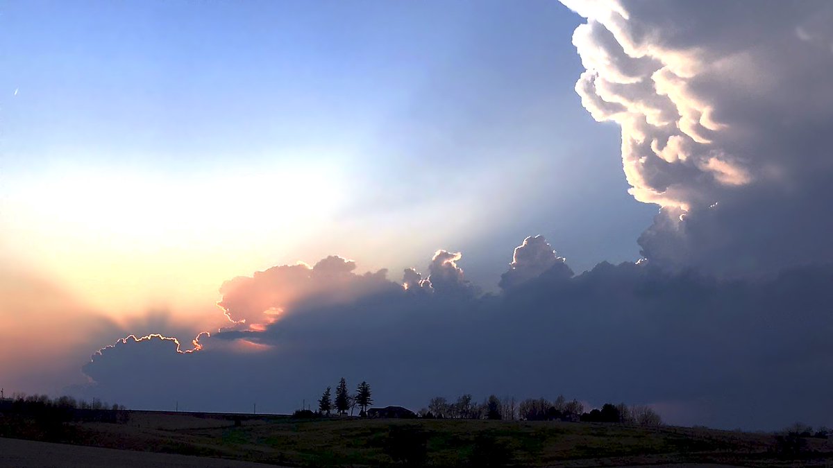
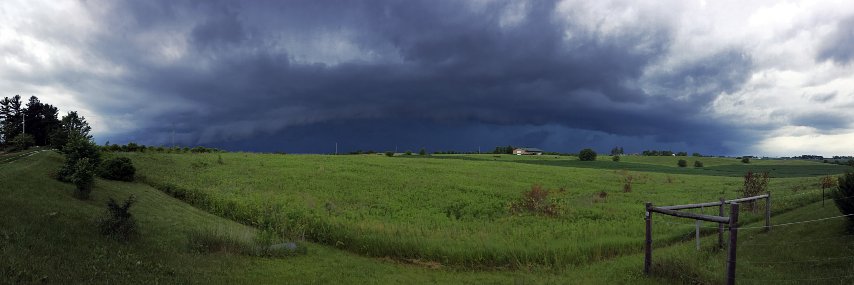
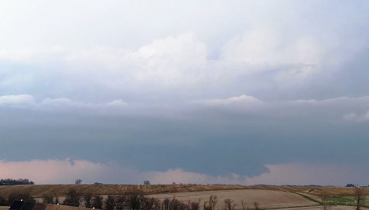
I finally got around to editing the shots from the April 7th photogenic, splitting supercells that produced monster hail to my north in Cedar Rapids. The crepuscular rays and gold lining shining around brand new development were something else! More of this tomorrow?🌩️#iawx
NWS Lake Charles has issued it's first ever Blizzard Warning for Jefferson and Orange counties as well as Cameron, Calcasieu, Jeff Davis, Acadia, Vermilion and Lafayette parishes until noon today.
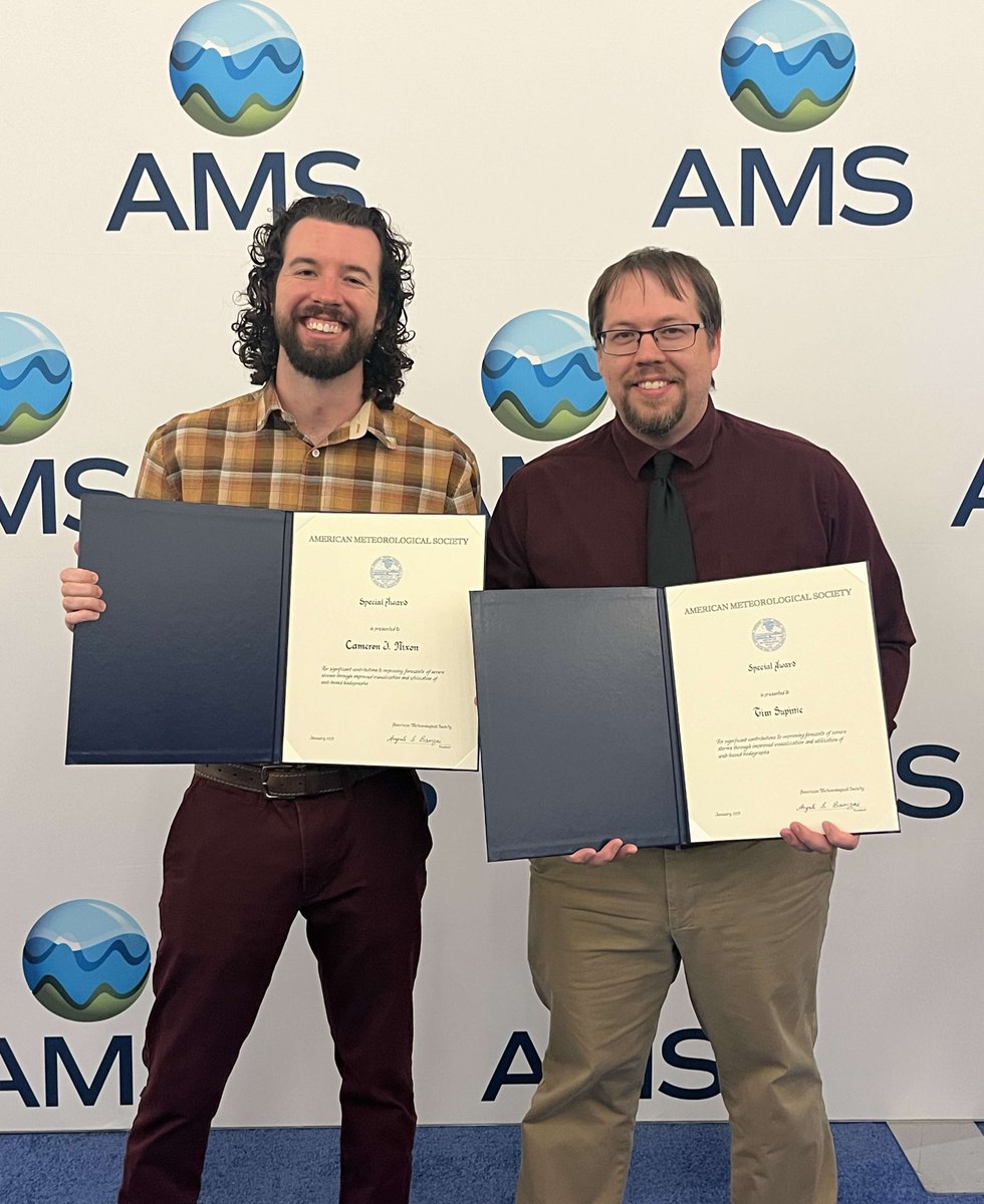
Tonight @plustssn and I had the honor of receiving an #AMS2025 special award for our contributions to improving forecasts with visualizations of hodographs!!
The Predecessor Rain Event (PRE) associated with Hurricane Helene can be visualized with radar & mid-troposphere heights (blue lines).
Helene's interaction with a cutoff low brought a frontal boundary to a stall over western NC with a deep moisture plume well ahead of Helene:
My paper on mergers, nudgers, and collisions (oh my) has been ACCEPTED for publication!!!🎉
Here's a teaser: where are nearby cells (and how many are there) prior to tornadogenesis? We found interesting differences even at 30-minute lead times:
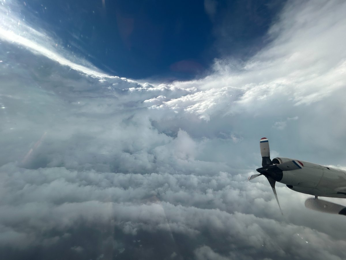
OVER THE CARIBBEAN - Inside the eye of Category 5 Hurricane #Beryl!
NOAA WP-3D Orion #NOAA43 “Miss Piggy” continues operations into Hurricane #Beryl to collect data for hurricane forecasting and research.
Visit https://t.co/0W0v11Anw1 for the latest forecast and advisories. #FlyNOAA
📸: Lt. Cmdr. Kevin Doremus, NOAA Corps
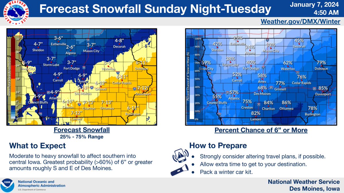
What week of winter weather in Iowa! Thank you snow plow drivers and others! Lapse combines @iowadot track-a-plow locations, DOT/DPS Road conditions, and NWS RADAR since 12 AM last Monday. Re-use as you wish. #iawx
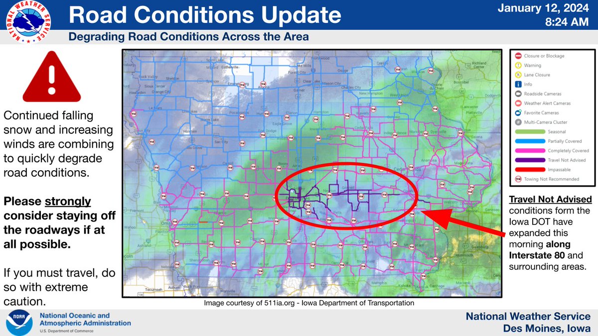
It is 𝗥𝗘𝗔𝗟𝗟𝗬 𝗡𝗔𝗦𝗧𝗬 out there on many roadways. @iowadot has 𝗱𝗼𝘄𝗻𝗴𝗿𝗮𝗱𝗲𝗱 most of the Des Moines Metro interstates/highways and I-80 over through Iowa City to 𝗧𝗿𝗮𝘃𝗲𝗹 𝗡𝗼𝘁 𝗔𝗱𝘃𝗶𝘀𝗲𝗱.
Seriously consider avoiding travel if possible.
#iawx#blizzard
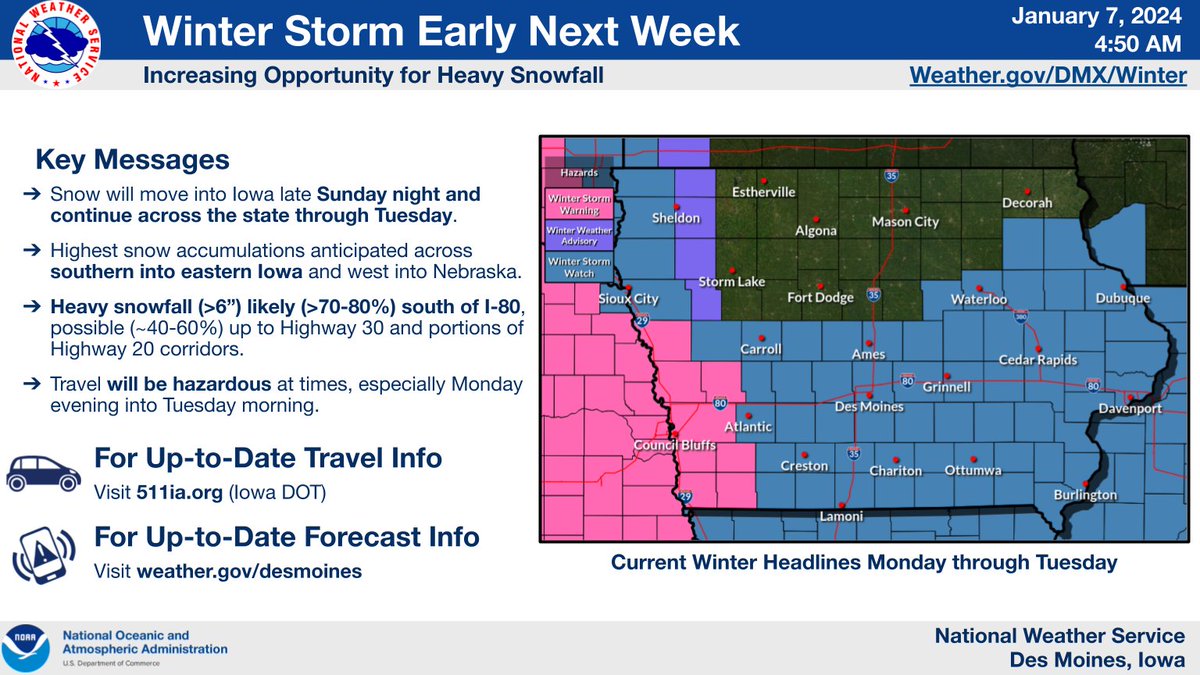
Buckle up for this forecast update.
🧐
A northward shift in storm track has been signaled the last few model cycles, and you can probably guess what that means for the area.
🤔😮⬆️🌨️
More snow, and our first sizable winter storm of the season. #iawx#winteriscoming
I love snow as much as the next guy, but I think it’s high time to give more of this to the lower 48. We’re now 8 inches short of our entire seasonal average (77.9”) and it’s *checks notes* December 17th?
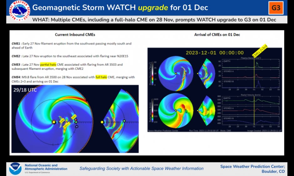
Following several coronal mass ejections (CMEs) on Nov. 27 and 28, a Watch has been issued for a strong Geomagnetic Storm (G3) beginning 00 UTC Fri (7pm EST Thu). Auroras may be visible as far south as Illinois & Oregon Thursday night/early Friday morning. https://t.co/SqhAvUex6e
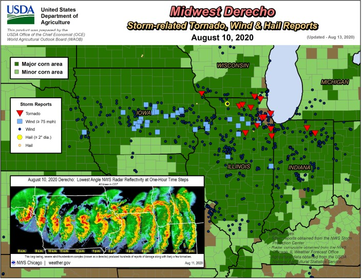
Today marks three years since the historic derecho tore through parts of the Midwest. Where were you as the storm hit? #iawx
Visit here for detailed info on the storm and its impacts in central Iowa: https://t.co/1WUplfqvtP
May 2023 Month-In-Review:
Highlights:
4th Consecutive May w/o a violent tornado
2nd May w/o a EF3+ tornado
2nd May with no Moderate or High Risk
Fewest Preliminary Severe Weather Reports (since 2004)
2nd Fewest Watches/3rd Fewest Tornado Watches
11 States with no Reports in May.