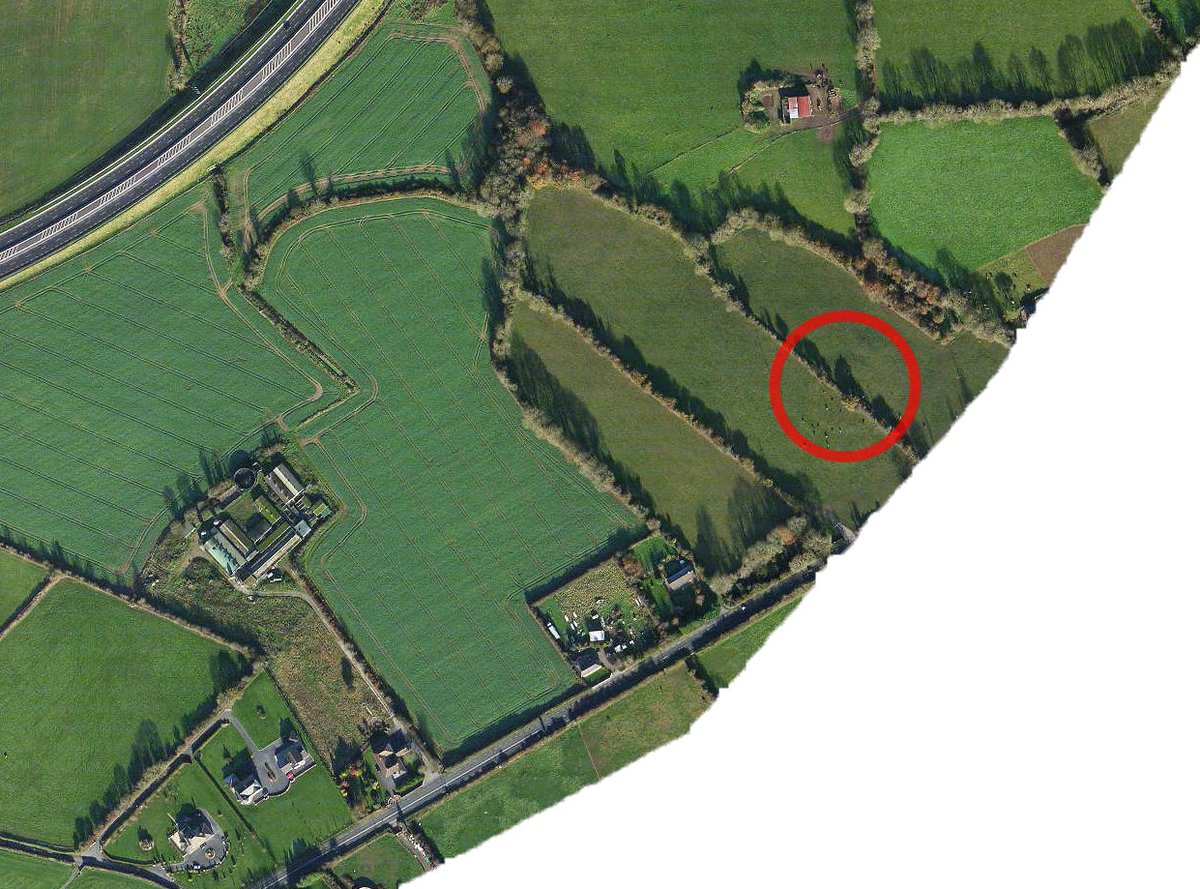
The LIDAR scans on ARCGIS are interesting. Quite a few ráthanna clearly visible on there that aren't documented on any OSI surveys or the HEV. Makes you wonder how many are lost to time.
The Cross (#1) Waterford. Named for the historic market cross that once stood at the end of Patrick Street. It was demolished in 1750, but is still named the cross by the older generation in Waterford to this day.
I was interested in confirming this local story about the origins of the name of Paddy Browne's road. I discovered it was indeed true. Paddy Browne's road ran through the land of a Patrick Browne, who had a 30 acre lease from Thomas Wyse, Esq.
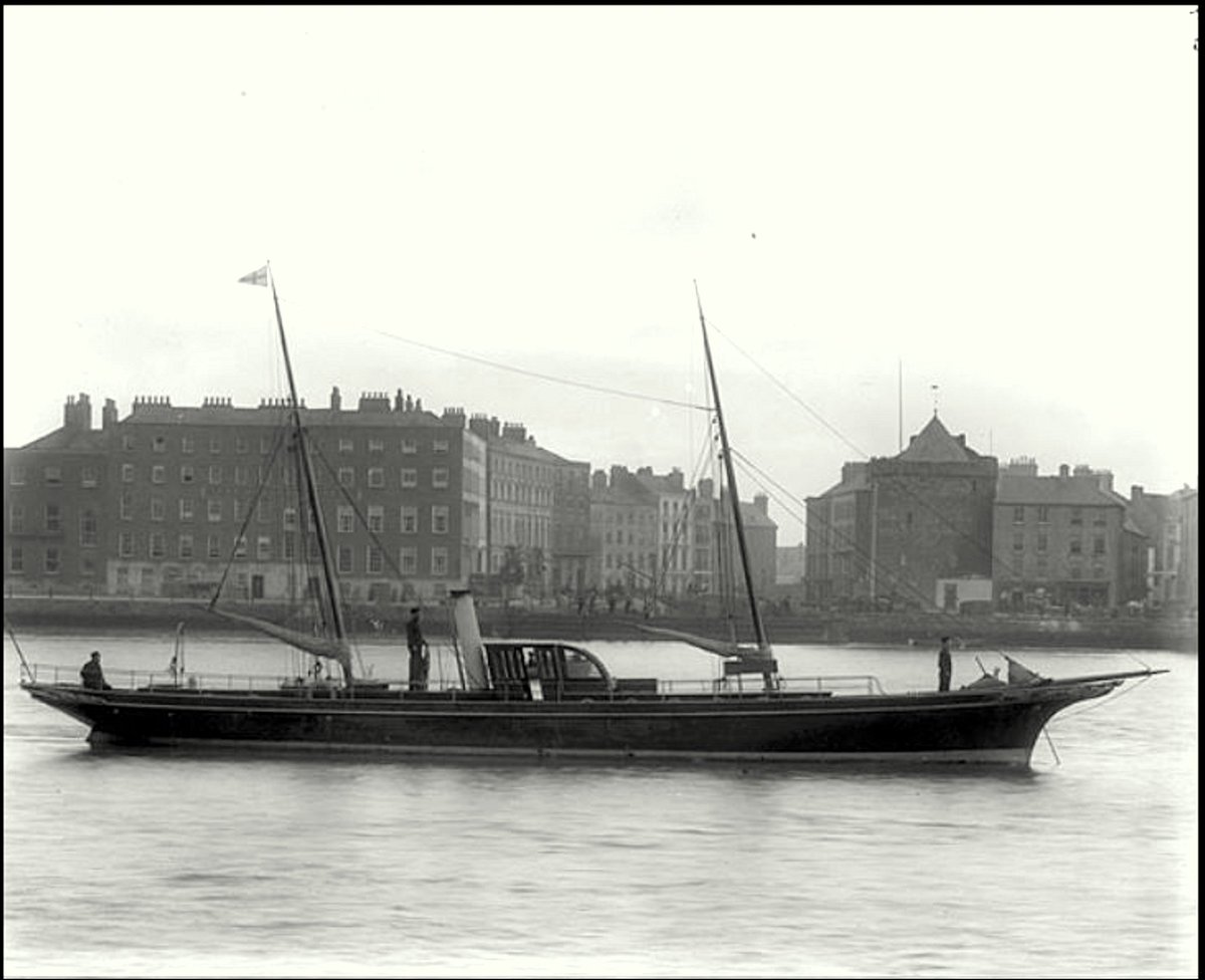
Another fabulous story in this year's @WfdHistSty journal David Carrolls story of the last ship built in the Neptune shipyard, #Waterford the steam yacht Maritana, claimed at the time to be the "most beautiful yacht built in #Ireland " seen here off Reginalds Tower. NLI AH POOLE
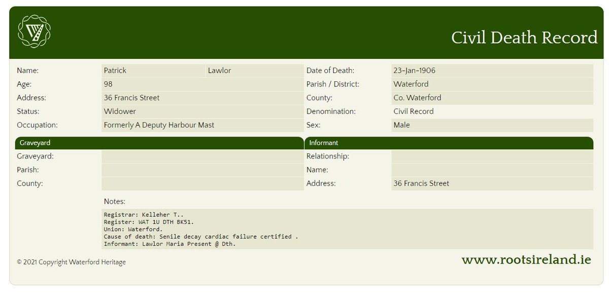
@tidesntales Do you know if there are records of harbour masters and deputy harbour masters for Waterford? My 4th great-grandfather Patrick Lawlor (also spelled Lalor) was listed as the deputy harbour master, I'm wondering if there are any records on him.
As its the last Friday, my monthly blog explores a curious placename on the River Barrow in Co #Kilkenny that may have originated with a highway robber.
https://t.co/L1KOSu6Vve
Turgesius Tower, shown here on a 1673 map stood at the end of what is now Barronstand St. by the AIB bank. The Tower was part of the original Viking walls, built circa 1000 AD and marked the perimeter of the city walls. The tower was demolished at the start of the 18th century.