Tropical Storm Edouard has strengthened further this afternoon as it nears the Texas and Louisiana coastline, with max winds now at 60 mph. Landfall will likely occur over the next hour or two, bringing tropical storm force winds and heavy rain to the northwest Gulf coast.
As we step into your Sunday we will be greeted by chilly temperatures to the 40s, before lots of sunshine takes us to the 70s by the afternoon. Unfortunately Sunday will be the first of many dry days across the area as high pressure moves over the state of Texas.
It is officially Halloween and we couldn't ask for better weather! Temperatures this afternoon will get to the low 70s, before we cool down to the 50s tonight.
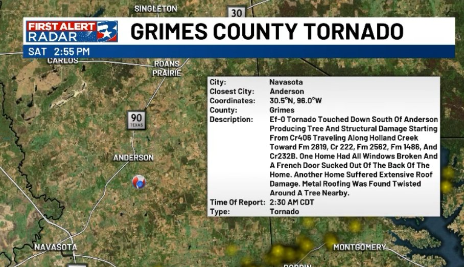
TORNADO CONFIRMED🌪
NWS Houston confirms a tornado touchdown in Grimes County as last night's storms moved through. We were tracking several different areas of rotation and tornado warned storms through the overnight along and east of Hwy 90.
WEEKEND STORMS DOUBLE FEATURE🌧
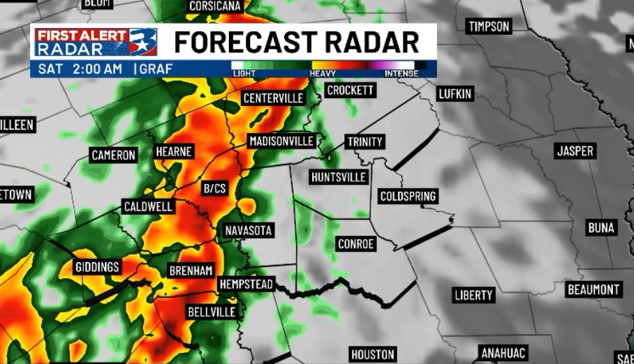
All set for our expected round of storms Friday night into early Saturday morning. Now looking MORE LIKELY that we "reload", and this low pressure system sparks up more storms by Saturday evening. Main threat is for strong wind in both timeframes
We've got eyes on our next potent weather system set to roll in to start the weekend.
Widespread rain and storms will push in overnight Friday, and could be a bit rowdy. Strong winds, heavy rain, hail, and a low tornado concern will need to be monitored. The system clears Sunday.
Quite a satellite image this morning! 🛰️🌀
Clouds extend 1000 miles from #Imelda's center all the way into Central PA.
#Humberto continues to churn in the Atlantic.
#PAwx
Once again heading into a more stagnent weather pattern, though this time with a direr airmass in place. Because of this, temperatures will cool to the mid 60s in the morning before heating up to the upper 80s/low 90s by the afternoon.
Wednesday is a First Alert Weather Day as a cold front moves through prompting strong storms capable of producing gusty winds, heavy rainfall, and small hail. Until then, more summer feels on tap.
Watching for more isolated showers and storms this afternoon, before we quiet things down into the overnight. Beyond Labor day, we wiill start to dry out and temperatures will push back to the low-mid 90s through the week.
More afternoon showers and storms expected into your Labor Day, though activity will much more isolated. As we lose the heat of the day, activity will start to quiet down into the overnight.