New Feature: For Toronto TTC Rapid Transit lines 1, 2 and 4 there is a new prediction source so approximate vehicle locations are available. I will work on tracking vehicle locations and generating performance reports.
I have created a pull request to start of process of adding vehicles.txt to the GTFS standard. It adds a new file to describe the capacity, accessibility, appearance and features of individual vehicles or vehicle ranges.
https://t.co/jp9bYMN5N9
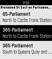
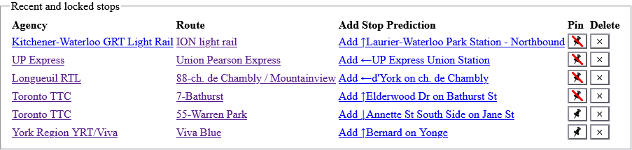
TransSee now records recently visited stops in browser local storage, allowing you to go back to them with the "Recent Stops" drop-down. If you are on a prediction page, you can add the stop to your prediction list. You can also pin stops to prevent them from being deleted.
New Feature: For Canada and the US, TransSee now gathers local precipitation from Environment Canada weather radar and uses it as a factor in predictions. The recorded values can be seen in the Trip Path pages.
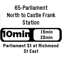
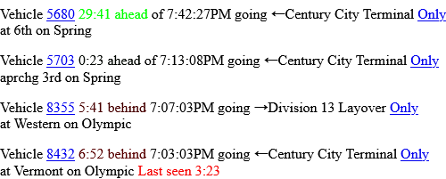
@appleSauce776@wongkarwasian TransSee takes past travel times into account giving a prediction range that takes into account when it is late. (This isn't available for TTC subway predictions.)
Finally got something like this working for my partner's apartment! Took a little while to learn how to ssh into a raspberry pi to get working and it's still a bit buggy but it works with basically every transit agency on Earth.
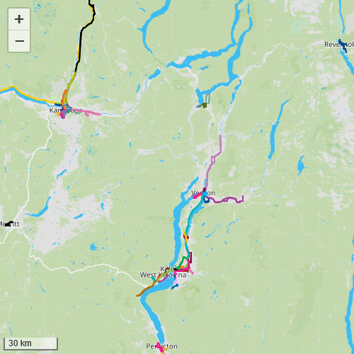
New Agencies: TransSee now supports 30 new systems in British Columbia that are part of BC Transit with predictions by past travel time and vehicle tracking.