SPC Nation⚡️ The job's not done until we bring back a High Risk! 🟪
I'm staying home!🌪
DMs are closed Please respect my decision 🙏
-Lyons
#AGTG✝️
#blessed#stayinghome
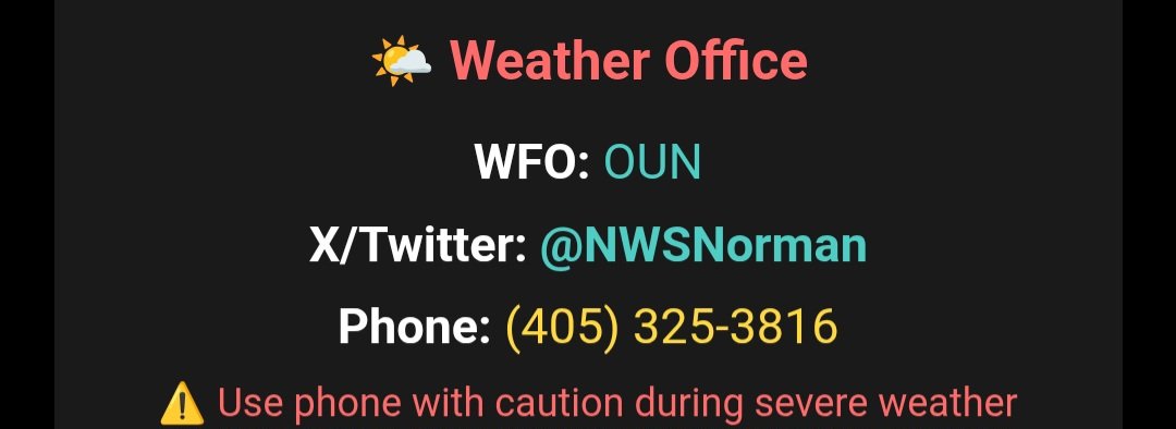
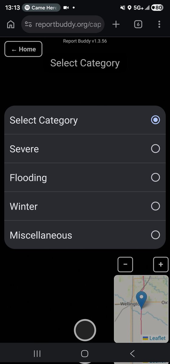
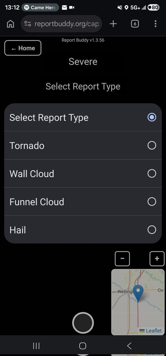
Chasers! Since we're going to be chasing & spotting storms that may cross several CWAs in their lifespan, use Report Buddy to help you get reports out to our NWS colleagues!
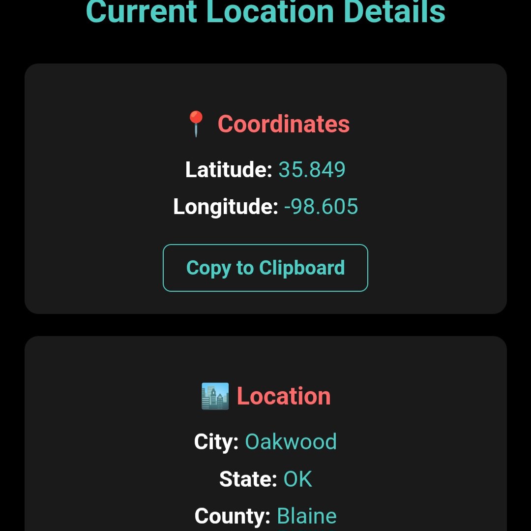
Report Buddy automatically detects your location and nearest CWA when submitting reports, you can use a menu drop-down to select from various report types!
https://t.co/JuSQQX6QUb @TwoDogsWx
I see lots of reports to both NWS Omaha and NWS Hastings for the one tornado, Report Buddy automatically detects what CWA youre in!
You can also use our drop-down and photo feature to easily report severe hazards!
https://t.co/wHljQPU7Ko @TwoDogsWx
HREF/SREF/NAM retirement:
I have seen some people provide some clarity on aspects of this, but since this is something at the SPC we have been working with for awhile, I wanted to address all aspects of this in one spot.
🧵
Excited to announce my (ongoing) partnership with Andrew Lyons )@TwoDogsWx) of our continued development of Report Buddy!
Report Buddy is designed to help storm spotters report hazardous weather more efficiently, allowing storm spotters to select from a drop-down of various reports and Report Buddy will generate pre-made text for them to copy to Facebook or X.
We've made several changes lately, including creating a PWA that can be downloaded onto mobile devices! You can also now directly copy your coordinates instead of having to make a full report to retrieve them, improvement to the quality of photos that're processed and improvements to load location services faster.
Thank you to those who already use Report Buddy, and for those newcomers we reach with this post, I'd love to hear your feedback on how we can improve Report Buddy and make your reporting easier!
https://t.co/JuSQQX6QUb
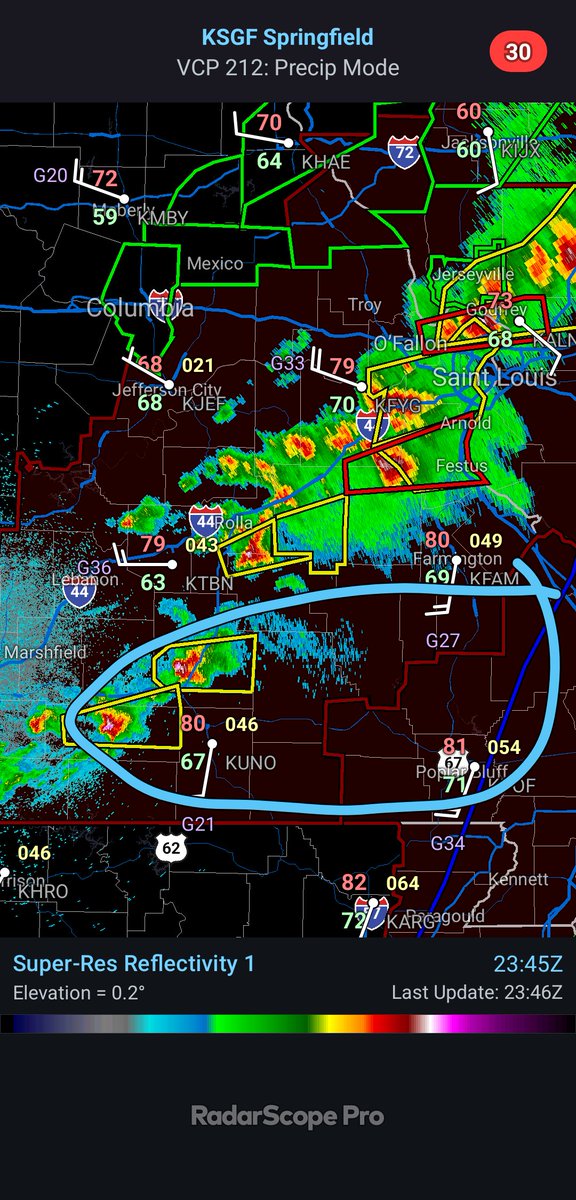
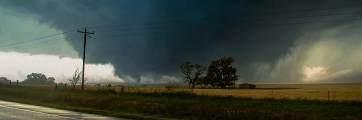
This cluster of storms approaching SE Missouri bears close watching. As long as they remain at least semi-discrete, they will start to feel the effects of an accelerating nocturnal LLJ and pose a risk for (potentially strong) tornadoes.
I would pay close attention to these two supercells over the next few hours. Visually robust rotating updrafts moving into a high STP (3-5) this evening. If they remin cellular I'd expect significant tornado potential with them in the next couple of hours.
Severe weather, including the potential for multiple strong (EF2) to intense (EF3) tornadoes, expected today across parts of central and southeast Missouri into southern Illinois.
Thank you everyone who joined the @NWSSPC live stream earlier!
That went way smoother than I expected for a first time. Will only get better from here. I hope everyone stays safe today!
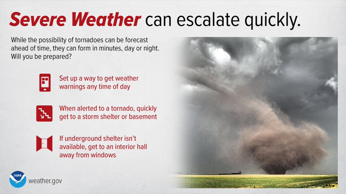
Today's severe weather setup is one with higher than usual uncertainty in timing/location, but the potential to ramp up quite quickly. Make sure you have a sheltering plan in place and are monitoring the weather this afternoon and evening. #okwx#texomawx
I will not tolerate disparaging remarks about individual forecasters, questioning competence, or anything the like.
We deal with a mountain of crap from unqualified and outright hostile people daily. Forecasts are imperfect because the data is imperfect. Show some respect.
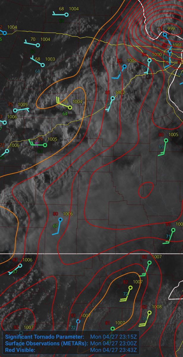
@FalcnStormChase Mesoanalysis is a good tool but it can also be misleading sometimes as it smoiths gradients. I reccomend doing maps by hand and working with the obs. I did several yesterday. This is a good starting point.
Hand Analysis Reference Guide.pdf https://t.co/rdL8JGqhuY
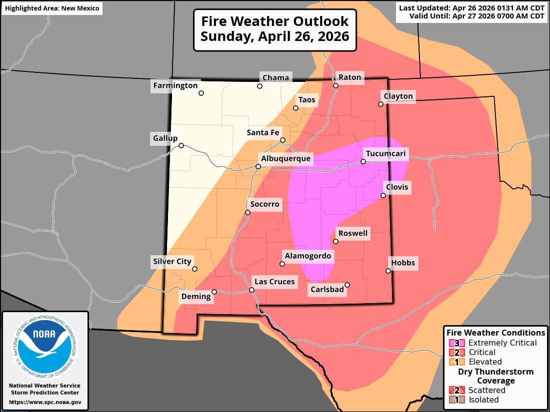
*EXTREME* fire weather conditions will develop Sunday afternoon across eastern New Mexico with southwest wind gusts as high as 60 mph, low relative humidity, and dry conditions. This is the first Extremely Critical outlook in New Mexico in 364 days. #NMFire#NMwx
It’s ridiculous how much crap the SPC and NWS get from fellow weather enthusiasts on here. Everyone thinks they know better than the pros. Yeah, they’re human and mess up sometimes, but don’t we all. Give it a rest and be better than that.