Tornadoes, aurora, 3km CAPE/vort bullseyes, streamwise hodos with that kink at 700mb, and the stray cat in my yard. As seen on TV one time like 7 years ago
Like a painting, but real. A dusty occluding tornado over open land as the sunset lights up its parent updraft. #kswx#stormhour@ReedTimmerAccu@spann
6.23.2023 - Johnson, KS
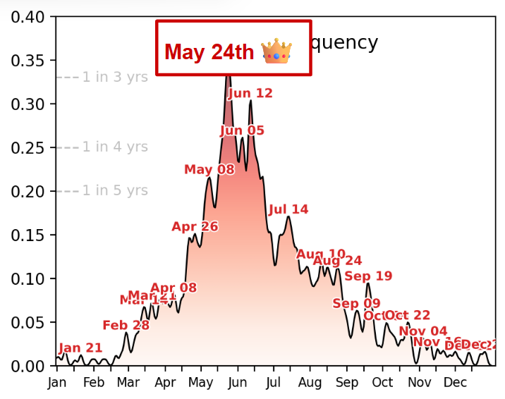
@swrightCO The hope is that stronger forcing from the Pacific increases into the summer (common in El Niño transition years, i.e analogs expect it) and helps us out. It’s called a jet extension and it is forecastable weeks ahead of time. Tbd if it works out.
This is probably the biggest Pacific Jet extension I’ve ever seen in June & it isn’t surprising to see as we discussed several days ago.
Buckle up…
@swrightCO You haven’t gotten a serious answer, at least I don’t think. The plain and obvious culprit is low latitude junk. Here is what that looks like modeled. Moisture return is inhibited, trough ejections are skewed, shear vectors are terrible, and chasing sucks.
We are the best storm chasers ever. How did no one target this? Literally zero issue of convergence the entire time. Next time you run your jaw about other drivers on the road impacting your target, look in the mirror and target better. It's not hard, guys.
Alright, if nobody’s gonna say it I will. Why was this not warned? This might be the worst NWS miss in a while. Likely strong to violent tornado and no warning, what are we doing?
1. the county sheriff and commissioner had a meeting with me in which they wanted to discuss the extreme difficulty that chaser convergence and careless/reckless chasers posed to emergency operations. as chasing continues to grow in popularity, please understand that a high…
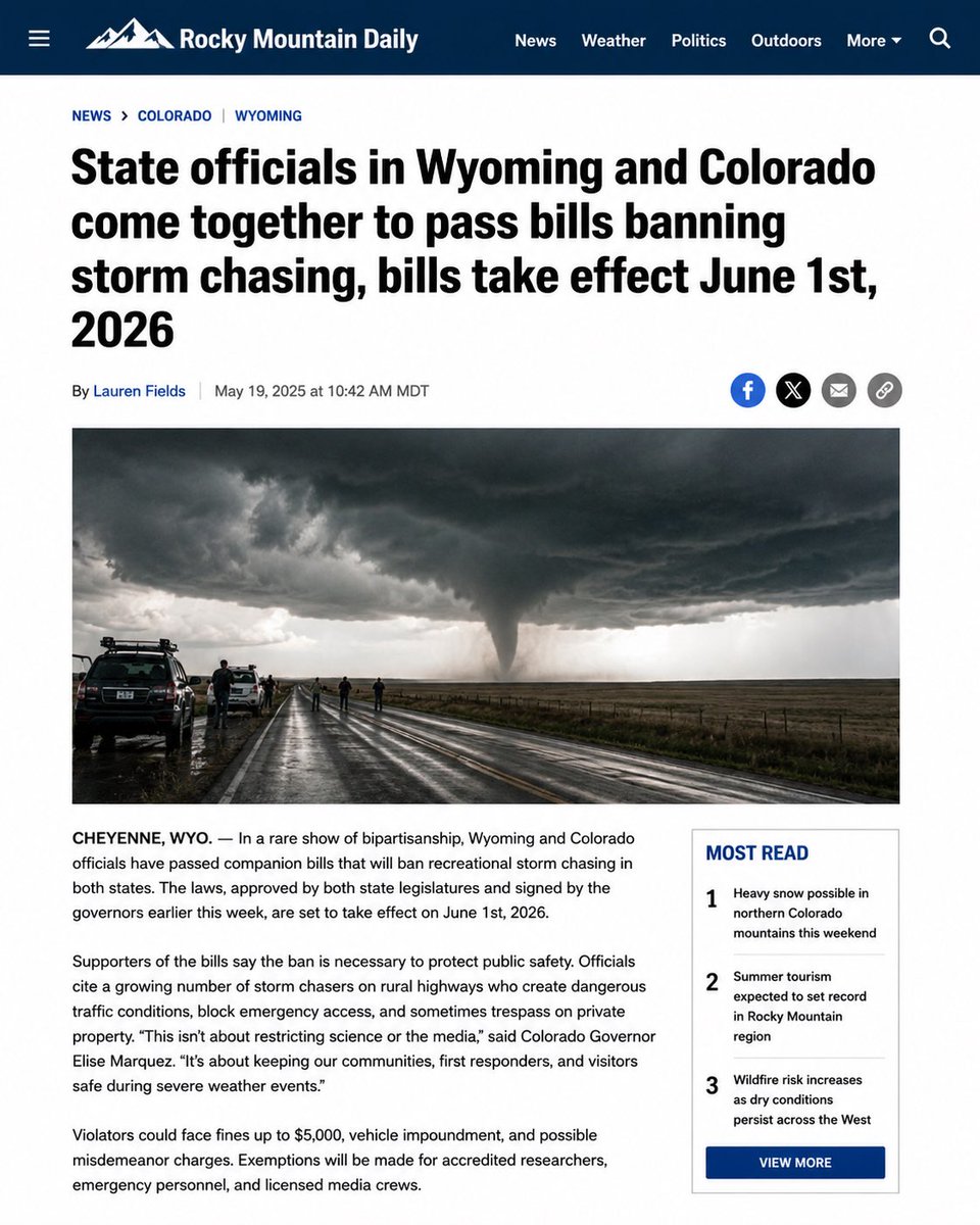
Two years ago, one of the most violent tornadoes in recent memory rolled across southwestern Oklahoma doing little damage. It maxed out at over a mile wide and moved slowly eastward for nearly an hour. May 2026 would never.
5.23.2024 - Eldorado, Oklahoma