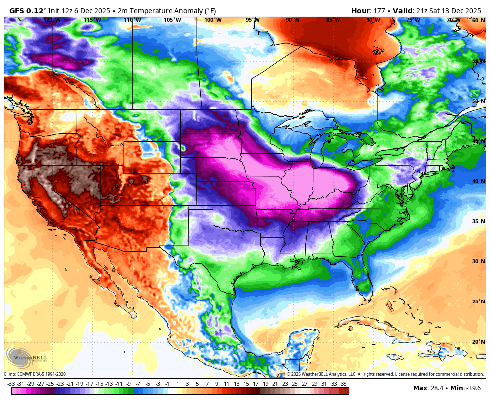
Very cold air will cover the eastern half of the U.S. in 7-10 days. Teens are likely over North Alabama Saturday, Sunday, and Monday morning (December 13, 14, 15)
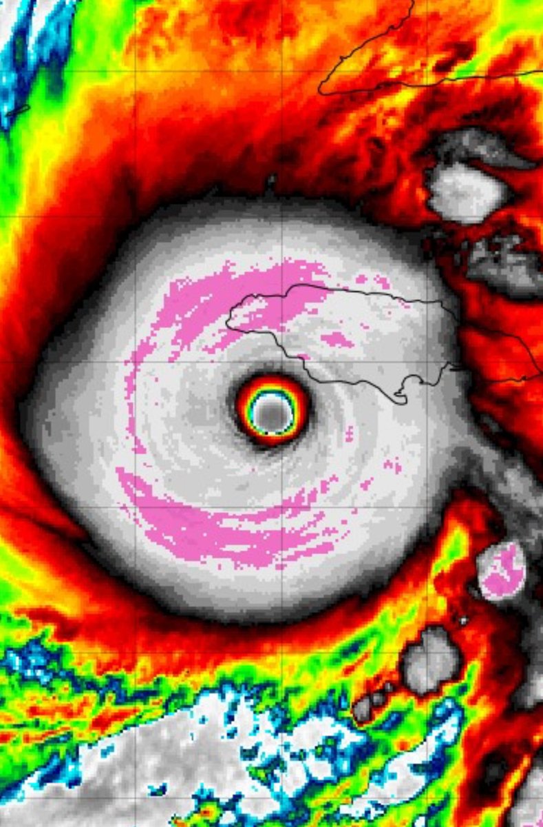
With a pressure of 896 mb, it’s looking likely that #MELISSA will be the 2nd most-intense landfalling Atlantic hurricane on record, only behind LABOR DAY 1935.
This is the first time back-to-back seasons (2024-2025) have featured sub-900 mb storms. Unbelievable.
LIVE ON FOX WEATHER: A very large and dangerous tornado just crossed the road right in front of FOX Weather Exclusive Storm Tracker @BrandonCopicWx
Download the FOX Weather app to watch live video.
Strong wedge tornado crossed highway 37 and went into Taylorsville. Highway 37 and the road parallel to it going north into Taylorsville are completely blocked by trees. #mswx @zaneo_11 @Osterhout1993
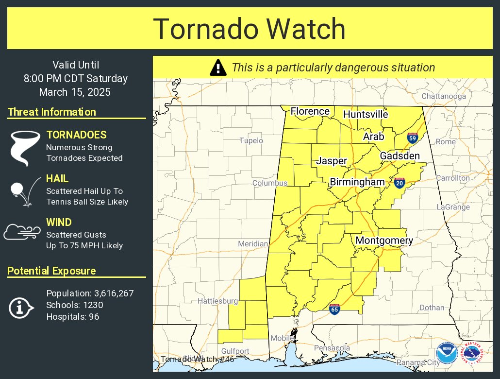
Governor Kay Ivey has issued a state of emergency for all 67 counties ahead of this weekend’s severe weather.
Governor Ivey also issued the following comment:
“The state of Alabama is at risk for potentially dangerous, severe weather throughout this weekend, so it is critical that everyone stays very aware of their local forecasts. Now is the time to make any preparations and have a plan, should the weather conditions become dangerous. Certainly, we are no stranger to Mother Nature’s wrath, but I encourage Alabamians to be vigilant beginning tonight. Stay weather aware and stay safe!” – Governor Kay Ivey
The state of emergency will go into effect today at 2:00 p.m. CT and will remain in effect for the duration of the state of emergency. Alabama law specifies that a state of emergency ordinarily will last 60 days; however, it may be terminated earlier by written proclamation.