Short piece out today in @washingtonpost's @monkeycageblog in which I discuss some of the intensified vulnerabilities facing residents of India's slum settlements during the lockdown.
https://t.co/oxPCp5WmOM
“…if cities are recognised as complex, changing sites, lockdown policies can end up being more inclusive, accounting for job precarity of #informal workers and the transient nature of migrant homes”, @Jasmitha5 and @vinitagrajan write for @scroll_in#IIHSin
The economist Jeffrey Hammer has collaborated with sociologists, videographers, and data visualizers on a unique site to better understand the nature of poverty and inequality in India, and how it is measured: https://t.co/bVMnnPYLgG
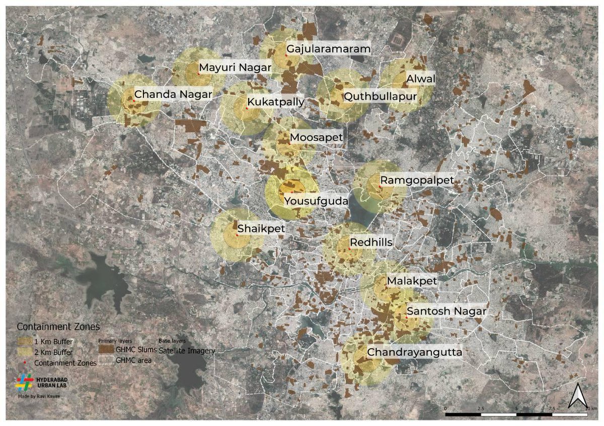
We mapped govt identified #COVID19 hotspots in #Hyderabad, with 1-2 KM buffer zones, and bastis. The critical areas seem to be Malakpet-Santosh Nagar, Gajularamaram-Quthbullapur and Yousufguda. Give extra attention and care to info and requests from these areas. #CovidLockdown
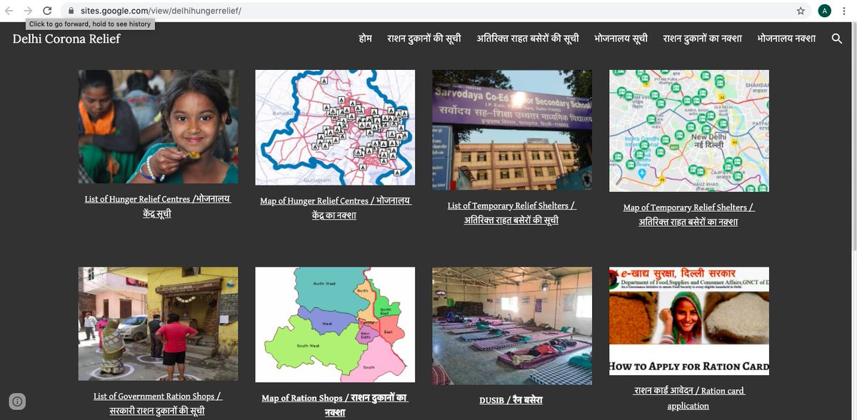
Research making a difference -- State of Delhi is using data from our research project on mapping spatial inequality to power its COVID relief website. https://t.co/3hqmI7PAa2
Congrats to Rajesh Veeraraghavan and the team. https://t.co/h1GWgpgnPW
Along with visuals, we are coming up with #podcasts as well. First episode of our podcast series, #COVID19 and the City is about Impact of COVID19 on platform based workers. Listen, like and share #fightagainstcorona#EffectsOfCovid19
https://t.co/7RjJBTObWA
We spoke to 100 municipal representatives, and wrote a blogpost about how urban local bodies are critical in the #fightagainstcorona . Note by @ayesha_minhaz and @IndivarJ
Check out our website and this space for new updates.
https://t.co/O1leyjoXaT
Throughout this lockdown period @UObservatory plans to continue publishing updated maps and using our public services dataset to help in the fight against #COVID19.
@Georgetown@georgetownsfs
@UObservatory shared some of its resources publicly in clear and accessible formats including simple dynamic maps, spreadsheets, pdf files and text messages embedded with geo coordinates to enable cross-platform accessibility.
#COVID19@Georgetown@georgetownsfs
Research x Action @PatrickHeller1 and Rajesh Veeraraghavan's efforts at mapping informal settlements and access to public services now very usefully brings together all the covid-19 related relief facilities/services of the Delhi government
https://t.co/gAfFqMGfW2