🛡️ UADAMAGE x Ukrainian Deminers Association 🇺🇦
We joined forces to test multisensor technologies in the field and strengthen humanitarian demining efforts through innovation and expert feedback.
Learn more on our website: https://t.co/RxBSfsHdpM
UADAMAGE: AI for Safety
From AI-powered UXO classification and offline field operations to underwater detection drones — we’re scaling technologies for humanitarian demining in Ukraine.
2026 is about turning tested solutions into operational impact.
Read more on our website ↓
Ukraine is shaping humanitarian demining standards the world will follow. https://t.co/OJ4cTyq5e5 published a report on the AI platform GRIT for prioritizing land clearance.
UADAMAGE works on data analysis tools for humanitarian demining.
More: https://t.co/kpnu4LTNkm
🤝 We are grateful to our partners for this initiative and the opportunity to share our developments. From now on, three multisensor systems will support the teams of the State Special Transport Service, making the detection of hidden threats more accurate and safer.
How can drones help detect explosive hazards hidden beneath the ground?
🇺🇦’s State Special Transport Service completed training on innovative multisensor technologies developed in #Ukraine, combining optical, thermal & magnetic detection systems to identify explosive hazards more accurately, and received new systems for humanitarian demining operations.
Implemented by Ukrainian company @UaDamage & @UNDP with support from @italyinukr & @NLinUkraine.
“99% accuracy” until a 1% error means a missed threat.
False negatives aren’t statistics. They are real risks. At UADAMAGE we focus not on “perfect AI” but on transparent, explainable systems supporting human decisions.
More here: https://t.co/YbrcEj3WIZ
🚀 Ukrainian Deep Tech is shaping new approaches to AI and geospatial analytics in real-world conditions.
UADAMAGE joined the Deep Tech Security Accelerator (DTSA) at SRI International to showcase technologies developed in Ukraine.
Read more below: https://t.co/O025jbSGDX
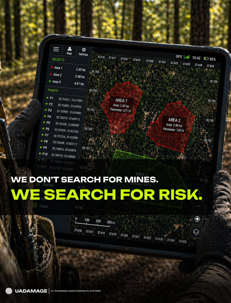
Raw detections create noise, not clarity. Too many signals slow demining operations instead of improving them.
At UADAMAGE, we turn aerial data into clear risk layers: safe corridors vs. contamination zones.
Less noise. Faster decisions.
Read more: https://t.co/fr5q1SvqQY
🌊 Water bodies may also be affected by explosive hazards.
Unlike land, underwater risks shift and are harder to detect, impacting communities and ecosystems.
This remains a complex area where approaches evolve. UADAMAGE is exploring it.
Learn more: https://t.co/YvoXwyvWRN
🛰️At XPONENTIAL Europe, UADAMAGE presented a drone-integrated AI system for real-time explosive hazard detection—reducing risks and accelerating land clearance in Ukraine.
More details: https://t.co/C4mhFoIeAA
#Innovation#AI#SafetyTech#UADAMAGE#Ukraine
🌐 In demining, tech shapes planning, safety, and efficiency 🚁🔍 UADAMAGE combines real field data 🇺🇦 with ready tools: own systems for long-term growth, partner platforms for speed 🚀
More: https://t.co/rj9Rm1eYJx
#AI#Safety#Ukraine
In humanitarian demining, digital risk maps turn team experience into actionable insight. They highlight priority zones, optimize efforts, and add confidence where uncertainty was high.
🗺️Learn how we combine human expertise & data: https://t.co/o6OiDMi77G
🌲 Forests once full of life are now a “green maze” of hidden mines. Children, communities, and firefighters face invisible dangers every day.
Learn how tech & AI help map risks and protect lives → https://t.co/s9VboXtNyr
#Innovation#Technology#AI#Safety#Recovery#Ukraine
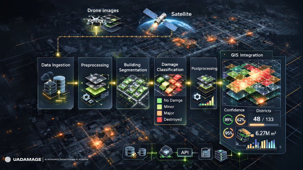
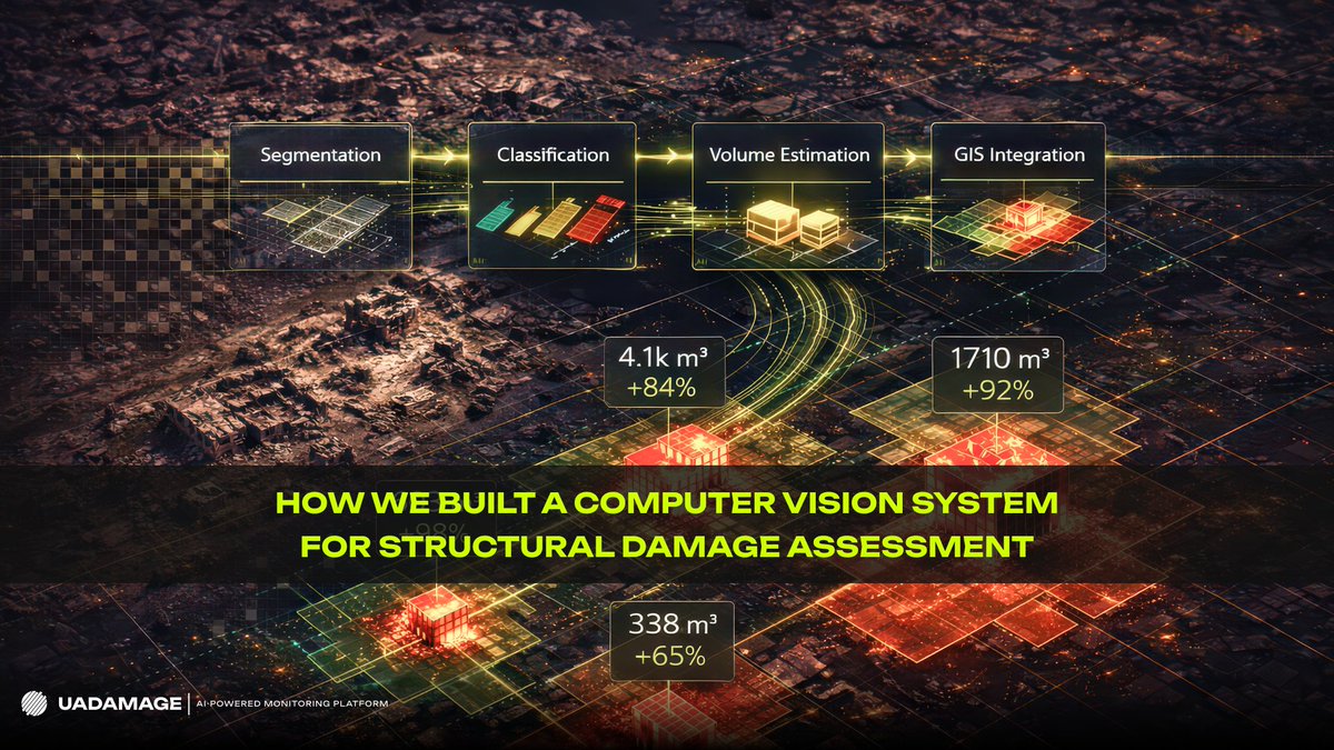
🗺️🏠 We built a production Computer Vision system to assess structural damage from satellite imagery. Not about metrics — about scale, speed, and decisions for recovery. 80% agreement with expert review.
How we did it ↓
https://t.co/tyiRbmOdoV
#Innovation#AI#Recovery#Ukraine
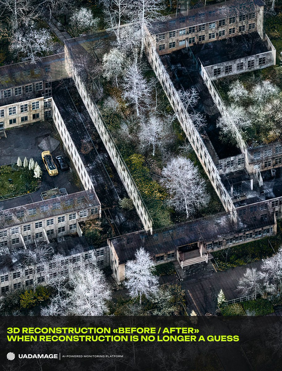
🏗 3D “Before / After”
Reconstruction shouldn’t be guesswork.UADAMAGE builds precise 3D models from satellite & aerial data — building geometry, damage volumes, change over time.
For communities, teams & donors:
data instead of assumptions.
More: https://t.co/1YDqZwTTTU
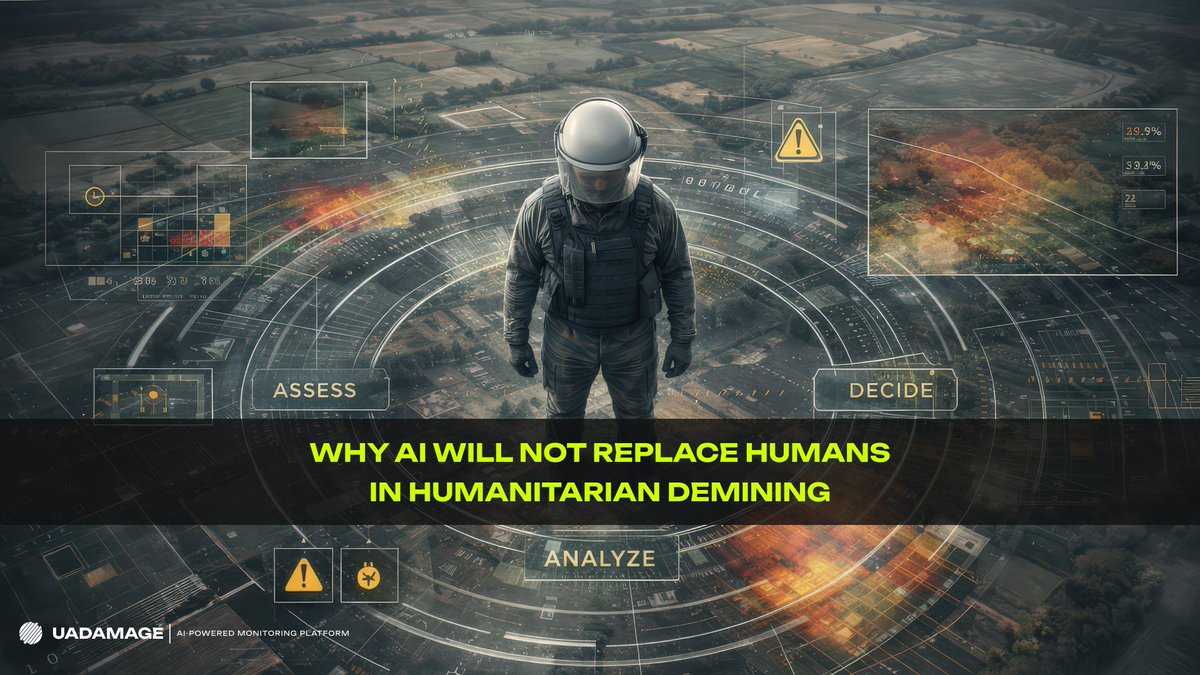
🧠 Why AI won’t replace humans in humanitarian demining
AI speeds up risk analysis and mapping, but safety can’t be automated. In Ukraine’s demining context, human expertise remains critical for interpretation, judgment, and accountability.
Read the full article on our website ⬇️
🌍 Risk Maps from the Air
UADAMAGE uses satellite imagery, drones, and #AI to detect craters, tracks, and terrain changes—helping demining teams work safer and faster, and communities return to normal life.
🔗More: https://t.co/xP4Jir2NYZ
💰 UADAMAGE combines satellite, drone & ground data with AI to give governments a clear picture of destruction. Our maps help prioritize demining, guide investments, and plan recovery with lower risk and cost.
More: https://t.co/EXPFkU8Pra