Cloudy skies will stick around for the next couple days. Rain will be very light in Northern Utah today and Wednesday. Expect more rain/snow showers beginning late Wednesday into early Thursday. ❄️🌧️
#utwx#uofu
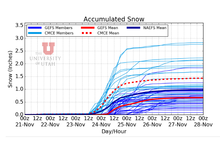
Our global computer models are not agreeing on the strength of our weekend storm. Right now, one is putting down one inch of snow in SLC and the other is showing four inches. I'll have more details as we get closer to the event. #utwx
CHRISTMAS EVE EVE: Also known as “Christmas Adam”. We’ve got a storm coming together that could bring a little valley snow Saturday-Sunday AM!
Valleys start off with rain then switch to snow on the back side. Right now mountains could see 6-12” valleys Tr-1”. Stayed tuned! 🎅
Happy Sunday! Look out for dry, cloudy weather this coming week, but don't fret, there is a potential for snowshowers in the mountains scattered throughout the week. Send your best skiing/snowboarding pics in for a shoutout #uofu#utwx
Last weekend brought more snow than expected, bolstering Utah's mountain snowpack. Temperatures will remain above average this week until Thursday-Friday when we will get a cooldown with chances of rain on Thursday and snow on Friday.
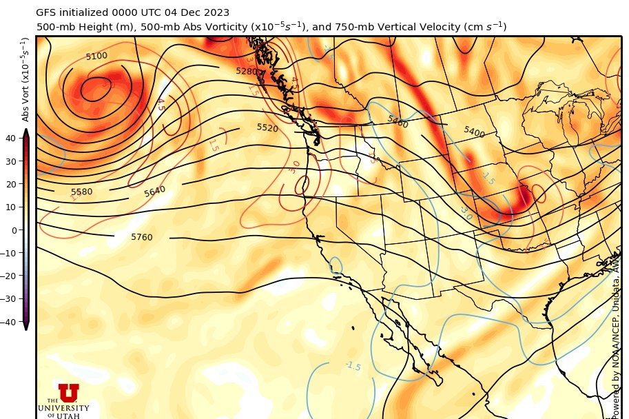
The high-pressure system in northern Utah is giving us clear skies but is also creating ideal conditions for an inversion over the valley floor, trapping pollutants. 😷 Temps will stay roughly the same through the rest of the week with snow chances Friday-Sunday. ❄️ #utwx#uofu
Right now a lot of our computer models are putting down a dusting to three inches of snow in many valleys of northern and central Utah on Friday. Locally higher amounts are possible off the GSL. Ski resorts should do well with 6-16" of new snow. #utwx
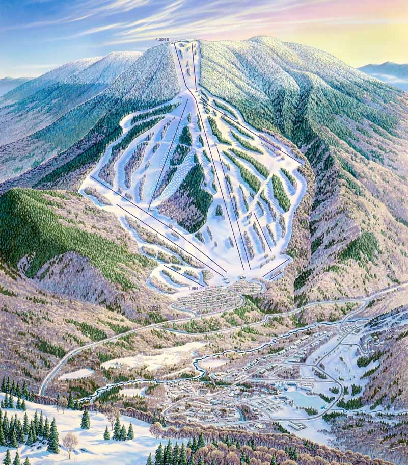
It's finally feeling a lot like Old Man Winter is here to stay. Can anyone #NameThatNiehues? On this piece I especially enjoyed painting the big bump run against a colorful sky.
𖧥
𖧥
𖧥
#WinterIsComing#Skiing#Snowboarding
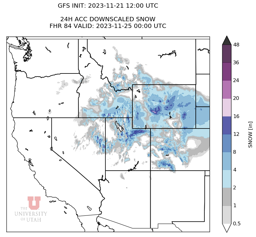
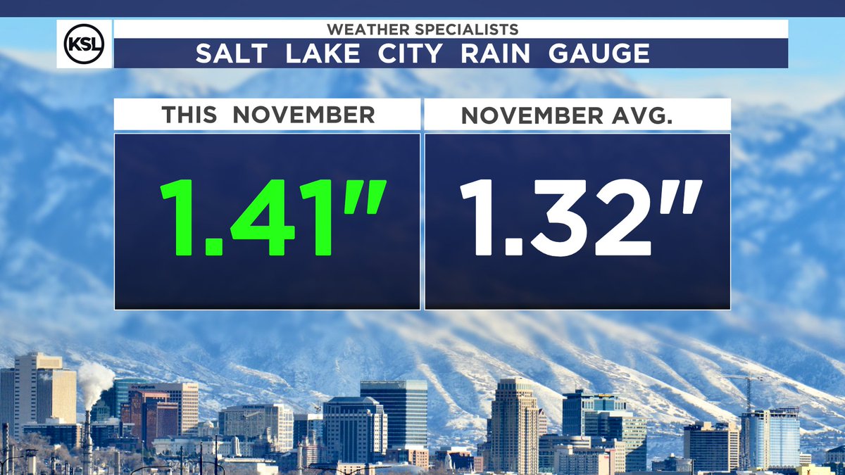
NOVEMBER WATER ✅
Salt Lake City has now passed the monthly average for water this month 🌧️. The Thanksgiving night storm will be icing on the cake, potentially quite literally ❄️. #utwx
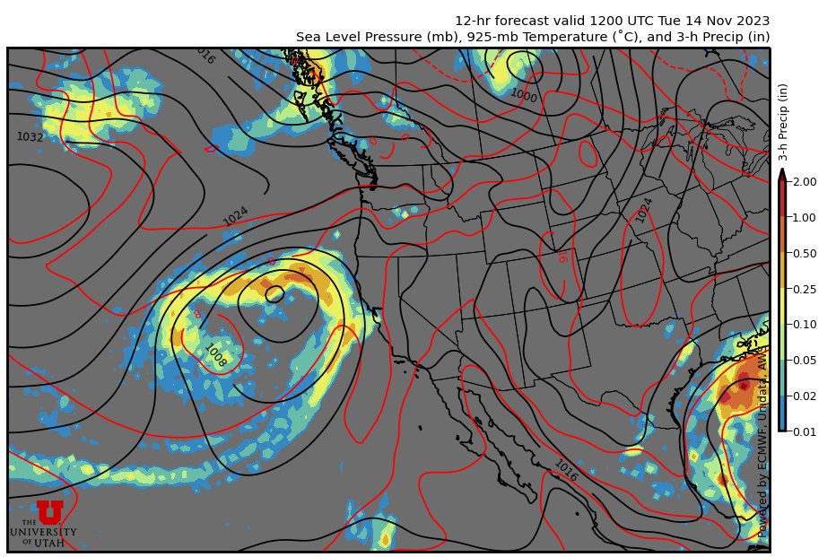
Cold temps and clear skies will be the theme of today and tomorrow in Northern Utah☀️ A storm will roll in on Thanksgiving afternoon with snow expected in the valleys❄️Anyone travelling Thursday night into Friday should exercise caution. #utwx#uofu
Temps will stay unseasonably warm today and tomorrow with some rain showers possible early Thursday. A cooldown is expected to start on Thursday with highs dropping to the mid 50's and even 40's early next week. #utwx#uofu
The cold front brought us plenty of morning rain along the Wasatch front! Scattered showers will linger for the rest of the day with a slight chance of snow in the western parts of the Salt Lake valley tonight. The rest of the week looks to be dry with cool temps. #utwx#uofu
It's finally Friday! We've been warming up these past days due to that high pressure system. A big temp drop is on its way by next Tuesday #uofu#utwx 🌞