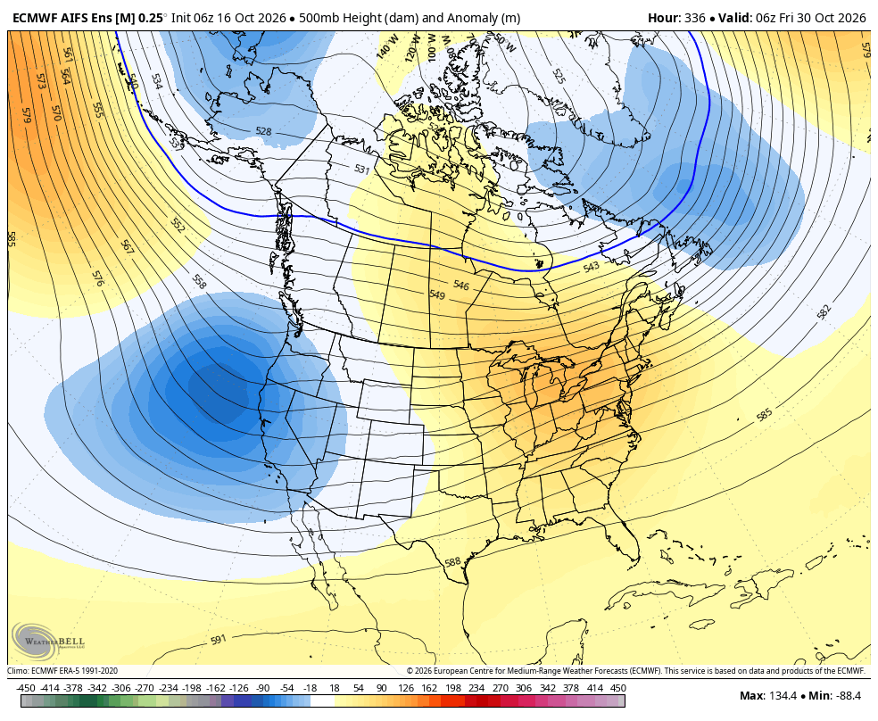
We have another storm coming in over the next few days with high-elevation snow. I know it's still October, but what I have seen so far this month does not comfort me. I'm traumatized by the warmth of last winter. I just want a nice, cold pattern. El Niño may not cooperate.
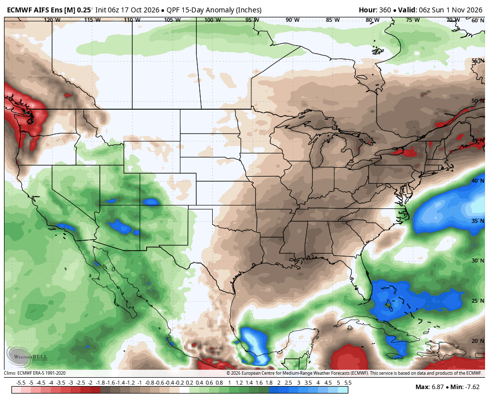
The forecasted precipitation anomalies for the next 15 days are very El Niño-like across the West. Coincidence? Or a harbinger of what's to come this winter...? I guess we will find out.
Some intriguing signals are already showing up along the West Coast for the end of October. This will be interesting to watch, because if this were to verify, it could mean an active early-season period for Sierra Nevada, and perhaps extending to Utah.
Will the new snow melt off? Hard to say for sure, but my guess is that most of the snow below 9000 ft and on exposed south- and west-facing slopes will melt off. However, I don't think the snow will melt off on the north-facing, shady slopes above 9000ft.
Sometimes 6 inches looks bigger than other times. Deer Valley’s new snow stake platform is so broad that, to me, 6 inches looks like a lot less than that on first glance. It’s going to take some getting used to.
Yesterday, I requested our team look into creating 3-day timelapses, as that seems like the sweet spot for a big storm. Today, we have 3-day timelapses! Here's the whole storm at Snowbird.
While there's a foot or so on the snow stake right now, I think we have actually seen quite a bit more. Especially early in the storm, we had several periods where it snowed an inch or two before melting off. Then, we've seen quite a bit of additional melt-off/compaction since. Hidden Peak, which is >1,500ft higher than this snow stake probably has seen 2+ feet of snow. The snow stake at this elevation is probably around 18 inches when you include the snow that had melted off during the first half of the storm.