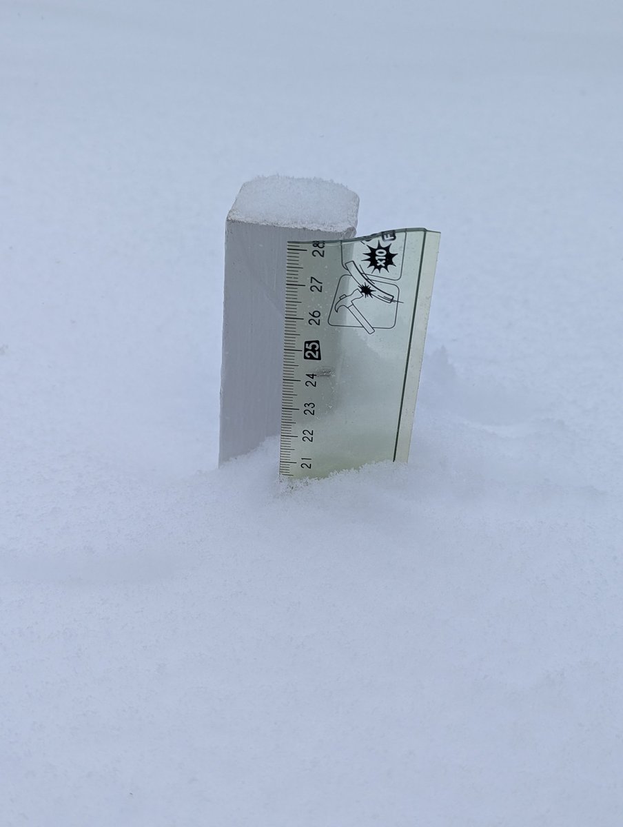
I have ~21-22 cm on snowboard in North York (as of 11:30am) since the storm began. BLSN 💨 definitely a factor for measurements. Snow is very light & fluffy! 😃
#ONStorm#ONwx
@ECCCWeatherON My favourite 😉 at the moment:
The itsy-bitsy spider climbed up the water spout.
Down came the rain, and washed the spider out.
Out came the sun, and dried up all the rain.
And the itsy-bitsy spider climbed up the spout again.
A bolide, or large meteor, broke up over South Carolina and Georgia earlier today, creating a fireball that was bright enough to be captured by GOES-19.
Made by Canada’s meteorologists, for Canadians. 🍁 Get reliable #forecasts directly from Canada’s official source. Download the #WeatherCAN app today! 📲
App Store: https://t.co/WOHOIT9vx4
Google Play: https://t.co/vmIwFIS71k
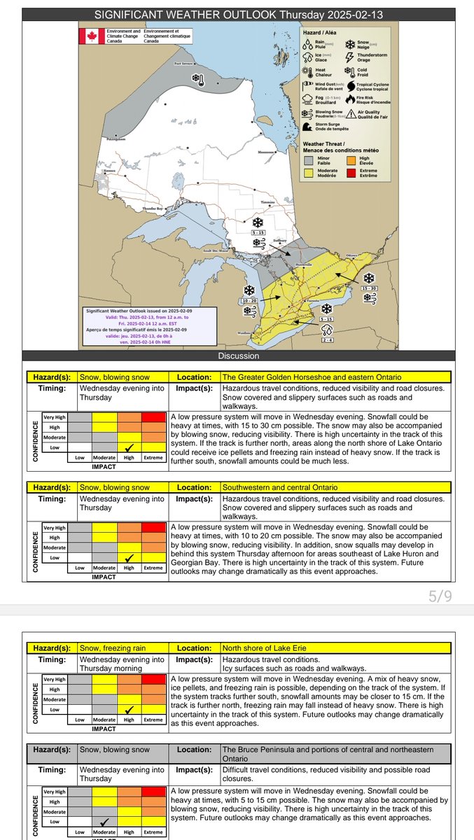
Significant Weather Outlook from @ECCCWeatherON for Thursday 👇
5-15cm of snow north shore of Lake #Erie
10-20cm parts of SW/ Central #Ontario
15-30cm #GTA towards Eastern Ont
#OnWX#Onstorm
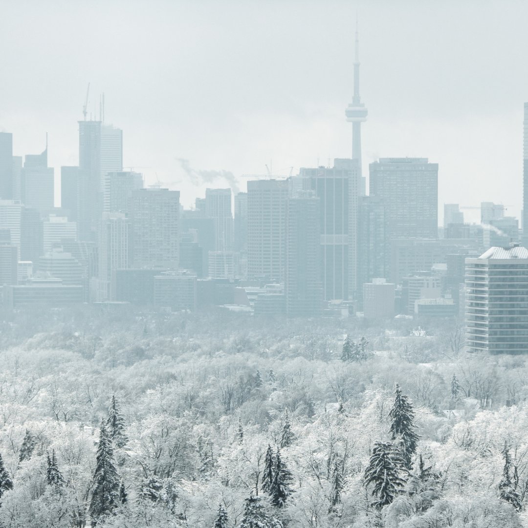
Up to 12cm of snow for #Toronto starting today!
Crews are ready. Salt trucks go out when the snow starts to accumulate & plows go out:
🌨️2.5cm – expressways
🌨️5cm – major roads, transit routes & streets with hills
🌨️8cm – residential streets
🌨️Sidewalks & bikeways 2 cm
This quad-view of satellite imagery shows four ongoing tropical systems around the world.
Along with Francine, this imagery shows two strengthening tropical depressions in the Atlantic and eastern Pacific oceans, and Tropical Storm Bebinca in the western Pacific Ocean.
A wildfire in Canada burns through the night as the aurora borealis dances overhead.
This imagery was taken by NOAA-20 earlier this week when a G2 geomagnetic storm reached Earth.