Severe Thunderstorm Warning including Joliet IL, Bolingbrook IL and Orland Park IL until 4:15 PM CDT. This destructive storm will contain wind gusts to 80 MPH!
At 2:45 PM CDT, 3 N Leland [De Kalb Co, IL] Public reports Tstm Wnd Gst of M61 MPH. Personal Weather station 3.8 NNW of Leland, IL measured wind gust as line of storms moved through. #ilwx https://t.co/52mDBLxoN8
From the National Tsunami Warning Center:
✅ NO tsunami, NO danger from a recent earthquake.
Duty Scientists analyzed the event
at 1400 EDT Jun 08:
M6.4 in the Cuba region.
A Tsunami Information Statement for this event is posted at https://t.co/npoUHxWBas
June 3 8AM PDT- The first tropical storm of the Eastern Pacific Hurricane Season has formed #Amanda. Strengthening is expected over the next couple of days, before a weakening trend this weekend.
At 10:55 AM CDT, Homewood [Cook Co, IL] Trained Spotter reports Tstm Wnd Dmg. Trained spotter reports a few 3-4 inch diameter branches downed in Homewood. Time estimated by radar. #ilwx https://t.co/VgKtEwa6GW
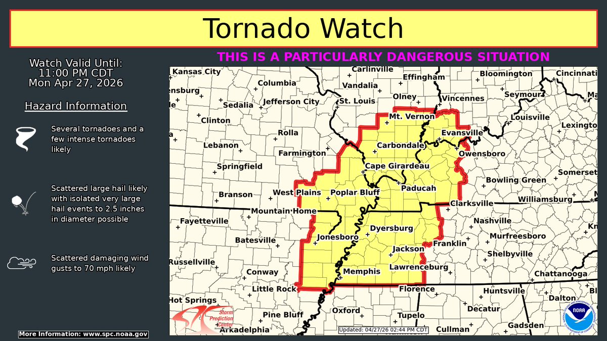
A Tornado Watch is in effect for portions of northeast AR, southern IL, southern IN, western KY, southeast MO, western TN until 11 pm CDT.
THIS IS A PARTICUARLY DANGEROUS SITUATION!
Several tornadoes, with a few intense tornadoes, will be likely. #ARwx#INwx#ILwx#KYwx#MOwx
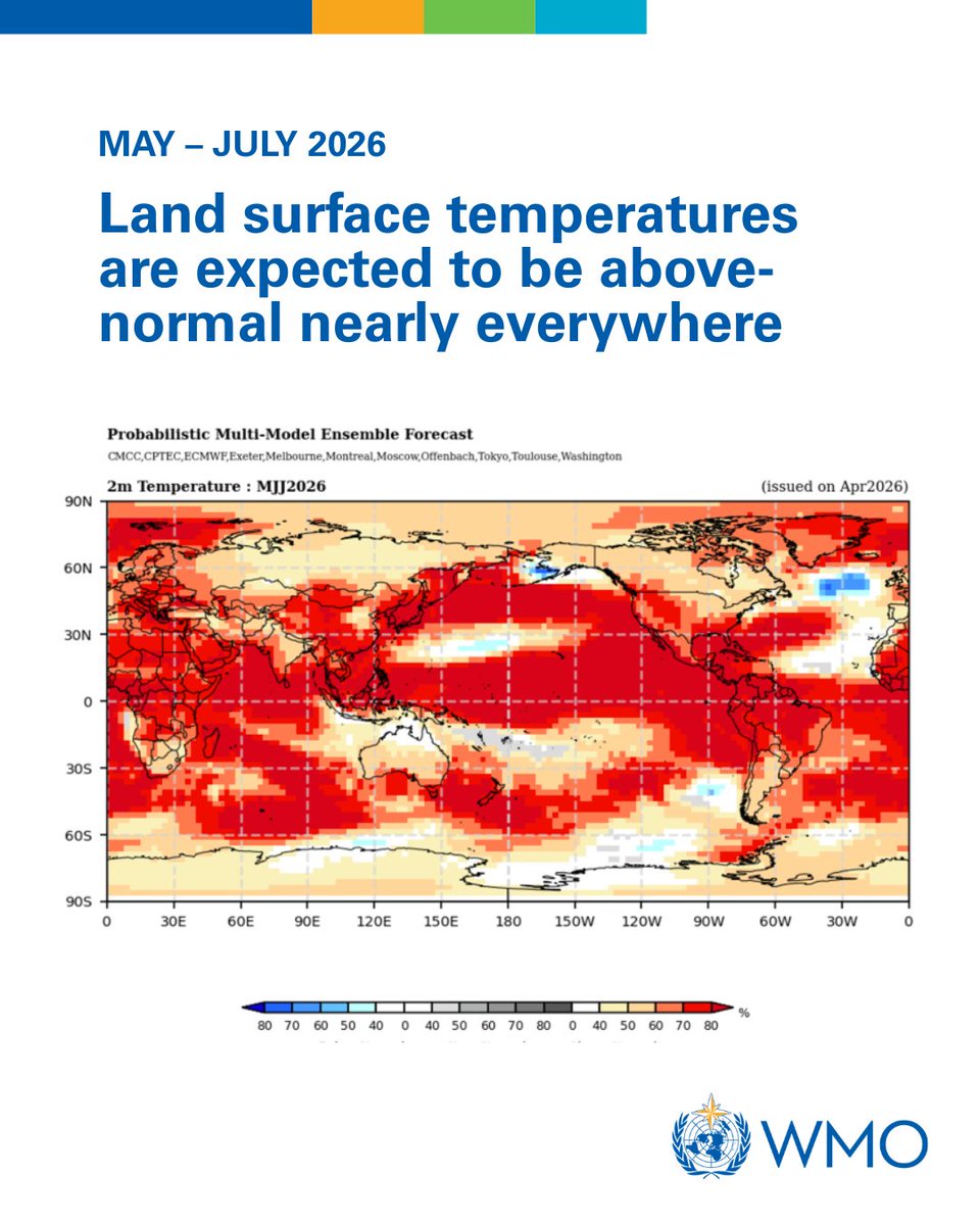
An El Niño event is expected from mid-2026, impacting global temperature & rainfall patterns, according to WMO's global seasonal climate update. Models indicate that this may be a strong one!
More details 👉 https://t.co/zQDJ6uWGJE


![iembot_lot's tweet photo. At 2:45 PM CDT, 3 N Leland [De Kalb Co, IL] Public reports Tstm Wnd Gst of M61 MPH. Personal Weather station 3.8 NNW of Leland, IL measured wind gust as line of storms moved through. #ilwx https://t.co/52mDBLxoN8 https://t.co/4smkUyRLsm](https://pbs.twimg.com/media/HKej9n-WAAATX_F.jpg)

![iembot_lot's tweet photo. LOT issues Severe Thunderstorm Watch for Boone, De Kalb, Lee, McHenry, Ogle, Winnebago [IL] till Jun 10, 7:00 PM CDT https://t.co/nK9CaaWpYz https://t.co/efHhQQsmzv](https://pbs.twimg.com/media/HKd7jM4WgAAh1yk.png)


![iembot_lot's tweet photo. At 10:55 AM CDT, Homewood [Cook Co, IL] Trained Spotter reports Tstm Wnd Dmg. Trained spotter reports a few 3-4 inch diameter branches downed in Homewood. Time estimated by radar. #ilwx https://t.co/VgKtEwa6GW https://t.co/ETQJ2Oa7hw](https://pbs.twimg.com/media/HInT41YWYAAsEhh.jpg)


