All residents of the Panhandle, Big Bend & FL West Coast down to Tampa Bay should use this time being sure they have the hurricane supplies they need just in case.
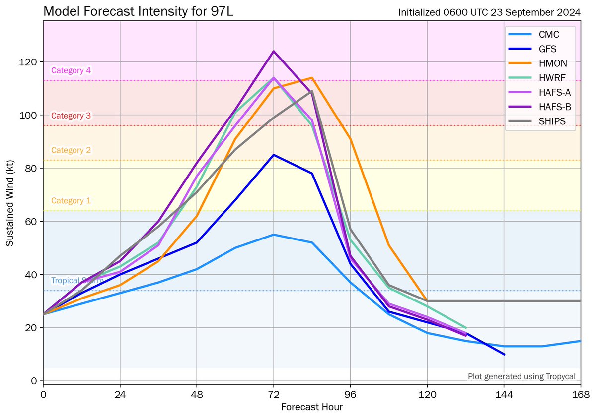
Soon to be #Helene will likely be an extremely intense hurricane with landfall Thursday. Important thread: 1/
Tampa’s most oppressive summer ever finally ends:
“The summers of the 2020s will be the coolest summers you will ever experience again. And the only way to stop it is for humanity to shed its addiction to burning fossil fuels and arrest the heating” https://t.co/ajZT7giOUF
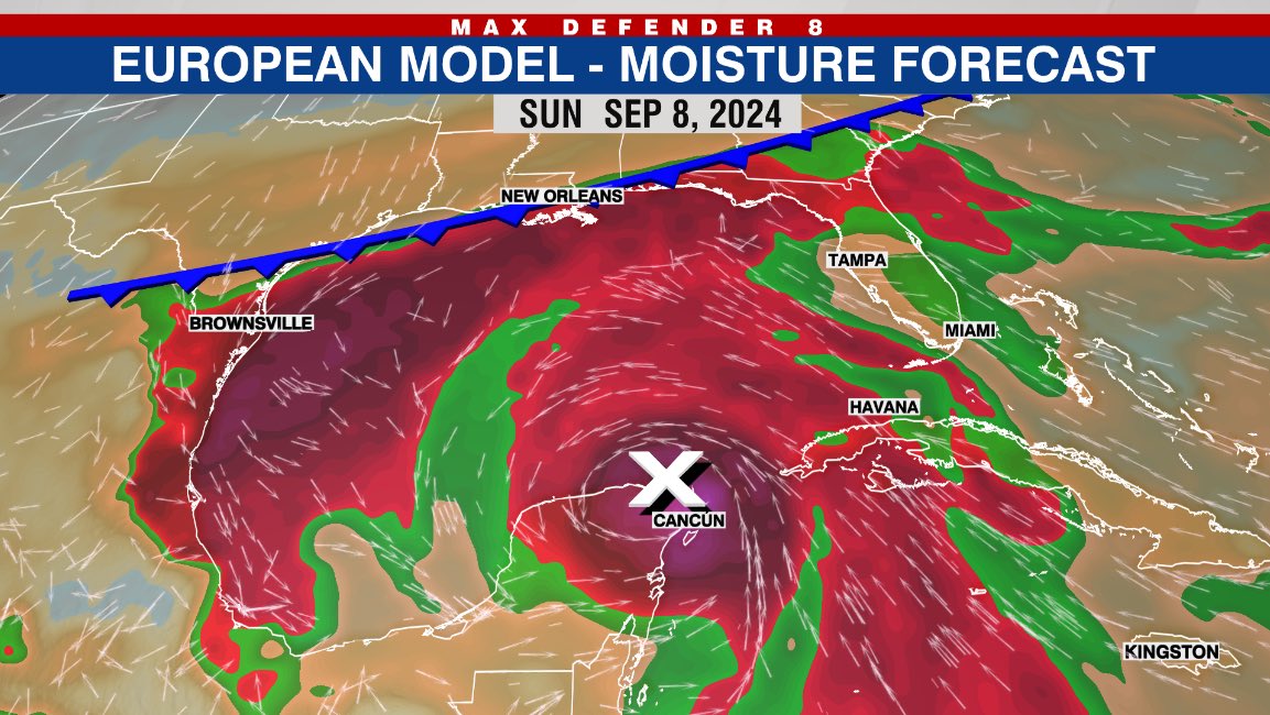
Next week is going to be interesting and perhaps laboring as a long-lived system likely forms in the Gulf. But where does it go? And how does the climate/ steering change a we move into Fall? Here's more: https://t.co/WhWgSfJmYt @WFLA
#Francine will likely have a small core, and near record Gulf temps, ideal for rapid intensification. It will likely get quite intense.
Luckily there’s strong shear near landfall. So hopefully it will be weakening as it heads in. Still our in house model has gusts ~130mph 1/
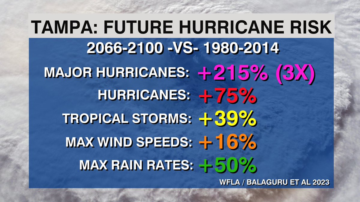
New: 3X increase in major hurricane landfalls in Florida’s Future!?! That’s what an exclusive study by @PNNLab & @WFLA just found. With huge increases in max winds/ rain too all along Gulf and SE coast due to climate change.
Read /watch more here: https://t.co/DAQdOKO03s
Heads up! Next week we’ll be watching every move of a tropical wave moving towards the Caribbean now. Many solutions develop it and eventually turn it north into Gulf. Waters in Caribbean & Gulf are record hot with high octane fuel. Gulf residents pay close attention!
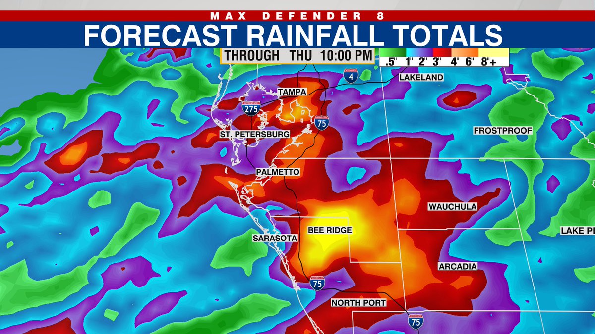
Heads up! Over the next two days, an unsual August front, stalled across Tampa Bay, will produce heavy downpours, often moving over the same towns, especially south of Tampa Bay. After Debby the ground is saturated and flooding will happen more easily. Be prepared just in case.
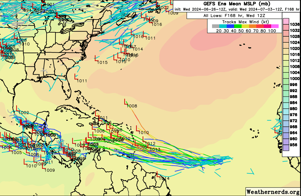
The wave we are tracking in the central tropical Atlantic has a 70% chance of development. Models are robust as we could have our first hurricane in a few days in the eastern Caribbean, but its fate after that is very uncertain, as it may face hostile conditions. Stay tuned!
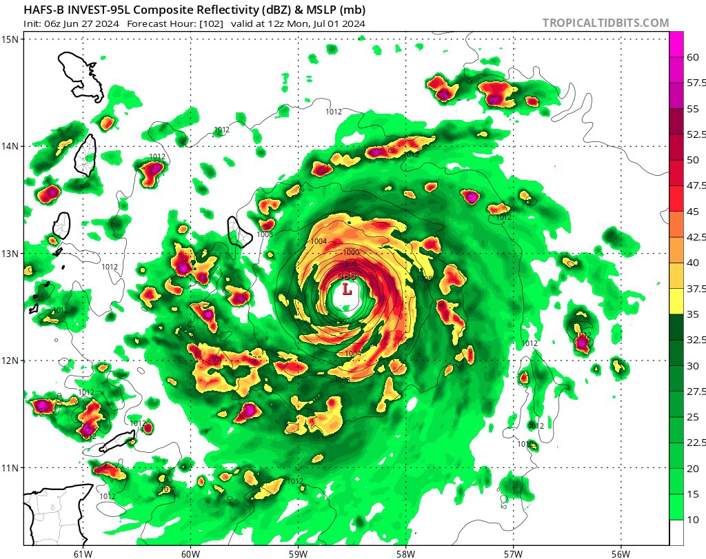
Could we have a hurricane before the system reaches the Lesser Antilles Sunday-Monday? Yes. Many of the hurricane models do indeed show a low end hurricane by then. If so it would be in extremely rare company, and possibly the furthest east June deep tropics hurricane 1/
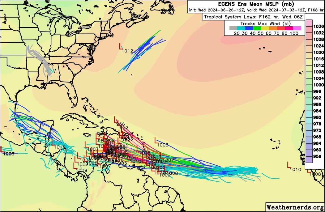
Ensembles Left: Euro, Right: GFS (American). Strong signal for development as wave moves into Antilles & Caribbean. But afterward the models diverge - Euro intesifies, GFS dissapates over Graveyard. Bottom line for US: No need to worry, long way away, lots of uncertainty... 1/
This is quite the convergent band! Look at those showers racing NEward, crashing into the stalled band. That’s how you get a foot in a few hours. Classic Florida set up.
Significant flooding as Meso low & stalled localized band, fed from south, sets up shop over Sarasota, Bradenton, Longboat Key. So far up to 9” in Gulf Gate Estates, north of Osprey, South of Sarasota. Barrier Island 5-7” w/ several more inches to come through mid evening @WFLA
Sarasota, big heads up!!! Major flooding developing!! Very heavy band of tropical downpours piling up across the county. The band is stalled. So far a bullseye of 5-7” has fallen, and several more inches likely through mid evening. #flwx@WFLA
The @WMO came out with it's huge annual assessment of the state of our climate and to no one's surprise it shows our planet is way off-kilter and warming rapidly. Here's a short summary. If you'd like to read more, go here: https://t.co/1Qo1XW7dAj
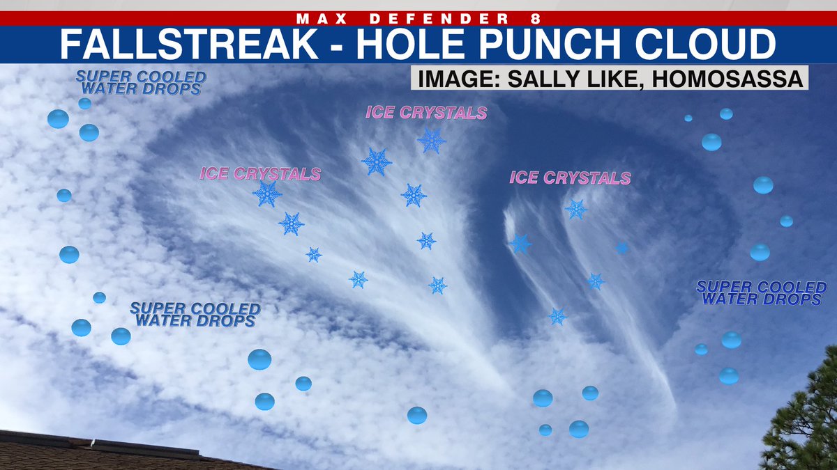
Ever see one of these? Somewhat rare, and a spectacle to see. Fallstreak hole punch clouds consist of a streak forming a hole in the cloud. They are produced when water drops below freezing quickly freeze and drop out of the cloud from a disturbance like a plane flying thru.
In today’s Berardelli Bonus, 1% of the nation was below normal this winter. Lucky me, I was one of them! Across the rest of the nation it was a blowtorch, by far the warmest winter on record. Thanks @Climatologist49 and @ClimateCentral for the great GFX help!
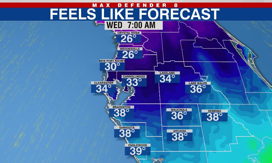
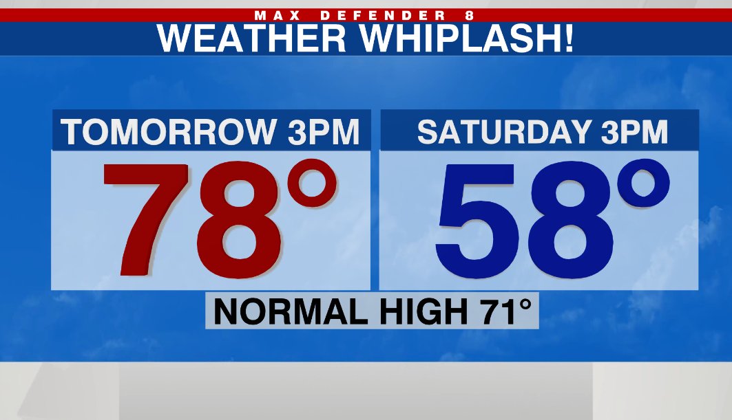
Tampa Bay Area: Get ready for weather whiplash, starting with Friday and Saturday. Warm southerly breeze Friday afternoon but 20 degrees colder Saturday afternoon with a breezy north wind. Much colder air arrives the middle of next week!
Big heads up! This is called the significant tornado parameter, essentially the risk of seeing a tornado with ~100mph winds. Can’t say I’ve ever seen it this high for such a widespread area. Be prepared tomorrow from 2pm-7pm in the Bay Area from NW to SE. @WFLA