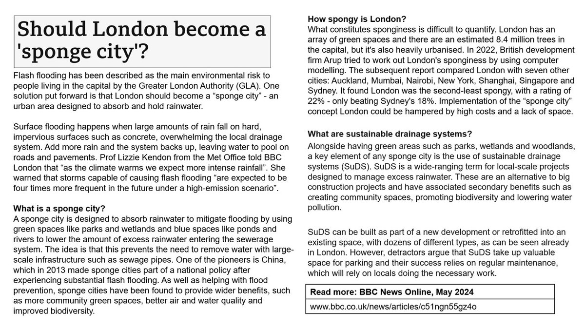
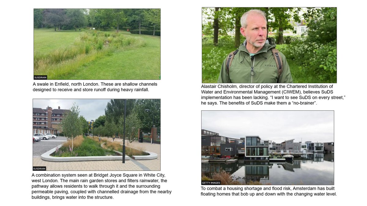
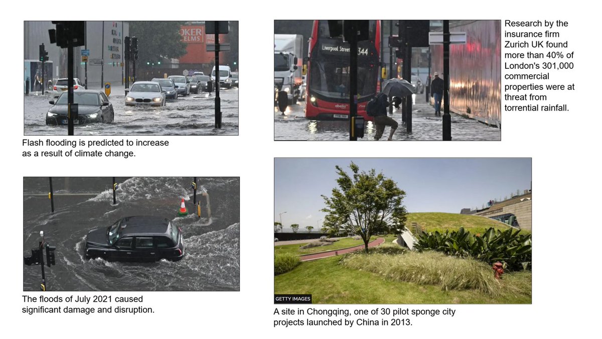
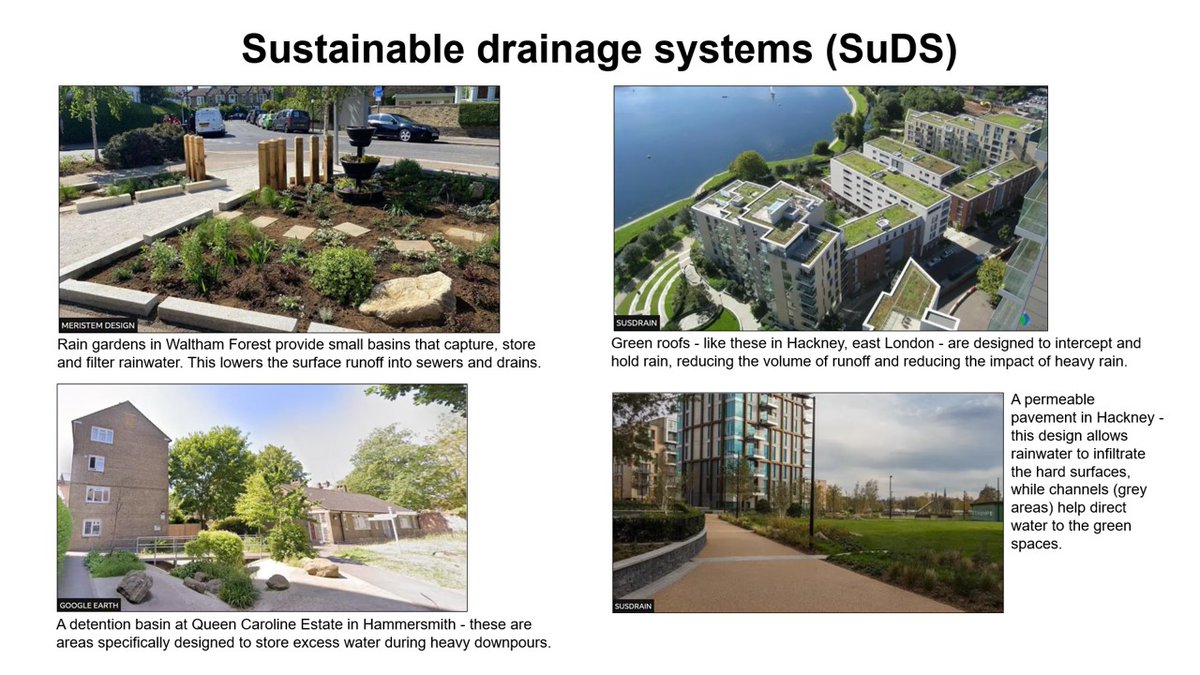
‘Sponge cities’ designed to absorb rainwater: This is an interesting BBC article about flood management I edited onto one page, with separate photo slides. Includes details on sustainable drainage systems (SuDS). Link above. #geography#geographyteacher
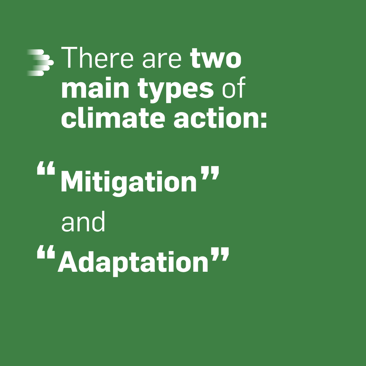
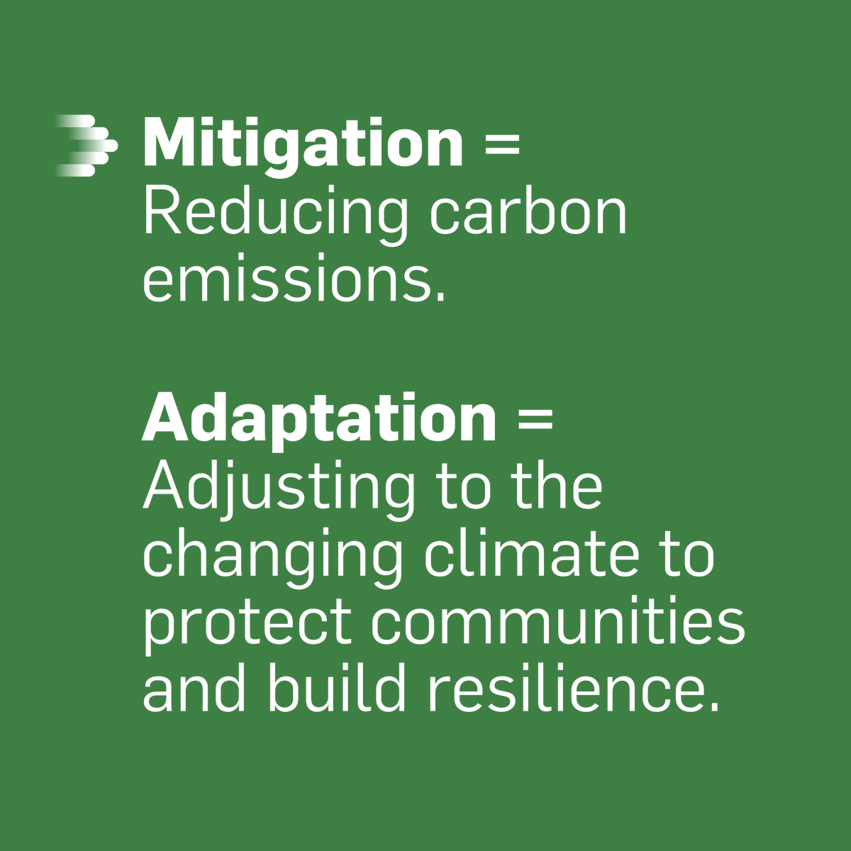
🌍 Mitigation and adaptation are key to reducing disaster risks and keeping our planet safe, for everyone.
This #EarthDay, learn how these strategies can help your business thrive and protect the planet: https://t.co/zhpmhjaWIJ
#ForwardFaster2030#EarthDay#ClimateAction
More great jobs at @woodbrhigh 👇
- Head of Social Sciences
- KS3 English Co-ordinator
- Teacher of English
- Admin Assistant
In our last survey, 100% of staff said they are proud to work here, and 100% said the school is well led! ☺️
Check them out ⬇️
https://t.co/B0MmKaoRo4
Last chance to apply for jobs at @woodbrhigh!
We need a 2nd in Geography, teachers in Geography and Business, as well as LSAs and a part-time 6th Form Study Supervisor. Check them out! ⬇️
Flexible working is possible. And the kids are superstars! 🌟
https://t.co/B0MmKaoRo4
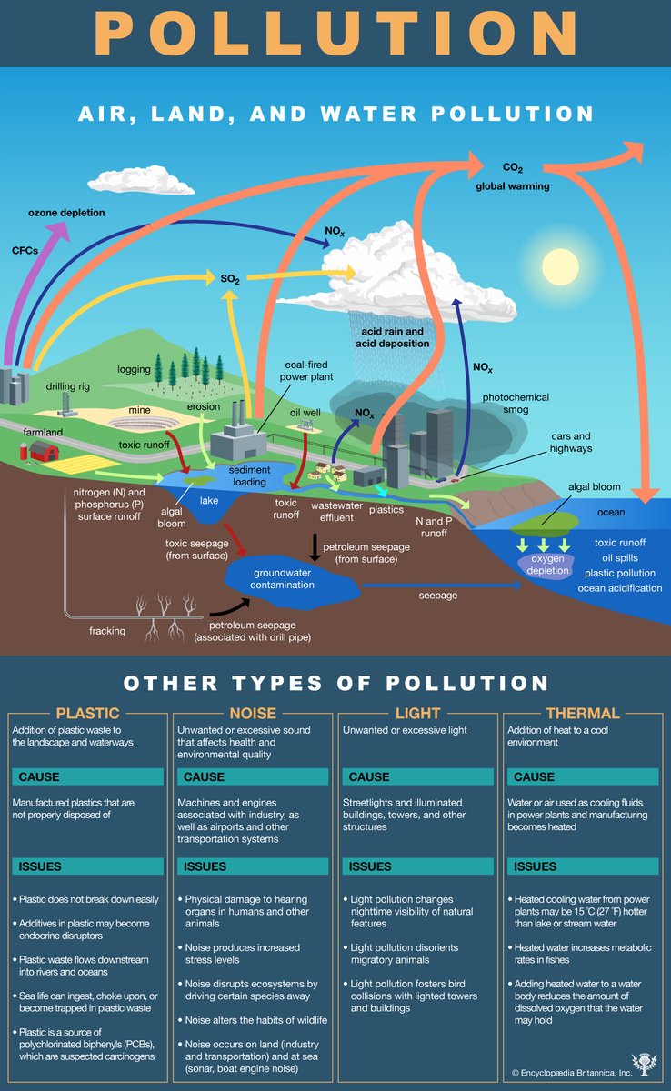
A helpful overview of the major kinds of pollution to share with your students: https://t.co/7KGQn8AfGb
Check out our geography trips: https://t.co/O6w3Scxbcb
#geographyteacher
Anticipatory action uses hazard forecast data to trigger early actions, to reduce impacts on those at risk.
🌋In Ecuador, the Geophysical Institute and Red Cross collaborate to develop triggers for ashfalls.
Learn more about triggers ➡️ https://t.co/G6lXpSEol0
Storm Ingunn, named by the Norwegian Meteorological Institute, will easily meet the criteria for explosive cyclogenesis as it passes to the north of the UK.
Its central pressure is forecast to drop 40-50mb over 24 hours.
@ben_rich explains more 👇
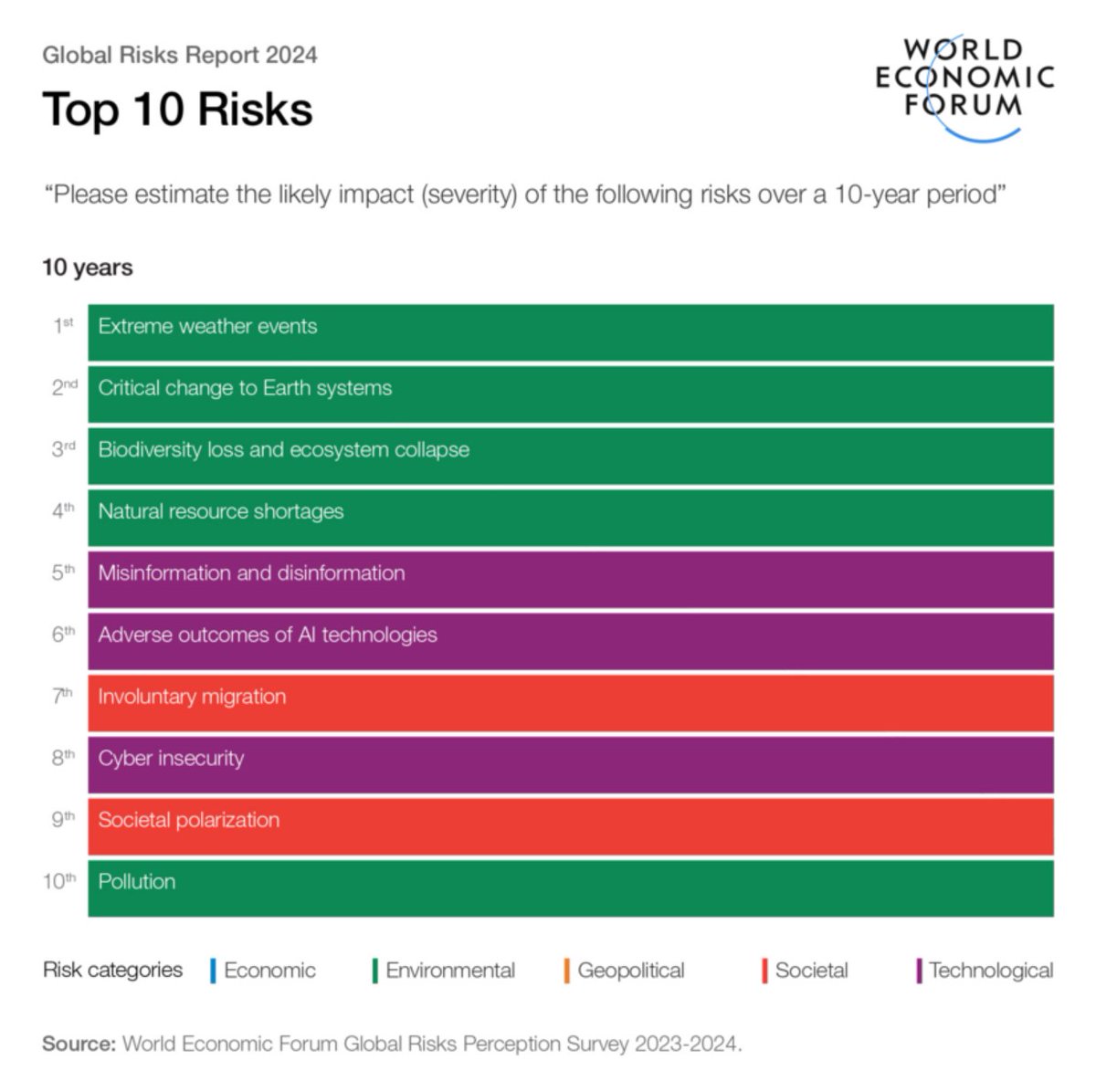
Top 3 long-term global risks:
1️⃣ extreme weather events
2️⃣ critical change to Earth systems
3️⃣ biodiversity loss & ecosystem collapse
💡While the challenge is great, so too is our capacity to respond.
Explore the @WEF 2024 Global Risks Report ➡️ https://t.co/3Z6THECWRG
Learn how to use QGIS, OpenStreetMap, and the ORS plugin to find shortest and fastest routes and to create 10 and 15-minute isochrone maps.
https://t.co/1VBvu67X4q
How much do governments spend on disaster risk reduction? Is it enough? Could we optimize funding streams across #DRR and climate adaptation? This guide helps us better understand what we are investing in, track the expenses over time and quantify them 👉 https://t.co/TJNCN447B2
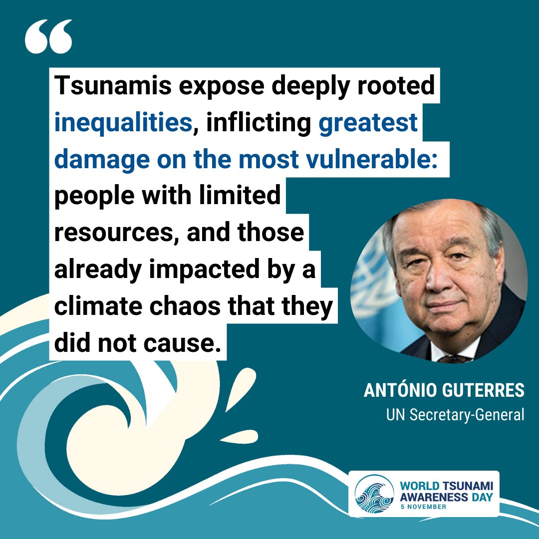
🌊"Tsunamis are the deadliest form of disaster. Yet, today, 1/3 of the 🗺️ population, mainly in least developed countries and small island developing states, are not covered by #EarlyWarningSystems" @antonioguterres@UN Secretary-General.#GetToHighGround 👉https://t.co/C9Y0fBKLts