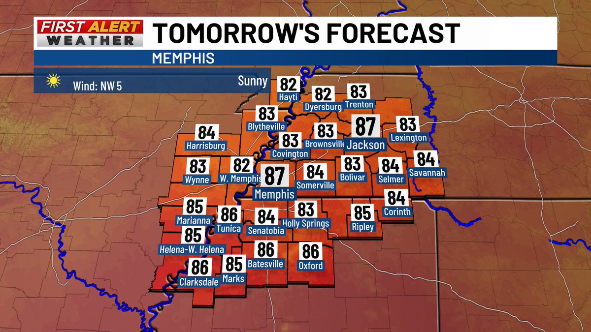
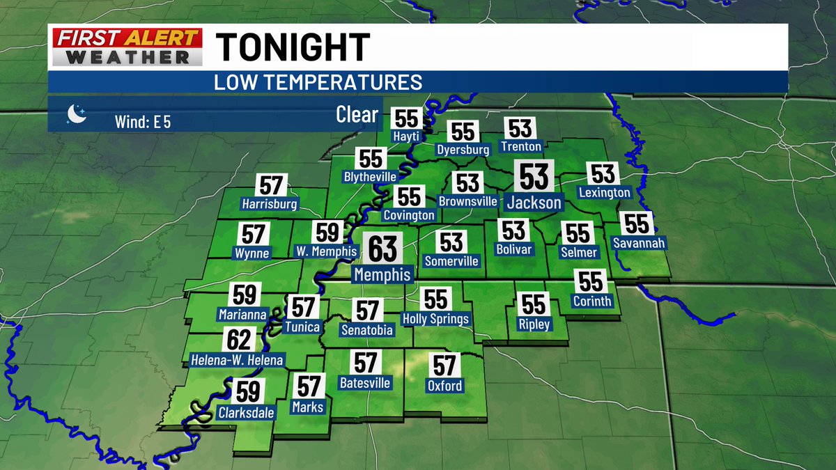
Rock solid weather conditions around the Mid-South for football games this evening! Grab a jacket as you head out the door to a game, as temperatures will slip from the lower 70s through the 60s as games continue.
@The_DocHolliday@Matt_Infield#TNwx#MSwx#ARwx
Before whatever happens [or doesn't happen!] this weekend, another few days of warm temperatures [with respect to average] and clear/sunny skies will continue. Take advantage of these nice days while you can!!
#TNwx#MSwx#ARwx#MOwx
Western #TNwx and Northern #MSwx have been mainly dry, but a few showers have been moving from the south to the north in Northeast #ARwx this afternoon. High pressure to the east is driving these showers to the north, which should stay sub-severe.
Cluster of showers and thunderstorms is attempting to get its act together in Shelby County. These are moving northeast at 25-30 mph and will have heavy rain and stronger winds [40-50 mph] in them
#TNwx
Taking the win that severe weather has generally been outside of the Mid-South on Wednesday. Still keeping an eye on storms in #ARwx, but we are [seemingly!] in a decent spot.
#TNwx#MSwx
The slight risk has been dropped throughout most of WEstern #TNwx but is still in place for most of #ARwx and Northern #MSwx. Keeping an eye on storms in Northern Arkansas as I type this out.
Most of the Mid-South has been upgraded to a slight risk of severe weather on Wednesday, August 26th. Strong winds are the biggest threat out of this.
Could have storms in the morning, which could hinder the risk a little bit, but the afternoon/evening hours could be stormy.
While there have been some stronger winds in parts of Northwestern #TNwx and Northeast #ARwx, we have been able to avoid some VERY strong winds like parts of #MOwx and #KYwx have seen. Still keeping an eye on things, but cautiously optimistic.
A few more counties in #TNwx were added to the severe thunderstorm watch, including Gibson, Benton, Carroll and Henry Counties. I don't anticipate this watch [which is until 3 AM] to be extended to the south, but keeping an eye on radar [which is 'behaving' locally].
NASTY storms near Cape Girardeau, #MOwx as there is a BUNCH of lightning moving through/just south of this area. Fortunately, those storms should not be an issue for the Mid-South, but I'm keeping an eye on the storms in Northeastern #ARwx
A severe thunderstorm watch was issued for Northwest #TNwx, Southeast #MOwx and Northeast #ARwx until 3 AM. Strong winds are the biggest issue with this.
Expecting a line to weaken as it approaches the Mid-South, but it could still pack a bit of a punch.
@MayorJohnHolden
Cluster of showers and thunderstorms [some severe] continue to slide to the southeast at around 45 mph in #ARwx. Thinking this avoids #TNwx but could move across the Mississippi River in #MSwx by about 4 PM. Strong winds, blowing dust, heavy rain would be biggest issues.
With a few showers and thunderstorms in Central and Northwestern #ARwx, the Storm Prediction Center has gone ahead and placed most of the Mid-South in a marginal risk [1/5] of severe weather today. Not expecting anything crazy, but keeping an eye on storms out west.
#TNwx#MSwx