Twitter Feed for the Bergen County NJ SKYWARN Program. This Feed is for information and communication of Severe Weather related matters in the Northern NJ area
@NWSNewYorkNY: Here is the latest briefing on the storm and the cold that quickly follows!
Note Snow/Freezing Precipitation are now part of the possible scenarios along with rapidly falling temperatures
Click the link here: https://t.co/BML90DDDOP
NWS New York NY is noting possible SKYWARN Activation Thursday into Friday In conjunction with a potentially significant Weather Event (Heavy Rain and Winds)
https://t.co/kd0mdOZZXg
@NWS: We want to see where all of our spotters are across the nation! Before #Skywarn22 ends today, check in using the link below and see yourself on the map. It’s very easy, and it lets us acknowledge all of our spotters!
View the map and check in here: https://t.co/ix9XocXHMM
@NWSNewYorkNY: A special thanks to all of our Skywarn spotters out there for volunteering their time to report hazardous weather to us. Skywarn Recognition Day continues today.
Its currently 57 degrees and overcast at the forecast office. What is the weather near you?
Wednesday (November 30) is the last day of the 2022 Atlantic Basin Hurricane Season.
Tropical Storms and Hurricanes are still possible outside of the actual Hurricane Season
Thursday, December 1 will be the 1st day of the 2022-2023 Meteorological Winter
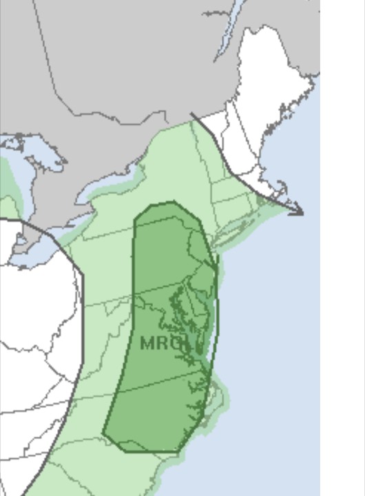
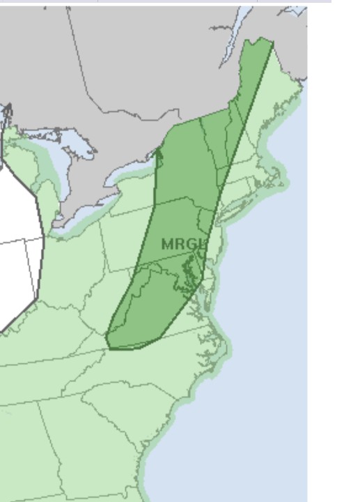
Storm Prediction Center in Norman OK has placed almost all of NJ in a Marginal Risk zone for possible Severe Weather today (Thursday)
Heavy Rain and resultant Road Flooding are also possible
https://t.co/W13uOY9nmr
NWS New York NY is noting possible SKYWARN Activation for Thursday in connection with the potential for possible Severe Weather.
Stay Alert for later updates
https://t.co/kd0mdP0xMO
NWS New York NY has requested SKYWARN Spotters to Report as per SOP as the Remants of former Hurricane IAN bring rain and moderate winds to our area on Saturday
https://t.co/kd0mdOZZXg
Reports can be submitted at:
https://t.co/mKwahW6UCC
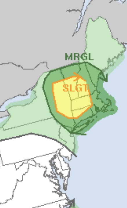
As per the Storm Prediction Center in Norman OK in their mid morning update all of NJ is in a Slight Risk zone for possible Severe Weather today.
High Winds, Hail and a potential for a Tornado are noted.
https://t.co/W13uOXRMuT
Storm Prediction Center in Norman OK has placed most of Northern NJ in a Marginal Risk zone for possible Severe Weather today (Monday)
https://t.co/W13uOXSkkr
In their mid Tuesday morning update the Storm Prediction Center in Norman OK has placed part (Northeastern) of our area in a Marginal Risk zone for possible Severe Weather today (Tuesday)
https://t.co/W13uOXRMuT
NWS New York NY is noting possible SKYWARN Activation for later today (Monday) mostly for Heavy Rain and resultant Road Flooding reports
Stay Alert for later updates
https://t.co/kd0mdOZZXg
Storm Prediction Center in Norman OK has placed almost all of NJ in a Marginal Risk zone for possible Severe Weather today (Monday)
Stay Alert for later updates and any Watches
https://t.co/W13uOXRMuT
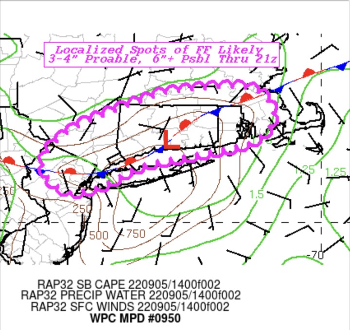
The Weather Prediction Center has CORRECTED the earliernMesoscale Discussion noting that (now) only a small part of NJ (Northeastern) is being addressed regarding significant Flooding
A Flood Watch remains active for our area as per NWS New York NY
https://t.co/4HxponMhvp
Weather Prediction Center has issued a Mesoscale Discussion noting possible significant Flooding in the northern NJ area and areas to the North and Northeast during the next few days
A Flood Watch remains active for our area as per NWS New York NY
https://t.co/4HxponMhvp
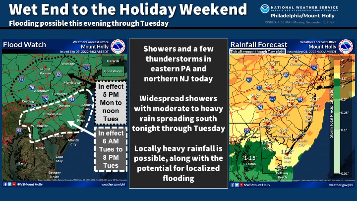
NWS New York NY has issued a Flood Watch for our area
SKYWARN Activation may be requested for reports of Road Closures and related problems
https://t.co/kd0mdOZZXg
Please report responsibility and safely as per SOP
Reports can be submitted at:
https://t.co/mKwahW6UCC
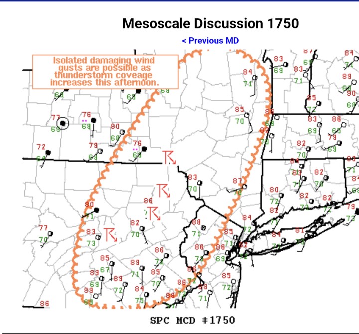
Storm Prediction Center in Norman OK has issued a Mesoscale Discussion noting only a 20 Percent Chance (Unlikely) for a Severe Weather Watch issuance this afternoon into the evening for part of our area
https://t.co/W72KaCx6fW
Storm Prediction Center in Norman OK has now (mid day Tuesday) included part of our area in a Marginal Risk zone for possible Severe Weather today (Tuesday)
Stay Alert for later updates and any Watches or Warnings
https://t.co/W13uOXRMuT