@dubsinfive Because this is Vince’s personality and has been for many years. I just look and move on honestly at this point . He does some incredible work no doubt but I just can’t support him as a person.
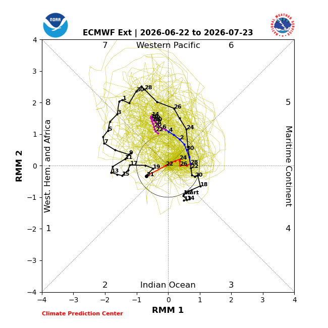
I think it's a tricky forecast for us ahead. We are already getting more north-flow signs that I think the MJO is pushing for us. Normally that would leave us below average, but I do wonder if the expansive Atlantic high will be able to push in more tropical mstr systems still.
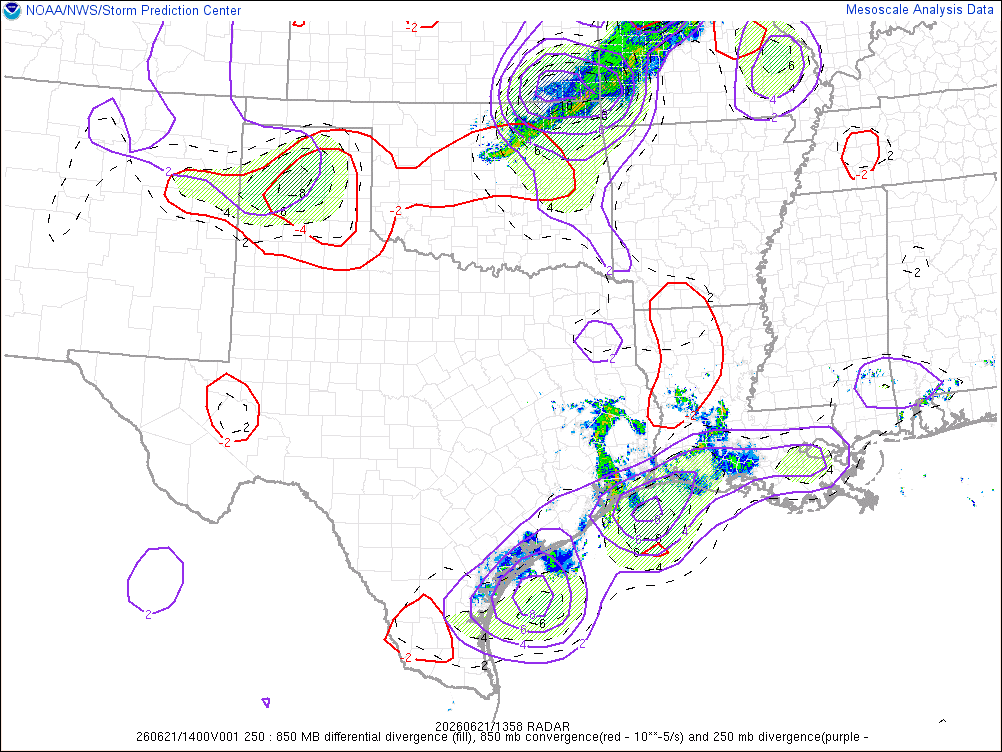
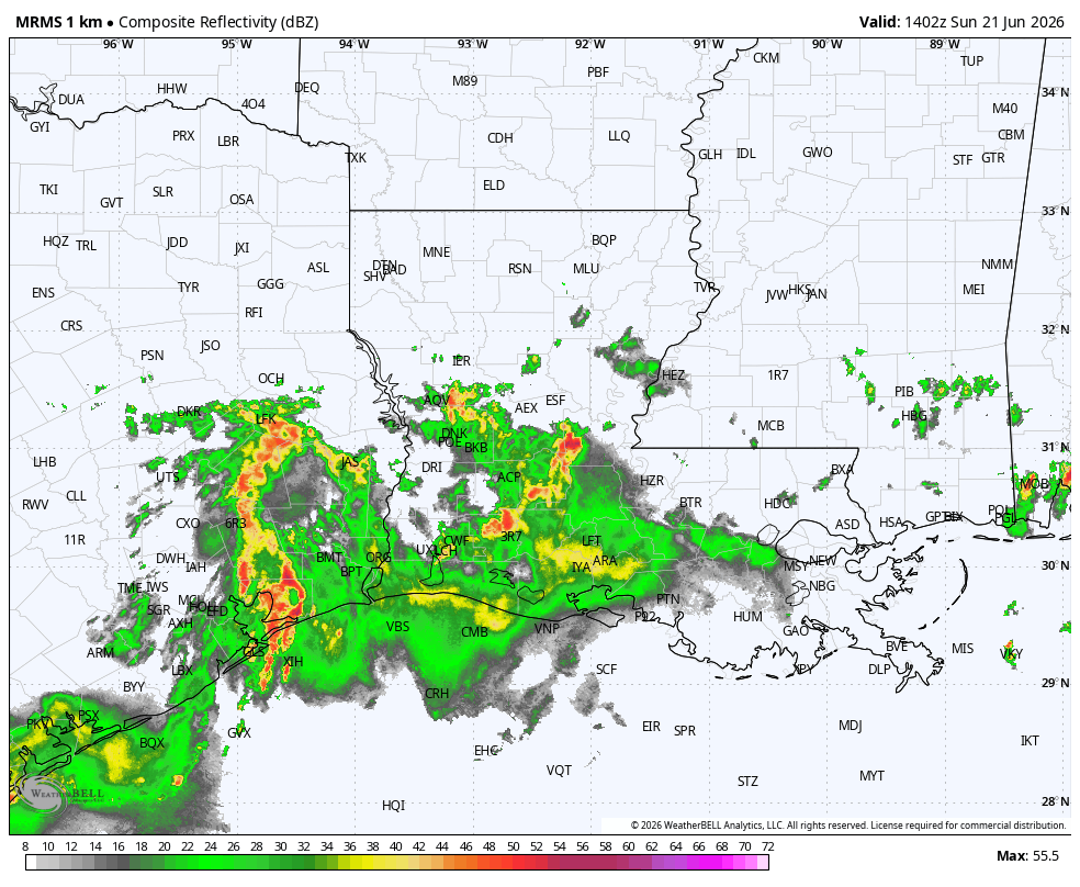
Quite an active start to the day across Acadiana / SWLA.. but thats what a broad upper level system, tons of divergence and fat MUCAPE will give you here in the summer. Miss from the CAMs but PM dry air mixing down should start to fade things out later.
ugh.. almost got this cell out of CenLA but with the OFB passed it its motion has gone down significantly. Going to need to be extremely cautious of flash flooding as our ground that has no areawide spots of standing water will rapidly flash flood.
Going to be a hard forecast ON but I wouldn't rule out a stronger storm or 2 mixed in. Tomorrow with how unstable it is and the fact we had conv-t storms across Acadiana today likely means areawide storms Saturday. Always a mess with weak systems giving glancing blows of lift.
It was clear going into this that someone would get those higher end totals that the GRAF and HRRR was outputting but as always its almost impossible to pinpoint and sadly it played out. Also partial kudos to the GRAF for sniffing out the flooding bands for parts of SELA.
A ONCE IN A 1000 YEAR RAINFALL FOR AVOYELLES PARISH? The historical climate data says so.
Some nerdy perspective utilizing the Precipitation Frequency (PF) Estimates with 90% confidence Intervals from the NOAA Atlas 14, Volume 9, Version 2.
FYI NOAA Atlas 14 provides the official historical rainfall frequency estimates for most of the United States. It is heavily utilized by meteorologists, hydrologists, civil engineers, urban planners, and government agencies to design, build, and regulate infrastructure.
While we still await some verifiable rain gauge data, based off of the doppler estimates of 25-30" and a preliminary rain gauge reports of 23-24" in the area of Southern Avoyelles, we can make this statement confidently.
Given most of that fell in about 12 hours, with rainfall rates of up to 4" per hour at times, the rains that fell met the criteria of a 1000 year return period that averages 17.1" with a climatological range of 11.5-23.9" ...even if it fell in a 24 hour period at lower hourly rates!
Meaning, based on this atlas, a rainfall of this magnitude in this specific area would occur once every 1000 years!
This rainfall may may also break the all time Louisiana 24hr rainfall record for the state of 24.40" in 24 hrs held at the Sabine National Wildlife Refuge in Hackberry associated with a tropical depression in 1962! This is why we sweat the details of any tropical system and environment surrounding it, no matter the intensity, very seriously.
BTW Lafayette’s 24hr record is 19.63” with a slow moving hurricane on August 9, 1940...more than 30" fell in portions of Acadiana with that storm over a 3 day period.
Recent trends over the last couple of decades, including multiple 1000 year rainfalls reported on the Gulf Coast, Harvey and the Unnamed LA Storm of 2016 come to mind, are showing us that a warmer atmosphere holds more water, and that rainfall rates are getting higher, the frequency of these events are increasing, and tropical systems at our latitude are moving more slowly.
So this event was a chart-buster for sure, and the data from table below might very well be outdated given the multidecadal trends of our warmer atmosphere and the subsequent bigger rainfall events that we see occurring. #LAwx #Climate #Arthur
Absolutely miserable conditions even for the overnight hours. High end dew points are 1 keeping temps in the low 80s and 2 said dew points are again very high. If you ever wanted to sweat at night just standing, now’s your time to shine.. or suffer 😅
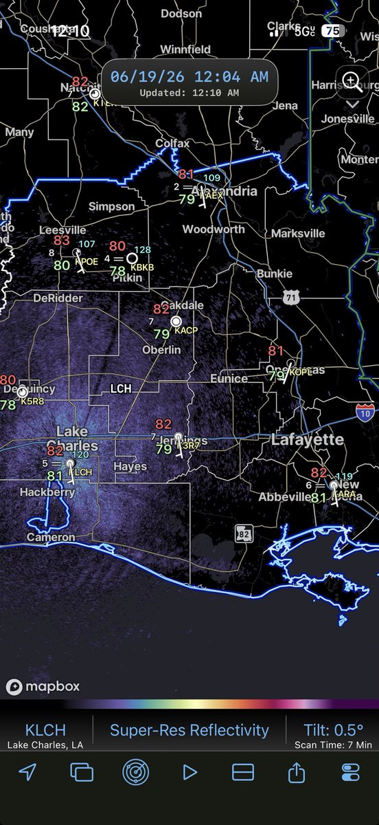
Loop of all of the rainfall across Avoyelles Parish over the last few hours. Horrible reports starting to come out of the area with many homes flooding. With flooding setups it’s always hard to tell who could get devastating flooding but when it all lines up this is what you get
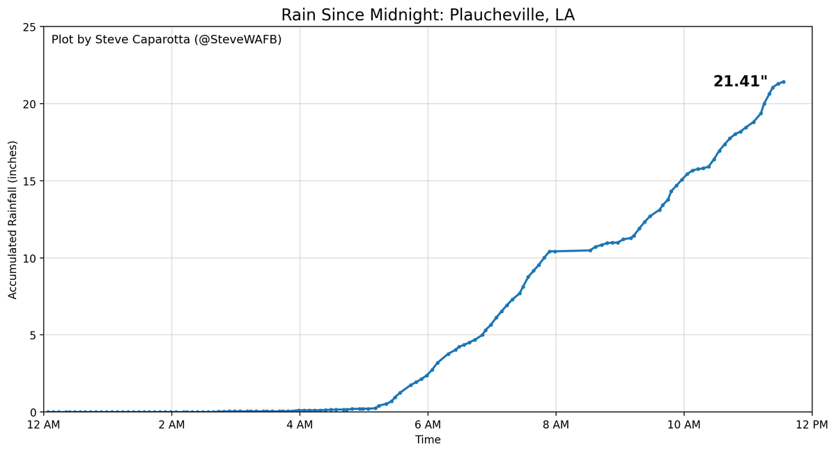
Here's a plot of the rain in Plaucheville...now over 21 inches since midnight, with nearly 19 inches of that in the last 6 hours.
NOAA's Atlas 14 indicates that type of rain is beyond a 1,000 year event...or put another way...has less than a 0.1% chance of occurring in any given year.
Radar elevation plays a part but when a NEXRAD site shows 20"+ of rain you just know what has to be happening at the surface. Rain is not letting up yet and has been holding steady. This is a PARTICULARLY DANGEROUS SITUATION